


<< Our Photo Pages >> Grotta dei Puntali - Cave or Rock Shelter in Italy in Sicily (Sicilia)
Submitted by Torwen on Sunday, 12 July 2009 Page Views: 4880
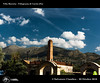
Natural PlacesSite Name: Grotta dei PuntaliCountry: Italy Region: Sicily (Sicilia) Type: Cave or Rock Shelter
Latitude: 38.150490N Longitude: 13.155760E
Condition:
| 5 | Perfect |
| 4 | Almost Perfect |
| 3 | Reasonable but with some damage |
| 2 | Ruined but still recognisable as an ancient site |
| 1 | Pretty much destroyed, possibly visible as crop marks |
| 0 | No data. |
| -1 | Completely destroyed |
| 5 | Superb |
| 4 | Good |
| 3 | Ordinary |
| 2 | Not Good |
| 1 | Awful |
| 0 | No data. |
| 5 | Can be driven to, probably with disabled access |
| 4 | Short walk on a footpath |
| 3 | Requiring a bit more of a walk |
| 2 | A long walk |
| 1 | In the middle of nowhere, a nightmare to find |
| 0 | No data. |
| 5 | co-ordinates taken by GPS or official recorded co-ordinates |
| 4 | co-ordinates scaled from a detailed map |
| 3 | co-ordinates scaled from a bad map |
| 2 | co-ordinates of the nearest village |
| 1 | co-ordinates of the nearest town |
| 0 | no data |
Be the first person to rate this site - see the 'Contribute!' box in the right hand menu.
Internal Links:
External Links:
")
Cave with rock art.
Official Web Site: www.grottadeipuntali.it
You may be viewing yesterday's version of this page. To see the most up to date information please register for a free account.
Do not use the above information on other web sites or publications without permission of the contributor.
Nearby Images from Flickr

The above images may not be of the site on this page, but were taken nearby. They are loaded from Flickr so please click on them for image credits.
Click here to see more info for this site
Nearby sites
Click here to view sites on an interactive map of the areaKey: Red: member's photo, Blue: 3rd party photo, Yellow: other image, Green: no photo - please go there and take one, Grey: site destroyed
Download sites to:
KML (Google Earth)
GPX (GPS waypoints)
CSV (Garmin/Navman)
CSV (Excel)
To unlock full downloads you need to sign up as a Contributory Member. Otherwise downloads are limited to 50 sites.
Turn off the page maps and other distractions
Nearby sites listing. In the following links * = Image available
17.7km ENE 77° Grotta dell'Addaura Cave or Rock Shelter
20.7km S 170° Monte Iato Ancient Village or Settlement
32.6km W 262° Grotta dell'Uzzo* Cave or Rock Shelter
33.6km E 101° Solunto* Ancient Village or Settlement
36.6km SW 231° Segesta* Ancient Village or Settlement
51.5km S 181° Mount Adranone* Ancient Village or Settlement
57.9km ESE 112° Mura Pregne dolmen (Sicily)* Burial Chamber or Dolmen
61.7km ESE 108° Gela Temples Ancient Temple
61.7km ESE 108° Himera Temple* Ancient Temple
63.8km S 175° Caltabellotta* Ancient Temple
63.9km S 176° Caltabellotta Temple of Cronos* Ancient Temple
68.0km WSW 243° Mozia* Museum
68.6km SSW 204° Selinous Temple of Apollo* Ancient Temple
68.7km SSW 204° Selinous Temple F* Ancient Temple
68.7km SSW 204° Selinous Temple of Hera* Ancient Temple
69.2km SSW 205° Selinous* Ancient Village or Settlement
69.4km SSW 205° Selinous Temple D Ancient Temple
69.4km SSW 205° Selinous Temple C* Ancient Temple
69.5km SSW 205° Selinous Temple A and O* Ancient Temple
70.3km SSW 213° Cave di Cusa* Ancient Mine, Quarry or other Industry
74.8km WSW 239° Capo Boeo* Museum
74.8km WSW 258° Grotta del Genovese* Cave or Rock Shelter
77.1km E 99° Cefalu Temple of Artemis* Ancient Temple
84.8km S 173° Heraclea Minoa* Ancient Village or Settlement
98.3km E 100° Halaesa* Ancient Village or Settlement
View more nearby sites and additional images


 We would like to know more about this location. Please feel free to add a brief description and any relevant information in your own language.
 Wir möchten mehr über diese Stätte erfahren. Bitte zögern Sie nicht, eine kurze Beschreibung und relevante Informationen in Deutsch hinzuzufügen.
 Nous aimerions en savoir encore un peu sur les lieux. S'il vous plaît n'hesitez pas à ajouter une courte description et tous les renseignements pertinents dans votre propre langue.
 Quisieramos informarnos un poco más de las lugares. No dude en añadir una breve descripción y otros datos relevantes en su propio idioma.