

<< Our Photo Pages >> Slawendorf Passentin - Museum in Germany in Mecklenburg-Western Pomerania
Submitted by Boeddel on Monday, 10 January 2022 Page Views: 521
MuseumsSite Name: Slawendorf PassentinCountry: Germany
NOTE: This site is 2.686 km away from the location you searched for.
Land: Mecklenburg-Western Pomerania Type: Museum
Nearest Town: Neubrandenburg Nearest Village: Passentin
Latitude: 53.543087N Longitude: 13.120508E
Condition:
| 5 | Perfect |
| 4 | Almost Perfect |
| 3 | Reasonable but with some damage |
| 2 | Ruined but still recognisable as an ancient site |
| 1 | Pretty much destroyed, possibly visible as crop marks |
| 0 | No data. |
| -1 | Completely destroyed |
| 5 | Superb |
| 4 | Good |
| 3 | Ordinary |
| 2 | Not Good |
| 1 | Awful |
| 0 | No data. |
| 5 | Can be driven to, probably with disabled access |
| 4 | Short walk on a footpath |
| 3 | Requiring a bit more of a walk |
| 2 | A long walk |
| 1 | In the middle of nowhere, a nightmare to find |
| 0 | No data. |
| 5 | co-ordinates taken by GPS or official recorded co-ordinates |
| 4 | co-ordinates scaled from a detailed map |
| 3 | co-ordinates scaled from a bad map |
| 2 | co-ordinates of the nearest village |
| 1 | co-ordinates of the nearest town |
| 0 | no data |
Internal Links:
External Links:
I have visited· I would like to visit
Boeddel visited on 13th May 2018 - their rating: Cond: 4 Amb: 4 Access: 4
")
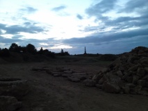
In the village of Passentin, between Neubrandenburg and Penzlin, is a reconstructed Slavic village that was build from 1994-1998. There are festivals at certain times and overnight stays for school classes and groups are also offered.
Unfortunately the village is only open a few days a year.
Website: slawendorf-passentin.de
You may be viewing yesterday's version of this page. To see the most up to date information please register for a free account.
")
")
")
")
")
")
")
")
Do not use the above information on other web sites or publications without permission of the contributor.
Click here to see more info for this site
Nearby sites
Click here to view sites on an interactive map of the areaKey: Red: member's photo, Blue: 3rd party photo, Yellow: other image, Green: no photo - please go there and take one, Grey: site destroyed
Download sites to:
KML (Google Earth)
GPX (GPS waypoints)
CSV (Garmin/Navman)
CSV (Excel)
To unlock full downloads you need to sign up as a Contributory Member. Otherwise downloads are limited to 50 sites.
Turn off the page maps and other distractions
Nearby sites listing. In the following links * = Image available
3.6km NNE 25° De groote Stein Chemnitz Natural Stone / Erratic / Other Natural Feature
3.8km S 169° Tempelberg Krukow* Stone Circle
5.7km SSE 160° Hügelgrab Alt Rehse* Round Barrow(s)
6.5km SSE 169° Hügelgrab Siehdichum Round Barrow(s)
7.7km SSE 158° Fischerinsel Wustrow Ancient Village or Settlement
7.8km SSE 166° Wustrow Hügelgrab* Round Barrow(s)
7.8km SW 226° Hügelgräber Mollenstorf* Barrow Cemetery
8.1km ESE 108° Großsteingrab Neubrandenburg* Burial Chamber or Dolmen
8.2km SW 234° Mollenstorf Rillenstein* Rock Art
8.3km NE 53° Riesenstein Krappmühle* Rock Art
8.6km SSE 169° Schalenstein Zippelow 2 Rock Art
8.7km SSE 169° Schalenstein Zippelow 1 Rock Art
8.7km E 87° Steinkisten Kulturpark* Cist
9.0km E 80° Museum Neubrandenburg* Museum
9.9km SSE 167° Bacherswall Ancient Village or Settlement
11.1km W 280° Grosssteingrab Gross Flotow* Burial Chamber or Dolmen
12.0km E 100° Grosser Stein Neubrandenburg Rock Art
12.1km W 279° Riesenstein Flotow* Natural Stone / Erratic / Other Natural Feature
12.1km N 350° Kastorfer See Burgwall III* Hillfort
12.5km N 351° Kastorfer See Burgwall I* Ancient Village or Settlement
12.5km W 260° Steingrab Möllenhagen* Chambered Tomb
12.5km N 350° Kastorfer See kleiner Burgwall II Ancient Village or Settlement
12.6km WSW 239° Schliemann Museum* Museum
12.6km WSW 239° Schälchenstein Ankershagen* Rock Art
12.9km W 260° Burgwall Möllenhagen* Ancient Village or Settlement
View more nearby sites and additional images


 We would like to know more about this location. Please feel free to add a brief description and any relevant information in your own language.
 Wir möchten mehr über diese Stätte erfahren. Bitte zögern Sie nicht, eine kurze Beschreibung und relevante Informationen in Deutsch hinzuzufügen.
 Nous aimerions en savoir encore un peu sur les lieux. S'il vous plaît n'hesitez pas à ajouter une courte description et tous les renseignements pertinents dans votre propre langue.
 Quisieramos informarnos un poco más de las lugares. No dude en añadir una breve descripción y otros datos relevantes en su propio idioma.