


<< Text Pages >> 금강리 - Burial Chamber or Dolmen in South Korea
Submitted by Klingon on Tuesday, 14 November 2006 Page Views: 2586
Neolithic and Bronze AgeSite Name: 금강리 Alternative Name: geum-gang-niCountry: South Korea
NOTE: This site is 8.227 km away from the location you searched for.
Type: Burial Chamber or Dolmen
Latitude: 38.298950N Longitude: 128.490530E
Condition:
| 5 | Perfect |
| 4 | Almost Perfect |
| 3 | Reasonable but with some damage |
| 2 | Ruined but still recognisable as an ancient site |
| 1 | Pretty much destroyed, possibly visible as crop marks |
| 0 | No data. |
| -1 | Completely destroyed |
| 5 | Superb |
| 4 | Good |
| 3 | Ordinary |
| 2 | Not Good |
| 1 | Awful |
| 0 | No data. |
| 5 | Can be driven to, probably with disabled access |
| 4 | Short walk on a footpath |
| 3 | Requiring a bit more of a walk |
| 2 | A long walk |
| 1 | In the middle of nowhere, a nightmare to find |
| 0 | No data. |
| 5 | co-ordinates taken by GPS or official recorded co-ordinates |
| 4 | co-ordinates scaled from a detailed map |
| 3 | co-ordinates scaled from a bad map |
| 2 | co-ordinates of the nearest village |
| 1 | co-ordinates of the nearest town |
| 0 | no data |
Be the first person to rate this site - see the 'Contribute!' box in the right hand menu.
Internal Links:
External Links:
Burial Chamber (Dolmen) in South Korea
SM Nelson (1993) Archaeology of Korea. Cambridge World Archaeology. Cambridge. pp. 112
You may be viewing yesterday's version of this page. To see the most up to date information please register for a free account.
Do not use the above information on other web sites or publications without permission of the contributor.
Nearby Images from Flickr
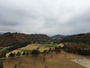
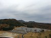
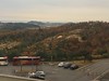
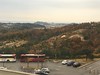
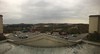
The above images may not be of the site on this page, but were taken nearby. They are loaded from Flickr so please click on them for image credits.
Click here to see more info for this site
Nearby sites
Click here to view sites on an interactive map of the areaKey: Red: member's photo, Blue: 3rd party photo, Yellow: other image, Green: no photo - please go there and take one, Grey: site destroyed
Download sites to:
KML (Google Earth)
GPX (GPS waypoints)
CSV (Garmin/Navman)
CSV (Excel)
To unlock full downloads you need to sign up as a Contributory Member. Otherwise downloads are limited to 50 sites.
Turn off the page maps and other distractions
Nearby sites listing. In the following links * = Image available
43.9km W 278° 중도 Burial Chamber or Dolmen
47.2km WSW 254° 전전리 Burial Chamber or Dolmen
58.3km W 273° 신매리 Burial Chamber or Dolmen
104.7km W 259° 양수리 Burial Chamber or Dolmen
123.9km S 188° Ipseong-ni menhir* Standing Stone (Menhir)
126.6km SW 214° Seogu-ri Menhir* Standing Stone (Menhir)
130.5km W 263° 옥성리 Burial Chamber or Dolmen
133.6km SW 222° 후남리 Burial Chamber or Dolmen
133.9km S 182° Danyang Sajiwon-ni* Pyramid / Mastaba
136.5km WSW 241° 가락동 Burial Chamber or Dolmen
138.7km W 263° Haggog-ri Dolmen* Burial Chamber or Dolmen
141.2km SW 228° 상자포리 Burial Chamber or Dolmen
143.7km S 187° Gakgi-ri menhirs* Standing Stones
144.3km SSW 213° Cheo-ri Menhir* Standing Stone (Menhir)
144.6km SW 236° Seoul Amsa-dong prehistoric Sites* Ancient Village or Settlement
145.5km S 191° Jecheon Gyo-ri* Pyramid / Mastaba
145.9km SSW 202° Buheung-sa temple* Pyramid / Mastaba
146.2km SW 232° NamhanSanseong* Hillfort
146.8km SW 235° BungnapToseong* Hillfort
147.0km SW 236° AchasanSeong* Hillfort
147.8km S 181° 황송리 Burial Chamber or Dolmen
148.4km SW 235° MongchonToseong* Hillfort
149.1km SW 234° Bangi-dong gobungun* Round Barrow(s)
149.2km WSW 247° 역삼동 Burial Chamber or Dolmen
150.5km SW 234° Seokchon-dong gobungun* Chambered Cairn
View more nearby sites and additional images


 We would like to know more about this location. Please feel free to add a brief description and any relevant information in your own language.
 Wir möchten mehr über diese Stätte erfahren. Bitte zögern Sie nicht, eine kurze Beschreibung und relevante Informationen in Deutsch hinzuzufügen.
 Nous aimerions en savoir encore un peu sur les lieux. S'il vous plaît n'hesitez pas à ajouter une courte description et tous les renseignements pertinents dans votre propre langue.
 Quisieramos informarnos un poco más de las lugares. No dude en añadir una breve descripción y otros datos relevantes en su propio idioma.