


<< Text Pages >> Kalumburu - Cave or Rock Shelter in Australia
Submitted by coldrum on Monday, 02 February 2009 Page Views: 4303
Natural PlacesSite Name: KalumburuCountry: Australia
NOTE: This site is 33.083 km away from the location you searched for.
Type: Cave or Rock Shelter
Nearest Town: Kalumburu
Latitude: 14.25319S Longitude: 126.618590E
Condition:
| 5 | Perfect |
| 4 | Almost Perfect |
| 3 | Reasonable but with some damage |
| 2 | Ruined but still recognisable as an ancient site |
| 1 | Pretty much destroyed, possibly visible as crop marks |
| 0 | No data. |
| -1 | Completely destroyed |
| 5 | Superb |
| 4 | Good |
| 3 | Ordinary |
| 2 | Not Good |
| 1 | Awful |
| 0 | No data. |
| 5 | Can be driven to, probably with disabled access |
| 4 | Short walk on a footpath |
| 3 | Requiring a bit more of a walk |
| 2 | A long walk |
| 1 | In the middle of nowhere, a nightmare to find |
| 0 | No data. |
| 5 | co-ordinates taken by GPS or official recorded co-ordinates |
| 4 | co-ordinates scaled from a detailed map |
| 3 | co-ordinates scaled from a bad map |
| 2 | co-ordinates of the nearest village |
| 1 | co-ordinates of the nearest town |
| 0 | no data |
Be the first person to rate this site - see the 'Contribute!' box in the right hand menu.
Internal Links:
External Links:
Cave or Rock Shelter in Australia
Aboriginal rock art found under rock overhangs in the Kalumburu area. Some of the art is thought to go back 25,000 years.
http://www.sacredearthsafaris.com.au/Kalumburu.html
You may be viewing yesterday's version of this page. To see the most up to date information please register for a free account.
Do not use the above information on other web sites or publications without permission of the contributor.
Nearby Images from Flickr
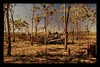
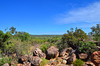
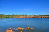
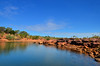
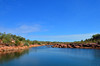
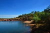
The above images may not be of the site on this page, but were taken nearby. They are loaded from Flickr so please click on them for image credits.
Click here to see more info for this site
Nearby sites
Click here to view sites on an interactive map of the areaKey: Red: member's photo, Blue: 3rd party photo, Yellow: other image, Green: no photo - please go there and take one, Grey: site destroyed
Download sites to:
KML (Google Earth)
GPX (GPS waypoints)
CSV (Garmin/Navman)
CSV (Excel)
To unlock full downloads you need to sign up as a Contributory Member. Otherwise downloads are limited to 50 sites.
Turn off the page maps and other distractions
Nearby sites listing. In the following links * = Image available
102.4km S 170° Drysdale River National Park Rock Art
561.2km SSE 167° Wolf Creek Crater Natural Stone / Erratic / Other Natural Feature
643.4km ENE 79° Kakadu* Rock Art
654.5km N 6° Jerimalai Cave or Rock Shelter
707.3km ENE 75° Kakadu - Madjedbebe* Cave or Rock Shelter
716.0km ENE 74° Kakadu - Ubirr* Rock Art
814.7km ENE 74° Nawarla Gabarnmung rock art site Rock Art
834.7km NW 307° Rindi Umalulu Burial Chamber or Dolmen
856.5km NW 314° Bena Village Megaliths* Ancient Village or Settlement
925.2km WNW 303° Anakalang Burial Chamber or Dolmen
926.1km NW 313° Liang Bua Cave Cave or Rock Shelter
934.9km WNW 302° Waikabubak East Burial Chamber or Dolmen
937.6km WNW 302° Waikabubak Burial Chamber or Dolmen
1072.3km SE 132° Devil's Marbles* Natural Stone / Erratic / Other Natural Feature
1214.6km SW 228° Nunyerry Creek* Rock Art
1248.9km SW 218° Hope Downs Cave or Rock Shelter
1260.1km SW 234° Burrup Peninsula* Rock Art
1281.2km NW 323° Leang Leang Rock Art
1282.3km NW 321° Maros (Sulawesi) Rock Art
1316.7km SSE 160° Ayers Rock* Rock Art
1321.0km SW 223° Pibara Petroglyphs* Rock Art
1335.6km SSE 150° Henbury Meteorite Craters* Natural Stone / Erratic / Other Natural Feature
1381.5km WNW 297° Pura Besakih Ancient Temple
1384.0km WNW 294° Pura Batu Pageh* Ancient Temple
1388.0km WNW 296° Goa Garba* Cave or Rock Shelter
View more nearby sites and additional images


 We would like to know more about this location. Please feel free to add a brief description and any relevant information in your own language.
 Wir möchten mehr über diese Stätte erfahren. Bitte zögern Sie nicht, eine kurze Beschreibung und relevante Informationen in Deutsch hinzuzufügen.
 Nous aimerions en savoir encore un peu sur les lieux. S'il vous plaît n'hesitez pas à ajouter une courte description et tous les renseignements pertinents dans votre propre langue.
 Quisieramos informarnos un poco más de las lugares. No dude en añadir una breve descripción y otros datos relevantes en su propio idioma.