 with our Megalithic Portal iPhone app")


<< Our Photo Pages >> Malchin (5) - Chambered Tomb in Germany in Mecklenburg-Western Pomerania
Submitted by stollentroll on Tuesday, 22 November 2005 Page Views: 1879
Neolithic and Bronze AgeSite Name: Malchin (5)Country: Germany
NOTE: This site is 3.119 km away from the location you searched for.
Land: Mecklenburg-Western Pomerania Type: Chambered Tomb
Nearest Town: Malchin Nearest Village: Vietzenhof
Latitude: 53.712900N Longitude: 12.745330E
Condition:
| 5 | Perfect |
| 4 | Almost Perfect |
| 3 | Reasonable but with some damage |
| 2 | Ruined but still recognisable as an ancient site |
| 1 | Pretty much destroyed, possibly visible as crop marks |
| 0 | No data. |
| -1 | Completely destroyed |
| 5 | Superb |
| 4 | Good |
| 3 | Ordinary |
| 2 | Not Good |
| 1 | Awful |
| 0 | No data. |
| 5 | Can be driven to, probably with disabled access |
| 4 | Short walk on a footpath |
| 3 | Requiring a bit more of a walk |
| 2 | A long walk |
| 1 | In the middle of nowhere, a nightmare to find |
| 0 | No data. |
| 5 | co-ordinates taken by GPS or official recorded co-ordinates |
| 4 | co-ordinates scaled from a detailed map |
| 3 | co-ordinates scaled from a bad map |
| 2 | co-ordinates of the nearest village |
| 1 | co-ordinates of the nearest town |
| 0 | no data |
Internal Links:
External Links:
 (PID:17739)")
Chambered tomb (stone chest), just 3 Meters away from Malchin 4.
You may be viewing yesterday's version of this page. To see the most up to date information please register for a free account.
Do not use the above information on other web sites or publications without permission of the contributor.
Nearby Images from Flickr
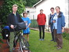
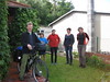

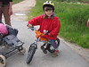
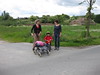
The above images may not be of the site on this page, but were taken nearby. They are loaded from Flickr so please click on them for image credits.
Click here to see more info for this site
Nearby sites
Click here to view sites on an interactive map of the areaKey: Red: member's photo, Blue: 3rd party photo, Yellow: other image, Green: no photo - please go there and take one, Grey: site destroyed
Download sites to:
KML (Google Earth)
GPX (GPS waypoints)
CSV (Garmin/Navman)
CSV (Excel)
To unlock full downloads you need to sign up as a Contributory Member. Otherwise downloads are limited to 50 sites.
Turn off the page maps and other distractions
Nearby sites listing. In the following links * = Image available
2m S 180° Malchin (4)* Chambered Tomb
52m SSW 202° Malchin (3)* Chambered Tomb
77m SSW 192° Malchin (2)* Chambered Tomb
77m SSW 192° Malchin (1)* Cist
3.9km WSW 254° Basedow Steingrab 1* Chambered Tomb
4.1km WSW 255° Basedow Steingrab 3* Chambered Tomb
4.8km SE 144° Demzin* Chambered Tomb
5.6km SSW 195° Liepen-Langwitz (2)* Chambered Tomb
5.6km SSW 204° Liepen-Langwitz (1)* Chambered Tomb
6.0km SSW 208° Langwitz* Chambered Tomb
7.7km S 171° Faulenrost Steingrab* Chambered Tomb
7.7km NE 52° Kummerow* Chambered Tomb
8.1km WNW 284° Glasow (1) Chambered Tomb
8.1km WSW 239° Basedow (2)* Chambered Tomb
8.1km WNW 285° Glasow (2) Chambered Tomb
8.9km N 5° Franzensberg Steingrab Chambered Tomb
11.3km W 262° Carlshof* Chambered Tomb
13.2km W 262° Hügelgräber Bülower Busch* Barrow Cemetery
13.2km SW 227° Moltzow Grabhuegel 2* Round Barrow(s)
13.3km SW 228° Moltzow Steingrab 1* Chambered Tomb
13.3km SW 227° Moltzow Grabhuegel 1* Round Barrow(s)
13.5km SW 226° Moltzow Steingrab 2* Chambered Tomb
14.8km NW 309° Teterow Huenenstein* Chambered Tomb
14.9km WNW 293° Hohes Holz Steinkistengrab* Cist
15.5km S 180° Carlsruh Schälchenstein* Rock Art
View more nearby sites and additional images


 We would like to know more about this location. Please feel free to add a brief description and any relevant information in your own language.
 Wir möchten mehr über diese Stätte erfahren. Bitte zögern Sie nicht, eine kurze Beschreibung und relevante Informationen in Deutsch hinzuzufügen.
 Nous aimerions en savoir encore un peu sur les lieux. S'il vous plaît n'hesitez pas à ajouter une courte description et tous les renseignements pertinents dans votre propre langue.
 Quisieramos informarnos un poco más de las lugares. No dude en añadir una breve descripción y otros datos relevantes en su propio idioma.