


<< Other Photo Pages >> Waldkirch Dolmen - Natural Stone / Erratic / Other Natural Feature in Germany in Bavaria
Submitted by holger_rix on Saturday, 26 December 2015 Page Views: 1205
Natural PlacesSite Name: Waldkirch Dolmen Alternative Name: DolmeCountry: Germany
NOTE: This site is 2.986 km away from the location you searched for.
Land: Bavaria Type: Natural Stone / Erratic / Other Natural Feature
Nearest Village: Waldkirch
Latitude: 49.727815N Longitude: 12.395620E
Condition:
| 5 | Perfect |
| 4 | Almost Perfect |
| 3 | Reasonable but with some damage |
| 2 | Ruined but still recognisable as an ancient site |
| 1 | Pretty much destroyed, possibly visible as crop marks |
| 0 | No data. |
| -1 | Completely destroyed |
| 5 | Superb |
| 4 | Good |
| 3 | Ordinary |
| 2 | Not Good |
| 1 | Awful |
| 0 | No data. |
| 5 | Can be driven to, probably with disabled access |
| 4 | Short walk on a footpath |
| 3 | Requiring a bit more of a walk |
| 2 | A long walk |
| 1 | In the middle of nowhere, a nightmare to find |
| 0 | No data. |
| 5 | co-ordinates taken by GPS or official recorded co-ordinates |
| 4 | co-ordinates scaled from a detailed map |
| 3 | co-ordinates scaled from a bad map |
| 2 | co-ordinates of the nearest village |
| 1 | co-ordinates of the nearest town |
| 0 | no data |
Be the first person to rate this site - see the 'Contribute!' box in the right hand menu.
Internal Links:
External Links:
")
Para Dolmen
You may be viewing yesterday's version of this page. To see the most up to date information please register for a free account.
Do not use the above information on other web sites or publications without permission of the contributor.
Nearby Images from Flickr

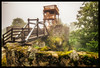
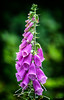
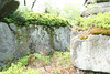


The above images may not be of the site on this page, but were taken nearby. They are loaded from Flickr so please click on them for image credits.
Click here to see more info for this site
Nearby sites
Click here to view sites on an interactive map of the areaKey: Red: member's photo, Blue: 3rd party photo, Yellow: other image, Green: no photo - please go there and take one, Grey: site destroyed
Download sites to:
KML (Google Earth)
GPX (GPS waypoints)
CSV (Garmin/Navman)
CSV (Excel)
To unlock full downloads you need to sign up as a Contributory Member. Otherwise downloads are limited to 50 sites.
Turn off the page maps and other distractions
Nearby sites listing. In the following links * = Image available
9.2km NNE 16° Geschichtspark Bärnau-Tachov* Museum
15.9km ENE 63° Tachov 2 propitiatory cross* Ancient Cross
19.1km ENE 65° Tachov 1 propitiatory cross* Ancient Cross
20.9km ENE 62° Cross stones Vítkov* Standing Stones
23.0km ENE 74° Devil's Stone (Trnová)* Standing Stone (Menhir)
24.2km ENE 69° Menhir Klíčov* Standing Stone (Menhir)
24.4km ENE 64° Cross stone Lom u Tachova* Sculptured Stone
27.8km NW 317° Summstein Fuchsmühl Modern Stone Circle etc
33.4km E 96° Borovany Devil's stone* Standing Stone (Menhir)
34.0km NNE 26° May Top Kynžvart* Natural Stone / Erratic / Other Natural Feature
34.1km NNE 19° Stone Crosses Dolní Žandov* Ancient Cross
34.1km SSW 199° Grabhügel Willhofer Berg Round Barrow(s)
35.0km NNE 19° Stone Cross Dolní Žandov II* Ancient Cross
35.6km N 354° Stone Cross Háje* Ancient Cross
36.5km S 190° Trojaburg Uckersdorf* Turf Maze
36.6km N 360° Podhrad stone crosses* Ancient Cross
38.4km ESE 116° Snem henge A* Henge
38.7km ESE 117° Snem henge B* Henge
39.2km ESE 118° Snem henge C* Henge
39.9km NE 35° Ringval Nimrod* Misc. Earthwork
40.1km NNE 17° Ringval Těšov I* Misc. Earthwork
40.4km ESE 117° Remiz Mohyly* Barrow Cemetery
41.1km S 180° Druidenstein Kroeblitz Natural Stone / Erratic / Other Natural Feature
41.6km N 354° Komorní Hůrka stone cross* Ancient Cross
41.6km S 177° Druidenstein bei Nefling Rock Outcrop
View more nearby sites and additional images


 We would like to know more about this location. Please feel free to add a brief description and any relevant information in your own language.
 Wir möchten mehr über diese Stätte erfahren. Bitte zögern Sie nicht, eine kurze Beschreibung und relevante Informationen in Deutsch hinzuzufügen.
 Nous aimerions en savoir encore un peu sur les lieux. S'il vous plaît n'hesitez pas à ajouter une courte description et tous les renseignements pertinents dans votre propre langue.
 Quisieramos informarnos un poco más de las lugares. No dude en añadir una breve descripción y otros datos relevantes en su propio idioma.