 with our Megalithic Portal iPhone app")


<< Our Photo Pages >> Ruhestein Alb - Rock Art in Germany in Bavaria
Submitted by KaiHofmann on Wednesday, 30 December 2015 Page Views: 818
Rock ArtSite Name: Ruhestein Alb Alternative Name: BetsteinCountry: Germany
NOTE: This site is 11.303 km away from the location you searched for.
Land: Bavaria Type: Rock Art
Nearest Town: Rosenheim Nearest Village: Alb
Latitude: 47.816495N Longitude: 11.921547E
Condition:
| 5 | Perfect |
| 4 | Almost Perfect |
| 3 | Reasonable but with some damage |
| 2 | Ruined but still recognisable as an ancient site |
| 1 | Pretty much destroyed, possibly visible as crop marks |
| 0 | No data. |
| -1 | Completely destroyed |
| 5 | Superb |
| 4 | Good |
| 3 | Ordinary |
| 2 | Not Good |
| 1 | Awful |
| 0 | No data. |
| 5 | Can be driven to, probably with disabled access |
| 4 | Short walk on a footpath |
| 3 | Requiring a bit more of a walk |
| 2 | A long walk |
| 1 | In the middle of nowhere, a nightmare to find |
| 0 | No data. |
| 5 | co-ordinates taken by GPS or official recorded co-ordinates |
| 4 | co-ordinates scaled from a detailed map |
| 3 | co-ordinates scaled from a bad map |
| 2 | co-ordinates of the nearest village |
| 1 | co-ordinates of the nearest town |
| 0 | no data |
Internal Links:
External Links:
")
Cup-marked stone inside the Anianus church.
You may be viewing yesterday's version of this page. To see the most up to date information please register for a free account.
Do not use the above information on other web sites or publications without permission of the contributor.
Nearby Images from Flickr
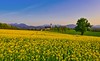
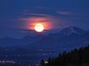


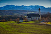
The above images may not be of the site on this page, but were taken nearby. They are loaded from Flickr so please click on them for image credits.
Click here to see more info for this site
Nearby sites
Click here to view sites on an interactive map of the areaKey: Red: member's photo, Blue: 3rd party photo, Yellow: other image, Green: no photo - please go there and take one, Grey: site destroyed
Download sites to:
KML (Google Earth)
GPX (GPS waypoints)
CSV (Garmin/Navman)
CSV (Excel)
To unlock full downloads you need to sign up as a Contributory Member. Otherwise downloads are limited to 50 sites.
Turn off the page maps and other distractions
Nearby sites listing. In the following links * = Image available
10m W 275° Anianus Quelle* Holy Well or Sacred Spring
476m NNW 335° Marinusquelle Holy Well or Sacred Spring
12.5km NW 308° Fentbach Schanze* Hillfort
16.6km NNW 328° Brunnenkapelle Kleinhelfendorf Holy Well or Sacred Spring
20.5km NNW 335° The UFO-stone of Egmating* Natural Stone / Erratic / Other Natural Feature
29.0km SSW 199° Schneidjoch Felsinschrift* Rock Art
29.0km WNW 297° Keltenschanze Endlhausen* Misc. Earthwork
29.1km SSW 199° Schneidjoch Heilige Quelle Holy Well or Sacred Spring
31.9km NW 305° Oberbiberg Viereckschanze* Misc. Earthwork
32.3km SE 140° Tischoferhoehle* Cave or Rock Shelter
32.4km NW 313° Oberhaching Viereckschanze* Misc. Earthwork
32.4km NW 313° Oberhaching Siedlung Ancient Village or Settlement
32.6km WNW 299° Holzhausen Viereckschanze (I)* Misc. Earthwork
32.7km WNW 299° Holzhausen Viereckschanze (II)* Misc. Earthwork
32.9km NW 308° Viereckschanze Deisenhofen (I)* Misc. Earthwork
32.9km NW 311° Doppelviereckschanze Deisenhofen* Misc. Earthwork
34.0km NW 310° Viereckschanze Deisenhofen (II)* Misc. Earthwork
35.7km E 83° Herrenchimsee Ringwall Ancient Village or Settlement
39.0km WNW 301° Birg Hohenschäftlarn Ancient Village or Settlement
39.4km NE 47° Grabhügel Reichertsham Barrow Cemetery
39.5km NE 48° Bräundlstein* Natural Stone / Erratic / Other Natural Feature
44.0km NW 326° Archäologische Staatssammlung Museum
45.2km ENE 69° Viereckschanze Truchtlaching* Misc. Earthwork
46.8km NW 306° Viereckschanze Buchendorf Misc. Earthwork
47.4km WSW 245° Birg Kochelsee* Hillfort
View more nearby sites and additional images


 We would like to know more about this location. Please feel free to add a brief description and any relevant information in your own language.
 Wir möchten mehr über diese Stätte erfahren. Bitte zögern Sie nicht, eine kurze Beschreibung und relevante Informationen in Deutsch hinzuzufügen.
 Nous aimerions en savoir encore un peu sur les lieux. S'il vous plaît n'hesitez pas à ajouter une courte description et tous les renseignements pertinents dans votre propre langue.
 Quisieramos informarnos un poco más de las lugares. No dude en añadir una breve descripción y otros datos relevantes en su propio idioma.