


<< Our Photo Pages >> Cossyra Acropolis - Ancient Village or Settlement in Italy in Sicily (Sicilia)
Submitted by AlexHunger on Thursday, 13 December 2007 Page Views: 5477
Multi-periodSite Name: Cossyra AcropolisCountry: Italy
NOTE: This site is 1.221 km away from the location you searched for.
Region: Sicily (Sicilia) Type: Ancient Village or Settlement
Nearest Town: Pantelleria Nearest Village: Pantelleria
Latitude: 36.822413N Longitude: 11.951404E
Condition:
| 5 | Perfect |
| 4 | Almost Perfect |
| 3 | Reasonable but with some damage |
| 2 | Ruined but still recognisable as an ancient site |
| 1 | Pretty much destroyed, possibly visible as crop marks |
| 0 | No data. |
| -1 | Completely destroyed |
| 5 | Superb |
| 4 | Good |
| 3 | Ordinary |
| 2 | Not Good |
| 1 | Awful |
| 0 | No data. |
| 5 | Can be driven to, probably with disabled access |
| 4 | Short walk on a footpath |
| 3 | Requiring a bit more of a walk |
| 2 | A long walk |
| 1 | In the middle of nowhere, a nightmare to find |
| 0 | No data. |
| 5 | co-ordinates taken by GPS or official recorded co-ordinates |
| 4 | co-ordinates scaled from a detailed map |
| 3 | co-ordinates scaled from a bad map |
| 2 | co-ordinates of the nearest village |
| 1 | co-ordinates of the nearest town |
| 0 | no data |
Internal Links:
External Links:
")
The acropolis has remains of walls made of rectangular masonry blocks, about 50 cisterns, an open space between 2 hills which held the agora as well as the foundations of a medium sized temple on one of the hills. Punic tombs and the votive terra-cottas of a small sanctuary of the Punic period were found near the north coast.
Cossyra was taken by Rome around 217 BCE, before they moved on to take Carthage itself. The inhabitants appear to have been assimilated reasonably peacefully by the Romans.
On the west coast, 3 km south-east of the harbour, there is a Neolithic village, with a rampart of small blocks of obsidian, about 7.5 m high, 10 m wide at the base, and 5 m at the top. On the undefended eastern side, remains of huts were found, with pottery, tools of obsidian, and other artifacts. The objects discovered are in the Syracuse museum. To the south-east, in the district known as the Cunelie, are a large number of tombs, known as Sesi, similar in character to the nuraghe of Sardinia, though of smaller size, consisting of round or elliptical towers with sepulchral chambers in them, built of rough blocks of lava. 57 of them can still be traced. The largest is an ellipse of about 18 by 20 m, but most of the sesi have a diameter of only 6 to 7.5 m. The identical character of the pottery found in the Sesi with that found in the prehistoric village proves that the former are the tombs of the inhabitants of the latter.
You may be viewing yesterday's version of this page. To see the most up to date information please register for a free account.
")
Do not use the above information on other web sites or publications without permission of the contributor.
davidmorgan has found this location on Google Street View:
Nearby Images from Flickr
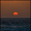
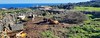
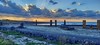
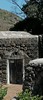
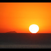
The above images may not be of the site on this page, but were taken nearby. They are loaded from Flickr so please click on them for image credits.
Click here to see more info for this site
Nearby sites
Click here to view sites on an interactive map of the areaKey: Red: member's photo, Blue: 3rd party photo, Yellow: other image, Green: no photo - please go there and take one, Grey: site destroyed
Download sites to:
KML (Google Earth)
GPX (GPS waypoints)
CSV (Garmin/Navman)
CSV (Excel)
To unlock full downloads you need to sign up as a Contributory Member. Otherwise downloads are limited to 50 sites.
Turn off the page maps and other distractions
Nearby sites listing. In the following links * = Image available
3.0km E 101° Cossyra Ashtarte Sanctuary Ancient Temple
40.7km NNE 20° Sicilian Channel Monolith* Standing Stone (Menhir)
74.4km W 272° Kelibia Fortress* Hillfort
74.6km W 271° Cloupia* Ancient Village or Settlement
76.9km W 281° Kerkouane* Ancient Village or Settlement
77.0km W 281° Kerkouane Museum* Museum
77.5km W 281° Arg el-Ghazouni Necropolis Rock Cut Tomb
81.4km W 272° El Harouri Necropolis Rock Cut Tomb
88.9km WNW 288° El Houaria Quarry* Ancient Mine, Quarry or other Industry
111.8km NE 37° Cave di Cusa* Ancient Mine, Quarry or other Industry
114.6km NE 42° Selinous Temple A and O* Ancient Temple
114.7km NE 42° Selinous Temple C* Ancient Temple
114.7km NE 42° Selinous Temple D Ancient Temple
114.8km NE 42° Selinous* Ancient Village or Settlement
115.5km NE 42° Selinous Temple of Hera* Ancient Temple
115.6km NE 42° Selinous Temple F* Ancient Temple
115.6km NE 42° Selinous Temple of Apollo* Ancient Temple
116.7km NNE 21° Capo Boeo* Museum
117.9km WSW 249° Neapolis (Nabeul)* Ancient Village or Settlement
118.1km WSW 249° Nabeul Museum Museum
124.8km NNE 21° Mozia* Museum
132.8km WSW 249° Pupput* Ancient Village or Settlement
133.9km ENE 61° Heraclea Minoa* Ancient Village or Settlement
135.2km NNE 14° Grotta del Genovese* Cave or Rock Shelter
139.3km NE 53° Caltabellotta Temple of Cronos* Ancient Temple
View more nearby sites and additional images


 We would like to know more about this location. Please feel free to add a brief description and any relevant information in your own language.
 Wir möchten mehr über diese Stätte erfahren. Bitte zögern Sie nicht, eine kurze Beschreibung und relevante Informationen in Deutsch hinzuzufügen.
 Nous aimerions en savoir encore un peu sur les lieux. S'il vous plaît n'hesitez pas à ajouter une courte description et tous les renseignements pertinents dans votre propre langue.
 Quisieramos informarnos un poco más de las lugares. No dude en añadir una breve descripción y otros datos relevantes en su propio idioma.