


<< Text Pages >> Esperhöhle Leutzdorf - Cave or Rock Shelter in Germany in Bavaria
Submitted by KaiHofmann on Monday, 25 September 2017 Page Views: 633
Natural PlacesSite Name: Esperhöhle LeutzdorfCountry: Germany
NOTE: This site is 9.28 km away from the location you searched for.
Land: Bavaria Type: Cave or Rock Shelter
Nearest Town: Bamberg Nearest Village: Gössweinstein
Latitude: 49.770888N Longitude: 11.296703E
Condition:
| 5 | Perfect |
| 4 | Almost Perfect |
| 3 | Reasonable but with some damage |
| 2 | Ruined but still recognisable as an ancient site |
| 1 | Pretty much destroyed, possibly visible as crop marks |
| 0 | No data. |
| -1 | Completely destroyed |
| 5 | Superb |
| 4 | Good |
| 3 | Ordinary |
| 2 | Not Good |
| 1 | Awful |
| 0 | No data. |
| 5 | Can be driven to, probably with disabled access |
| 4 | Short walk on a footpath |
| 3 | Requiring a bit more of a walk |
| 2 | A long walk |
| 1 | In the middle of nowhere, a nightmare to find |
| 0 | No data. |
| 5 | co-ordinates taken by GPS or official recorded co-ordinates |
| 4 | co-ordinates scaled from a detailed map |
| 3 | co-ordinates scaled from a bad map |
| 2 | co-ordinates of the nearest village |
| 1 | co-ordinates of the nearest town |
| 0 | no data |
Internal Links:
External Links:
Cave or Rock Shelter in Bavaria
Archaeologists found many iron age (6-5th century BCE) artifacts and human remains like skulls and bones) in this cave. It was probably an iron-age sanctuary.
You may be viewing yesterday's version of this page. To see the most up to date information please register for a free account.
Do not use the above information on other web sites or publications without permission of the contributor.
Nearby Images from Flickr
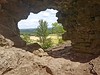
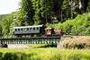
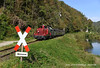
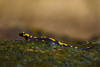
The above images may not be of the site on this page, but were taken nearby. They are loaded from Flickr so please click on them for image credits.
Click here to see more info for this site
Nearby sites
Click here to view sites on an interactive map of the areaKey: Red: member's photo, Blue: 3rd party photo, Yellow: other image, Green: no photo - please go there and take one, Grey: site destroyed
Download sites to:
KML (Google Earth)
GPX (GPS waypoints)
CSV (Garmin/Navman)
CSV (Excel)
To unlock full downloads you need to sign up as a Contributory Member. Otherwise downloads are limited to 50 sites.
Turn off the page maps and other distractions
Nearby sites listing. In the following links * = Image available
7.4km NW 310° Langenstein Streitberg Natural Stone / Erratic / Other Natural Feature
11.8km WSW 241° Walberla* Hillfort
15.3km NNE 29° Neubürg* Ancient Village or Settlement
19.8km SE 134° Felsenloch Plech Cave or Rock Shelter
21.8km SW 236° Mark-forst Grabhügel Artificial Mound
22.3km NW 318° Jungfernhoehle (Virgin's cave)* Cave or Rock Shelter
24.9km NW 304° Lietzendorf Grabhügel Barrow Cemetery
25.8km SE 126° Maximilianshoehle* Cave or Rock Shelter
26.2km ESE 123° Rabenfels Natural Stone / Erratic / Other Natural Feature
29.2km N 8° Turmberg Hillfort Hillfort
29.3km SSW 204° Kraftshofer Forst* Round Barrow(s)
31.1km SE 143° Dürrnberghöhlen* Cave or Rock Shelter
31.6km SSE 152° Wallanlage Windburg Hillfort
31.6km SW 236° Kosbacher Altar* Round Barrow(s)
31.7km SE 144° Starenfelshöhle* Cave or Rock Shelter
31.7km SE 146° Neutrasfelsen Natural Stone / Erratic / Other Natural Feature
32.6km SSW 193° Behringersdorf* Chambered Tomb
32.6km WNW 294° Historisches Museum Bamberg* Museum
33.7km SSE 157° Houbirg* Causewayed Enclosure
34.8km SSE 156° Hohler Fels Houbirg* Cave or Rock Shelter
36.4km SSE 152° Akropolis der Kelten* Ancient Village or Settlement
38.7km SSW 203° Naturhistorisches Museum Nürnberg* Museum
39.6km WNW 302° Bamberg Cave Rock Art
40.7km NNW 332° Staffelberg* Hillfort
42.3km ESE 121° Hahnbacher Teufelstein Natural Stone / Erratic / Other Natural Feature
View more nearby sites and additional images


 We would like to know more about this location. Please feel free to add a brief description and any relevant information in your own language.
 Wir möchten mehr über diese Stätte erfahren. Bitte zögern Sie nicht, eine kurze Beschreibung und relevante Informationen in Deutsch hinzuzufügen.
 Nous aimerions en savoir encore un peu sur les lieux. S'il vous plaît n'hesitez pas à ajouter une courte description et tous les renseignements pertinents dans votre propre langue.
 Quisieramos informarnos un poco más de las lugares. No dude en añadir una breve descripción y otros datos relevantes en su propio idioma.