


<< Our Photo Pages >> Kaltenbrunn - Modern Stone Circle etc in Germany in Bavaria
Submitted by Klingon on Thursday, 26 July 2018 Page Views: 1452
Modern SitesSite Name: KaltenbrunnCountry: Germany Land: Bavaria Type: Modern Stone Circle etc
Nearest Town: Garmisch-Partenkirchen Nearest Village: Kaltenbrunn
Latitude: 47.489934N Longitude: 11.176177E
Condition:
| 5 | Perfect |
| 4 | Almost Perfect |
| 3 | Reasonable but with some damage |
| 2 | Ruined but still recognisable as an ancient site |
| 1 | Pretty much destroyed, possibly visible as crop marks |
| 0 | No data. |
| -1 | Completely destroyed |
| 5 | Superb |
| 4 | Good |
| 3 | Ordinary |
| 2 | Not Good |
| 1 | Awful |
| 0 | No data. |
| 5 | Can be driven to, probably with disabled access |
| 4 | Short walk on a footpath |
| 3 | Requiring a bit more of a walk |
| 2 | A long walk |
| 1 | In the middle of nowhere, a nightmare to find |
| 0 | No data. |
| 5 | co-ordinates taken by GPS or official recorded co-ordinates |
| 4 | co-ordinates scaled from a detailed map |
| 3 | co-ordinates scaled from a bad map |
| 2 | co-ordinates of the nearest village |
| 1 | co-ordinates of the nearest town |
| 0 | no data |
Internal Links:
External Links:
I have visited· I would like to visit
Klingon saw from a distance on 12th Jul 2018 - their rating: Cond: 5 Amb: 4 Access: 4
")
You may be viewing yesterday's version of this page. To see the most up to date information please register for a free account.
")
Do not use the above information on other web sites or publications without permission of the contributor.
Nearby Images from Flickr
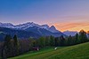
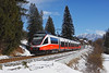
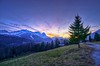
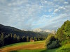
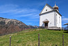
The above images may not be of the site on this page, but were taken nearby. They are loaded from Flickr so please click on them for image credits.
Click here to see more info for this site
Nearby sites
Click here to view sites on an interactive map of the areaKey: Red: member's photo, Blue: 3rd party photo, Yellow: other image, Green: no photo - please go there and take one, Grey: site destroyed
Download sites to:
KML (Google Earth)
GPX (GPS waypoints)
CSV (Garmin/Navman)
CSV (Excel)
To unlock full downloads you need to sign up as a Contributory Member. Otherwise downloads are limited to 50 sites.
Turn off the page maps and other distractions
Nearby sites listing. In the following links * = Image available
14.5km NW 320° Unterammergau* Rock Art
20.7km NE 38° Birg Kochelsee* Hillfort
34.8km SSE 148° Igls Hinkelstein Standing Stone (Menhir)
35.6km SSE 149° Goldbichl Natural Stone / Erratic / Other Natural Feature
36.5km WNW 283° Summstein Lithophon* Modern Stone Circle etc
39.4km SSE 149° Cupstone Slabs-Graveyard Tarzens* Rock Art
40.4km SW 216° Sautens Opferstein Natural Stone / Erratic / Other Natural Feature
42.0km SSE 167° Cupstone Menhir Viggar Valley Tyrol* Rock Art
42.1km S 170° Cupstone Lithagrub-Profegl Alm* Rock Art
43.8km SSW 205° Ötzi Village* Museum
47.2km E 79° Schneidjoch Heilige Quelle Holy Well or Sacred Spring
47.2km E 79° Schneidjoch Felsinschrift* Rock Art
47.3km ESE 114° Pleiades Stone of Tarzens* Rock Art
49.8km SSW 202° Innerbergalm Schalenstein Rock Art
50.3km SSW 198° Burgstein Schalenstein Rock Art
51.1km N 11° Pfahlbausiedlung Roseninsel* Crannog
55.3km NNW 331° Viereckschanze Leeder* Misc. Earthwork
56.9km N 0° Baiuvarian Cemetery Herrsching* Barrow Cemetery
56.9km N 0° Archaeological Park Herrsching* Museum
57.7km NNE 31° Keltenschanze Endlhausen* Misc. Earthwork
58.7km NNE 27° Holzhausen Viereckschanze (II)* Misc. Earthwork
58.9km NNE 27° Holzhausen Viereckschanze (I)* Misc. Earthwork
59.1km S 190° Windachtal Schalenstein I Rock Art
59.2km SSW 192° Sölden menhir* Standing Stone (Menhir)
59.6km SSW 192° Schlangenfelsen (Snake's rock) Rock Art
View more nearby sites and additional images


 We would like to know more about this location. Please feel free to add a brief description and any relevant information in your own language.
 Wir möchten mehr über diese Stätte erfahren. Bitte zögern Sie nicht, eine kurze Beschreibung und relevante Informationen in Deutsch hinzuzufügen.
 Nous aimerions en savoir encore un peu sur les lieux. S'il vous plaît n'hesitez pas à ajouter une courte description et tous les renseignements pertinents dans votre propre langue.
 Quisieramos informarnos un poco más de las lugares. No dude en añadir una breve descripción y otros datos relevantes en su propio idioma.