 with our Megalithic Portal iPhone app")


<< Text Pages >> Lietzendorf Grabhügel - Barrow Cemetery in Germany in Bavaria
Submitted by KaiHofmann on Monday, 19 January 2015 Page Views: 1121
Neolithic and Bronze AgeSite Name: Lietzendorf GrabhügelCountry: Germany
NOTE: This site is 6.697 km away from the location you searched for.
Land: Bavaria Type: Barrow Cemetery
Nearest Town: Bamberg Nearest Village: Lietzendorf
Latitude: 49.897158N Longitude: 11.009464E
Condition:
| 5 | Perfect |
| 4 | Almost Perfect |
| 3 | Reasonable but with some damage |
| 2 | Ruined but still recognisable as an ancient site |
| 1 | Pretty much destroyed, possibly visible as crop marks |
| 0 | No data. |
| -1 | Completely destroyed |
| 5 | Superb |
| 4 | Good |
| 3 | Ordinary |
| 2 | Not Good |
| 1 | Awful |
| 0 | No data. |
| 5 | Can be driven to, probably with disabled access |
| 4 | Short walk on a footpath |
| 3 | Requiring a bit more of a walk |
| 2 | A long walk |
| 1 | In the middle of nowhere, a nightmare to find |
| 0 | No data. |
| 5 | co-ordinates taken by GPS or official recorded co-ordinates |
| 4 | co-ordinates scaled from a detailed map |
| 3 | co-ordinates scaled from a bad map |
| 2 | co-ordinates of the nearest village |
| 1 | co-ordinates of the nearest town |
| 0 | no data |
Internal Links:
External Links:
Barrow Cemetery in Bavaria
Six large nice renovated iron-age (celtic) burial mounds with burial steles, close to the street.
You may be viewing yesterday's version of this page. To see the most up to date information please register for a free account.
Do not use the above information on other web sites or publications without permission of the contributor.
Nearby Images from Flickr
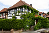
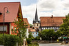
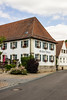
The above images may not be of the site on this page, but were taken nearby. They are loaded from Flickr so please click on them for image credits.
Click here to see more info for this site
Nearby sites
Click here to view sites on an interactive map of the areaKey: Red: member's photo, Blue: 3rd party photo, Yellow: other image, Green: no photo - please go there and take one, Grey: site destroyed
Download sites to:
KML (Google Earth)
GPX (GPS waypoints)
CSV (Garmin/Navman)
CSV (Excel)
To unlock full downloads you need to sign up as a Contributory Member. Otherwise downloads are limited to 50 sites.
Turn off the page maps and other distractions
Nearby sites listing. In the following links * = Image available
6.2km ENE 66° Jungfernhoehle (Virgin's cave)* Cave or Rock Shelter
9.2km W 266° Historisches Museum Bamberg* Museum
14.7km WNW 299° Bamberg Cave Rock Art
17.6km ESE 122° Langenstein Streitberg Natural Stone / Erratic / Other Natural Feature
21.7km N 3° Staffelberg* Hillfort
22.2km SSE 152° Walberla* Hillfort
24.9km SE 124° Esperhöhle Leutzdorf Cave or Rock Shelter
26.3km S 175° Mark-forst Grabhügel Artificial Mound
28.1km E 91° Neubürg* Ancient Village or Settlement
28.6km N 350° Püchitz Neolithic Village Ancient Village or Settlement
28.7km ENE 58° Turmberg Hillfort Hillfort
32.3km S 190° Kosbacher Altar* Round Barrow(s)
34.4km WSW 259° Hünerstein Ebrach Standing Stone (Menhir)
34.6km W 281° Kleiner Knetzberg Hillfort
37.5km W 262° Ebracher Bildstein* Sculptured Stone
39.0km NE 40° Schamelstein Sculptured Stone
40.4km SW 228° Oasen der Sinne* Museum
41.6km SSE 168° Kraftshofer Forst* Round Barrow(s)
44.6km SE 128° Felsenloch Plech Cave or Rock Shelter
47.8km SSE 164° Behringersdorf* Chambered Tomb
48.6km NNW 339° Saarbach Hünengrab Not Known (by us)
49.8km S 174° Naturhistorisches Museum Nürnberg* Museum
50.8km SE 125° Maximilianshoehle* Cave or Rock Shelter
51.1km NNW 344° Poststein Rock Art
51.1km ESE 124° Rabenfels Natural Stone / Erratic / Other Natural Feature
View more nearby sites and additional images


 We would like to know more about this location. Please feel free to add a brief description and any relevant information in your own language.
 Wir möchten mehr über diese Stätte erfahren. Bitte zögern Sie nicht, eine kurze Beschreibung und relevante Informationen in Deutsch hinzuzufügen.
 Nous aimerions en savoir encore un peu sur les lieux. S'il vous plaît n'hesitez pas à ajouter une courte description et tous les renseignements pertinents dans votre propre langue.
 Quisieramos informarnos un poco más de las lugares. No dude en añadir una breve descripción y otros datos relevantes en su propio idioma.