


<< Our Photo Pages >> Gräwig Grabhügelfeld - Barrow Cemetery in Germany in Lower Saxony, Bremen
Submitted by AlexHunger on Monday, 07 November 2005 Page Views: 3047
Neolithic and Bronze AgeSite Name: Gräwig GrabhügelfeldCountry: Germany
NOTE: This site is 20.142 km away from the location you searched for.
Land: Lower Saxony, Bremen Type: Barrow Cemetery
Nearest Town: Peine
Latitude: 52.296050N Longitude: 10.243710E
Condition:
| 5 | Perfect |
| 4 | Almost Perfect |
| 3 | Reasonable but with some damage |
| 2 | Ruined but still recognisable as an ancient site |
| 1 | Pretty much destroyed, possibly visible as crop marks |
| 0 | No data. |
| -1 | Completely destroyed |
| 5 | Superb |
| 4 | Good |
| 3 | Ordinary |
| 2 | Not Good |
| 1 | Awful |
| 0 | No data. |
| 5 | Can be driven to, probably with disabled access |
| 4 | Short walk on a footpath |
| 3 | Requiring a bit more of a walk |
| 2 | A long walk |
| 1 | In the middle of nowhere, a nightmare to find |
| 0 | No data. |
| 5 | co-ordinates taken by GPS or official recorded co-ordinates |
| 4 | co-ordinates scaled from a detailed map |
| 3 | co-ordinates scaled from a bad map |
| 2 | co-ordinates of the nearest village |
| 1 | co-ordinates of the nearest town |
| 0 | no data |
Internal Links:
External Links:
")
Series of about a dozen Bronze age tumuli in woods south of Peine, past hospital.
You may be viewing yesterday's version of this page. To see the most up to date information please register for a free account.
Do not use the above information on other web sites or publications without permission of the contributor.
Nearby Images from Flickr

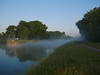
The above images may not be of the site on this page, but were taken nearby. They are loaded from Flickr so please click on them for image credits.
Click here to see more info for this site
Nearby sites
Click here to view sites on an interactive map of the areaKey: Red: member's photo, Blue: 3rd party photo, Yellow: other image, Green: no photo - please go there and take one, Grey: site destroyed
Download sites to:
KML (Google Earth)
GPX (GPS waypoints)
CSV (Garmin/Navman)
CSV (Excel)
To unlock full downloads you need to sign up as a Contributory Member. Otherwise downloads are limited to 50 sites.
Turn off the page maps and other distractions
Nearby sites listing. In the following links * = Image available
4.4km WSW 248° Bueltener Holz Huegelgrabfeld* Barrow Cemetery
6.8km SW 224° Adenstedter Lah Hügelgräber* Barrow Cemetery
21.8km SW 227° Glockenstein* Standing Stone (Menhir)
24.6km SE 126° Braunschweigisches Landesmuseum* Museum
26.1km SW 232° Roemer-und Pelizaeus-Museum Hildesheim* Museum
26.5km WSW 243° Giesener Forst Grabhügelfeld Barrow Cemetery
28.3km WNW 292° Urnengräberfeld Misburg* Barrow Cemetery
29.5km S 184° Hubertuskapelle* Cave or Rock Shelter
29.9km S 177° Steinkreuz Sehlde Ancient Cross
31.1km WNW 285° Heiligers Brunnen* Holy Well or Sacred Spring
31.2km WNW 285° Kopperloch* Holy Well or Sacred Spring
31.3km SW 235° Sorsum Galeriegrab Rock Cut Tomb
33.1km SSE 158° Scheibenkreuzstein Liebenburg* Early Christian Sculptured Stone
33.3km ESE 104° Kleiner Tafelberg Hügelgrab* Artificial Mound
33.4km WSW 237° Beusterburg Ringwall Causewayed Enclosure
33.6km ESE 111° Evessen Tumulus* Round Barrow(s)
34.1km WNW 288° Das Rad* Turf Maze
34.9km WSW 239° Grabhügelfeld Osterholz Barrow Cemetery
35.1km WNW 283° Anderlingen Steinkistengrab (Hannover)* Chambered Tomb
35.1km WNW 283° Niedersächsischen Landesmuseums Hannover* Museum
35.5km ESE 108° Evessen Steingrab* Chambered Tomb
35.8km SE 124° Remlingen Totenhütte* Chambered Tomb
37.3km S 169° Bredelem Menhir* Standing Stone (Menhir)
37.4km ESE 120° Galgenberg von Klein Vahlberg* Artificial Mound
37.5km ESE 121° Klein Vahlberg Menhir* Standing Stone (Menhir)
View more nearby sites and additional images


 We would like to know more about this location. Please feel free to add a brief description and any relevant information in your own language.
 Wir möchten mehr über diese Stätte erfahren. Bitte zögern Sie nicht, eine kurze Beschreibung und relevante Informationen in Deutsch hinzuzufügen.
 Nous aimerions en savoir encore un peu sur les lieux. S'il vous plaît n'hesitez pas à ajouter une courte description et tous les renseignements pertinents dans votre propre langue.
 Quisieramos informarnos un poco más de las lugares. No dude en añadir una breve descripción y otros datos relevantes en su propio idioma.