

<< Our Photo Pages >> Vangsgård Rundhøj - Round Barrow(s) in Denmark in Nordjylland
Submitted by Podovsky on Thursday, 22 August 2019 Page Views: 389
Neolithic and Bronze AgeSite Name: Vangsgård RundhøjCountry: Denmark
NOTE: This site is 5.344 km away from the location you searched for.
County: Nordjylland Type: Round Barrow(s)
Nearest Town: Hjørring Nearest Village: Gærum
Latitude: 57.420244N Longitude: 10.447768E
Condition:
| 5 | Perfect |
| 4 | Almost Perfect |
| 3 | Reasonable but with some damage |
| 2 | Ruined but still recognisable as an ancient site |
| 1 | Pretty much destroyed, possibly visible as crop marks |
| 0 | No data. |
| -1 | Completely destroyed |
| 5 | Superb |
| 4 | Good |
| 3 | Ordinary |
| 2 | Not Good |
| 1 | Awful |
| 0 | No data. |
| 5 | Can be driven to, probably with disabled access |
| 4 | Short walk on a footpath |
| 3 | Requiring a bit more of a walk |
| 2 | A long walk |
| 1 | In the middle of nowhere, a nightmare to find |
| 0 | No data. |
| 5 | co-ordinates taken by GPS or official recorded co-ordinates |
| 4 | co-ordinates scaled from a detailed map |
| 3 | co-ordinates scaled from a bad map |
| 2 | co-ordinates of the nearest village |
| 1 | co-ordinates of the nearest town |
| 0 | no data |
Internal Links:
External Links:
I have visited· I would like to visit
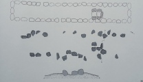
Podovsky visited on 20th Aug 2019 - their rating: Cond: 5 Amb: 5 Access: 5 Some stones are visible at the surface.
")
Situated next to the road.
For more information see Danish registration 100305-157
You may be viewing yesterday's version of this page. To see the most up to date information please register for a free account.
Do not use the above information on other web sites or publications without permission of the contributor.
Nearby Images from Flickr
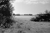
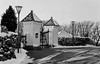

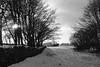
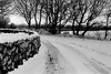
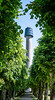
The above images may not be of the site on this page, but were taken nearby. They are loaded from Flickr so please click on them for image credits.
Click here to see more info for this site
Nearby sites
Click here to view sites on an interactive map of the areaKey: Red: member's photo, Blue: 3rd party photo, Yellow: other image, Green: no photo - please go there and take one, Grey: site destroyed
Download sites to:
KML (Google Earth)
GPX (GPS waypoints)
CSV (Garmin/Navman)
CSV (Excel)
To unlock full downloads you need to sign up as a Contributory Member. Otherwise downloads are limited to 50 sites.
Turn off the page maps and other distractions
Nearby sites listing. In the following links * = Image available
141m W 261° Vangsgård Runddysse* Burial Chamber or Dolmen
1.7km WSW 237° Højvang Slotshøj Runddysse* Burial Chamber or Dolmen
2.6km NNW 341° Favrholt Langdysse Long Barrow
2.7km SSW 212° Vester Præstegård Langdysse* Long Barrow
2.8km NW 317° Åsted Runddysse 1 Burial Chamber or Dolmen
2.9km NW 318° Åsted Runddysse 2 Burial Chamber or Dolmen
3.0km NW 322° Åsted Runddysse 3 Burial Chamber or Dolmen
3.4km SW 215° Vester Præstegård Blakshøj Jættestue* Passage Grave
3.6km SSE 154° Understed Ravntoft Stenkiste Cist
6.3km S 180° Gammel Præstegård Stenkiste Cist
6.3km NW 321° Vasen Langdysse Long Barrow
6.4km WSW 256° Eget Runddysse Burial Chamber or Dolmen
8.1km SW 218° Hørbylund Langdysse Long Barrow
10.0km WNW 285° Højen Langdysse* Long Barrow
10.1km WNW 284° Tislum Langdysse Long Barrow
10.1km NW 307° Tolne Langdysse* Long Barrow
10.3km SW 230° Højstrup Vang Runddysse Burial Chamber or Dolmen
10.6km SW 215° Hørby Langdysse Long Barrow
11.0km S 172° Volstrup Stenkiste Cist
11.7km NW 309° Skørbæk Hede Stensætning* Standing Stones
12.5km NW 315° Mosbjerg Eskjær Langdysse Long Barrow
12.6km NW 316° Mosbjerg Eskjær Runddysse Burial Chamber or Dolmen
12.7km NW 318° Vogn Stenkiste Cist
13.0km SSW 213° Ørslev Langdysse Long Barrow
14.3km SSW 199° Stenbakken Jyndovn Runddysse Burial Chamber or Dolmen
View more nearby sites and additional images


 We would like to know more about this location. Please feel free to add a brief description and any relevant information in your own language.
 Wir möchten mehr über diese Stätte erfahren. Bitte zögern Sie nicht, eine kurze Beschreibung und relevante Informationen in Deutsch hinzuzufügen.
 Nous aimerions en savoir encore un peu sur les lieux. S'il vous plaît n'hesitez pas à ajouter une courte description et tous les renseignements pertinents dans votre propre langue.
 Quisieramos informarnos un poco más de las lugares. No dude en añadir una breve descripción y otros datos relevantes en su propio idioma.