 with our Megalithic Portal iPhone app")

<< Our Photo Pages >> Pronstorf Schalenstein (Reinsbek) - Rock Art in Germany in Schleswig-Holstein, Hamburg
Submitted by holger_rix on Sunday, 08 June 2008 Page Views: 3092
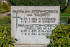
Rock ArtSite Name: Pronstorf Schalenstein (Reinsbek) Alternative Name: Schalenstein ReinsbekCountry: Germany
NOTE: This site is 0.104 km away from the location you searched for.
Land: Schleswig-Holstein, Hamburg Type: Rock Art
Nearest Town: Luebeck Nearest Village: Pronstorf
Latitude: 53.958072N Longitude: 10.471572E
Condition:
| 5 | Perfect |
| 4 | Almost Perfect |
| 3 | Reasonable but with some damage |
| 2 | Ruined but still recognisable as an ancient site |
| 1 | Pretty much destroyed, possibly visible as crop marks |
| 0 | No data. |
| -1 | Completely destroyed |
| 5 | Superb |
| 4 | Good |
| 3 | Ordinary |
| 2 | Not Good |
| 1 | Awful |
| 0 | No data. |
| 5 | Can be driven to, probably with disabled access |
| 4 | Short walk on a footpath |
| 3 | Requiring a bit more of a walk |
| 2 | A long walk |
| 1 | In the middle of nowhere, a nightmare to find |
| 0 | No data. |
| 5 | co-ordinates taken by GPS or official recorded co-ordinates |
| 4 | co-ordinates scaled from a detailed map |
| 3 | co-ordinates scaled from a bad map |
| 2 | co-ordinates of the nearest village |
| 1 | co-ordinates of the nearest town |
| 0 | no data |
Internal Links:
External Links:
 (PID:39482)")
German Info (Wikipedia)
This stone with apprx. 270 cup marks was found in the near Reinsbek and brought here to the church of Pronstorf.
You may be viewing yesterday's version of this page. To see the most up to date information please register for a free account.
 (PID:39486)")
 (PID:39485)")
 (PID:39481)")
Do not use the above information on other web sites or publications without permission of the contributor.
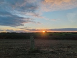
Nearby Images from Flickr
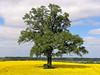
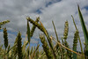

The above images may not be of the site on this page, but were taken nearby. They are loaded from Flickr so please click on them for image credits.
Click here to see more info for this site
Nearby sites
Click here to view sites on an interactive map of the areaKey: Red: member's photo, Blue: 3rd party photo, Yellow: other image, Green: no photo - please go there and take one, Grey: site destroyed
Download sites to:
KML (Google Earth)
GPX (GPS waypoints)
CSV (Garmin/Navman)
CSV (Excel)
To unlock full downloads you need to sign up as a Contributory Member. Otherwise downloads are limited to 50 sites.
Turn off the page maps and other distractions
Nearby sites listing. In the following links * = Image available
131m ENE 60° Pronstorf Huegelgrab 2* Round Barrow(s)
1.2km SSE 162° Pronstorf Huegelgrab 1* Round Barrow(s)
1.9km SE 143° Goldenbek Grabhuegelgruppe* Round Barrow(s)
2.1km NNE 17° Strenglin Huegelgrab 2* Round Barrow(s)
2.1km NNE 13° Strenglin Huegelgrab 1* Round Barrow(s)
5.6km WNW 301° Wensin Huegelgrab* Round Barrow(s)
8.9km W 280° Gross Roennau Steingrab* Burial Chamber or Dolmen
12.0km WNW 299° Blunk Schalenstein* Rock Art
12.0km NW 312° Muggesfelde Huegelgrab* Round Barrow(s)
12.6km S 177° Reinfeld Steingrab* Burial Chamber or Dolmen
14.0km WNW 283° Negernboetel Langbett 4* Long Barrow
14.2km W 281° Negernboetel Langbett 3* Long Barrow
14.3km W 281° Negernboetel Langbett 2* Long Barrow
14.3km W 280° Negernboetel Langbett 5* Long Barrow
14.3km W 281° Negernboetel Langbett 1* Long Barrow
14.6km NW 320° Tensfeld Langbett* Long Barrow
14.7km SW 218° Suehlen Huegelgrab* Round Barrow(s)
15.3km WSW 258° Fahrenkrug Huenengrab* Round Barrow(s)
15.3km WSW 257° Hoegersdorf Grabhuegel* Round Barrow(s)
15.8km W 260° Wittenborn Huegelgrab 1* Round Barrow(s)
15.9km NNW 337° Nehmten Steingrab 2* Long Barrow
16.0km NNW 337° Nehmten Steingrab 1* Long Barrow
16.0km NNW 337° Nehmten Steingrab 3 Long Barrow
16.1km NNW 338° Nehmten Huegelgrab 2* Round Barrow(s)
16.2km NNW 339° Nehmten Huegelgrab 1* Round Barrow(s)
View more nearby sites and additional images


 We would like to know more about this location. Please feel free to add a brief description and any relevant information in your own language.
 Wir möchten mehr über diese Stätte erfahren. Bitte zögern Sie nicht, eine kurze Beschreibung und relevante Informationen in Deutsch hinzuzufügen.
 Nous aimerions en savoir encore un peu sur les lieux. S'il vous plaît n'hesitez pas à ajouter une courte description et tous les renseignements pertinents dans votre propre langue.
 Quisieramos informarnos un poco más de las lugares. No dude en añadir una breve descripción y otros datos relevantes en su propio idioma.