


<< Our Photo Pages >> Borno Stone - Standing Stone (Menhir) in Italy in Lombardia
Submitted by AlexHunger on Sunday, 16 March 2008 Page Views: 4388
Neolithic and Bronze AgeSite Name: Borno StoneCountry: Italy
NOTE: This site is 8.964 km away from the location you searched for.
Region: Lombardia Type: Standing Stone (Menhir)
Nearest Town: Bergamo Nearest Village: Borno
Latitude: 45.945220N Longitude: 10.203720E
Condition:
| 5 | Perfect |
| 4 | Almost Perfect |
| 3 | Reasonable but with some damage |
| 2 | Ruined but still recognisable as an ancient site |
| 1 | Pretty much destroyed, possibly visible as crop marks |
| 0 | No data. |
| -1 | Completely destroyed |
| 5 | Superb |
| 4 | Good |
| 3 | Ordinary |
| 2 | Not Good |
| 1 | Awful |
| 0 | No data. |
| 5 | Can be driven to, probably with disabled access |
| 4 | Short walk on a footpath |
| 3 | Requiring a bit more of a walk |
| 2 | A long walk |
| 1 | In the middle of nowhere, a nightmare to find |
| 0 | No data. |
| 5 | co-ordinates taken by GPS or official recorded co-ordinates |
| 4 | co-ordinates scaled from a detailed map |
| 3 | co-ordinates scaled from a bad map |
| 2 | co-ordinates of the nearest village |
| 1 | co-ordinates of the nearest town |
| 0 | no data |
Internal Links:
External Links:
")
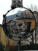
Standing stone, approx 3 Meters tall, not necessarily dating to antiquity, built into wall within village. The other Bronze age stones in the village could not be found.
You may be viewing yesterday's version of this page. To see the most up to date information please register for a free account.
Do not use the above information on other web sites or publications without permission of the contributor.
Nearby Images from Flickr
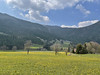
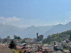
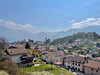
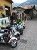
The above images may not be of the site on this page, but were taken nearby. They are loaded from Flickr so please click on them for image credits.
Click here to see more info for this site
Nearby sites
Click here to view sites on an interactive map of the areaKey: Red: member's photo, Blue: 3rd party photo, Yellow: other image, Green: no photo - please go there and take one, Grey: site destroyed
Download sites to:
KML (Google Earth)
GPX (GPS waypoints)
CSV (Garmin/Navman)
CSV (Excel)
To unlock full downloads you need to sign up as a Contributory Member. Otherwise downloads are limited to 50 sites.
Turn off the page maps and other distractions
Nearby sites listing. In the following links * = Image available
1.1km ENE 75° Borno 4 Sculptured Stone
3.9km ENE 60° Asino-Anvoia* Standing Stones
4.0km ENE 65° Anvoia Stones* Standing Stones
4.5km ENE 76° Ossimo Stones Sculptured Stone
6.0km S 184° Boario Terme Archeopark Museum
6.8km SSW 200° Luine* Rock Art
9.4km NE 38° Concarena* Natural Stone / Erratic / Other Natural Feature
13.6km ENE 57° Nadro Cup-Marked-Stone* Rock Art
13.7km ENE 57° Foppe-Nadro Museum* Museum
13.9km NE 55° Nadro Ancient Road* Ancient Trackway
14.0km NE 55° Foppe-Nadro Stone* Standing Stone (Menhir)
14.0km NE 54° Foppe-Nadro Villaggio Prehistorico* Museum
14.1km NE 53° Foppe-Nadro Rock 1* Rock Art
14.1km NE 53° Foppe-Nadro Rock 6* Rock Art
14.1km NE 53° Foppe-Nadro Rock 4* Rock Art
14.2km NE 47° Cemmo Stones* Rock Art
14.2km NE 53° Foppe-Nadro Rock 22* Rock Art
14.2km NE 53° Foppe-Nadro Rock 21* Rock Art
14.2km NE 53° Foppe-Nadro Rock 23* Rock Art
14.2km NE 54° Sotto Roccia shelter II* Cave or Rock Shelter
14.2km NE 53° Foppe-Nadro Rock 24* Rock Art
14.2km NE 53° Foppe-Nadro Rock 25* Rock Art
14.3km NE 53° Foppe-Nadro Rock 26* Rock Art
14.3km NE 53° Foppe-Nadro Rock 29* Rock Art
14.3km NE 53° Foppe-Nadro Rock 34* Rock Art
View more nearby sites and additional images

")
 We would like to know more about this location. Please feel free to add a brief description and any relevant information in your own language.
 Wir möchten mehr über diese Stätte erfahren. Bitte zögern Sie nicht, eine kurze Beschreibung und relevante Informationen in Deutsch hinzuzufügen.
 Nous aimerions en savoir encore un peu sur les lieux. S'il vous plaît n'hesitez pas à ajouter une courte description et tous les renseignements pertinents dans votre propre langue.
 Quisieramos informarnos un poco más de las lugares. No dude en añadir una breve descripción y otros datos relevantes en su propio idioma.