


<< Our Photo Pages >> Dolmen des Grès de Linas - Burial Chamber or Dolmen in France in Ile-de-France:Essonne (91)
Submitted by thecaptain on Thursday, 10 February 2005 Page Views: 4099
Neolithic and Bronze AgeSite Name: Dolmen des Grès de Linas Alternative Name: Le Loup de Thionville, Pierre Levée [de Graudeville]Country: France
NOTE: This site is 5.204 km away from the location you searched for.
Département: Ile-de-France:Essonne (91) Type: Burial Chamber or Dolmen
Nearest Town: Etampes Nearest Village: Congerville-Thionville
Latitude: 48.369485N Longitude: 1.986978E
Condition:
| 5 | Perfect |
| 4 | Almost Perfect |
| 3 | Reasonable but with some damage |
| 2 | Ruined but still recognisable as an ancient site |
| 1 | Pretty much destroyed, possibly visible as crop marks |
| 0 | No data. |
| -1 | Completely destroyed |
| 5 | Superb |
| 4 | Good |
| 3 | Ordinary |
| 2 | Not Good |
| 1 | Awful |
| 0 | No data. |
| 5 | Can be driven to, probably with disabled access |
| 4 | Short walk on a footpath |
| 3 | Requiring a bit more of a walk |
| 2 | A long walk |
| 1 | In the middle of nowhere, a nightmare to find |
| 0 | No data. |
| 5 | co-ordinates taken by GPS or official recorded co-ordinates |
| 4 | co-ordinates scaled from a detailed map |
| 3 | co-ordinates scaled from a bad map |
| 2 | co-ordinates of the nearest village |
| 1 | co-ordinates of the nearest town |
| 0 | no data |
Internal Links:
External Links:
I have visited· I would like to visit
TheCaptain couldn't find on 6th Aug 2005 I spent ages looking for this. I can only assume it is somewhere in the very dense fenced off woodland, in amongst the open fields. I am getting fed up of all this again.
neolithique02 have visited here
")
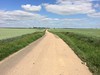
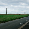
This site is in the fields. The easiest access is from (48.36935, 1.99485).
You may be viewing yesterday's version of this page. To see the most up to date information please register for a free account.
")
")
Do not use the above information on other web sites or publications without permission of the contributor.
Nearby Images from Flickr

The above images may not be of the site on this page, but were taken nearby. They are loaded from Flickr so please click on them for image credits.
Click here to see more info for this site
Nearby sites
Click here to view sites on an interactive map of the areaKey: Red: member's photo, Blue: 3rd party photo, Yellow: other image, Green: no photo - please go there and take one, Grey: site destroyed
Download sites to:
KML (Google Earth)
GPX (GPS waypoints)
CSV (Garmin/Navman)
CSV (Excel)
To unlock full downloads you need to sign up as a Contributory Member. Otherwise downloads are limited to 50 sites.
Turn off the page maps and other distractions
Nearby sites listing. In the following links * = Image available
1.9km N 2° La Grosse Pierre Passage Grave
9.9km NE 37° Les Boutards Passage Grave
10.2km NNE 30° Dolmen de Boutervilliers Burial Chamber or Dolmen
11.0km NE 53° Pierrefitte Menhir Standing Stone (Menhir)
12.6km SSE 168° La Pierre Clouée (Andonville)* Burial Chamber or Dolmen
17.8km ENE 57° Polissoir de Villemartin Polissoir
19.5km NNE 18° Sermaise menhir* Standing Stone (Menhir)
19.5km NW 304° Auneau tumulus Chambered Tomb
20.2km SSW 195° Dolmen dit la Pierre de Gargantua Burial Chamber or Dolmen
23.6km SW 233° Dolmen la Pierre Levée (Ymonville) Burial Chamber or Dolmen
24.8km SSW 208° La Pierre du Mesnil Standing Stone (Menhir)
24.9km NE 49° Roche qui Tourne* Burial Chamber or Dolmen
25.1km W 265° Grosse Pierre d'Ymorville Standing Stone (Menhir)
25.6km NE 52° La Pierre Levée (Janville)* Burial Chamber or Dolmen
26.4km NW 308° La Mère aux Cailles* Standing Stone (Menhir)
26.5km NW 308° Chantecoq dolmen* Burial Chamber or Dolmen
26.6km SW 215° Dolmen dit la Pierre Godon Burial Chamber or Dolmen
26.8km NW 308° Menhir dit la Roche Burial Chamber or Dolmen
27.0km SW 231° Viabon No.2 Dolmen Burial Chamber or Dolmen
27.3km SSW 212° Menainville Tumulus Chambered Tomb
27.3km NW 307° Pont sous Gallardon menhir Standing Stone (Menhir)
28.2km SSW 191° Dolmen de la Pierre Luteau Burial Chamber or Dolmen
28.2km NNE 33° Menhir dit la Pierre Beaumirault* Standing Stone (Menhir)
28.4km E 92° Menhir de la Pierre Droite (Prunay)* Standing Stone (Menhir)
28.4km WSW 244° Dolmen de la Pierre Levée (Voves) Burial Chamber or Dolmen
View more nearby sites and additional images


 We would like to know more about this location. Please feel free to add a brief description and any relevant information in your own language.
 Wir möchten mehr über diese Stätte erfahren. Bitte zögern Sie nicht, eine kurze Beschreibung und relevante Informationen in Deutsch hinzuzufügen.
 Nous aimerions en savoir encore un peu sur les lieux. S'il vous plaît n'hesitez pas à ajouter une courte description et tous les renseignements pertinents dans votre propre langue.
 Quisieramos informarnos un poco más de las lugares. No dude en añadir una breve descripción y otros datos relevantes en su propio idioma.