


<< Text Pages >> Dolmen de D'Ardenya - Burial Chamber or Dolmen in Spain in Cataluña
Submitted by holger_rix on Monday, 02 November 2015 Page Views: 1742
Neolithic and Bronze AgeSite Name: Dolmen de D''ArdenyaCountry: Spain
NOTE: This site is 7.161 km away from the location you searched for.
Region: Cataluña Type: Burial Chamber or Dolmen
Latitude: 41.352278N Longitude: 1.918147E
Condition:
| 5 | Perfect |
| 4 | Almost Perfect |
| 3 | Reasonable but with some damage |
| 2 | Ruined but still recognisable as an ancient site |
| 1 | Pretty much destroyed, possibly visible as crop marks |
| 0 | No data. |
| -1 | Completely destroyed |
| 5 | Superb |
| 4 | Good |
| 3 | Ordinary |
| 2 | Not Good |
| 1 | Awful |
| 0 | No data. |
| 5 | Can be driven to, probably with disabled access |
| 4 | Short walk on a footpath |
| 3 | Requiring a bit more of a walk |
| 2 | A long walk |
| 1 | In the middle of nowhere, a nightmare to find |
| 0 | No data. |
| 5 | co-ordinates taken by GPS or official recorded co-ordinates |
| 4 | co-ordinates scaled from a detailed map |
| 3 | co-ordinates scaled from a bad map |
| 2 | co-ordinates of the nearest village |
| 1 | co-ordinates of the nearest town |
| 0 | no data |
Be the first person to rate this site - see the 'Contribute!' box in the right hand menu.
Internal Links:
External Links:
Burial Chamber (Dolmen) in Cataluña
You may be viewing yesterday's version of this page. To see the most up to date information please register for a free account.
Do not use the above information on other web sites or publications without permission of the contributor.
Nearby Images from Flickr
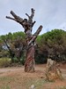
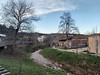
The above images may not be of the site on this page, but were taken nearby. They are loaded from Flickr so please click on them for image credits.
Click here to see more info for this site
Nearby sites
Click here to view sites on an interactive map of the areaKey: Red: member's photo, Blue: 3rd party photo, Yellow: other image, Green: no photo - please go there and take one, Grey: site destroyed
Download sites to:
KML (Google Earth)
GPX (GPS waypoints)
CSV (Garmin/Navman)
CSV (Excel)
To unlock full downloads you need to sign up as a Contributory Member. Otherwise downloads are limited to 50 sites.
Turn off the page maps and other distractions
Nearby sites listing. In the following links * = Image available
6.9km S 183° Dolmen de Campgràs Burial Chamber or Dolmen
8.3km SE 124° Gavà Prehistoric Mines* Ancient Mine, Quarry or other Industry
16.9km ENE 73° Menhir De l'Angel* Natural Stone / Erratic / Other Natural Feature
18.2km WSW 253° Castell d'Olèrdola Ancient Village or Settlement
20.1km E 84° Museu Arqueològic de Catalunya* Museum
20.1km E 84° Menhir Vinya Monera* Standing Stone (Menhir)
20.1km E 84° Dolmen Vinya Monera* Burial Chamber or Dolmen
27.4km NW 316° Parc Arqueològic Neandertal de Capellades* Ancient Village or Settlement
27.4km ENE 61° Poblat Ibèric Puig Castellar Ancient Village or Settlement
27.8km ENE 62° Dolmen Cau d'En Genis* Burial Chamber or Dolmen
28.6km NW 310° Menhir de Cabrera* Standing Stone (Menhir)
30.7km NNW 338° Megàlit de la Diablera Natural Stone / Erratic / Other Natural Feature
31.9km NE 50° Mollet del Vallès menhir* Standing Stone (Menhir)
32.2km NNE 13° Tombes de Can Robert* Barrow Cemetery
33.5km NE 41° Menhir de la Pedra Llarga* Standing Stone (Menhir)
33.6km WNW 297° Dolmen de Comallagosa Burial Chamber or Dolmen
33.6km ENE 56° Menhir de Castellruf* Standing Stone (Menhir)
34.0km NE 37° Menhir de Can Tarragona Standing Stone (Menhir)
34.1km ENE 58° Dolmen de Castellruf* Burial Chamber or Dolmen
34.7km NNE 28° Dolmen de Serra Cavallera* Burial Chamber or Dolmen
35.1km NE 47° Menhir La Pedra Serrada* Standing Stone (Menhir)
35.3km ENE 59° Dolmen de Can Gurri* Burial Chamber or Dolmen
35.8km NE 52° Mons Observans Ancient Village or Settlement
36.4km NNE 31° La Torre Roja Ancient Village or Settlement
37.3km ENE 61° Paradolmen d'en Boter Burial Chamber or Dolmen
View more nearby sites and additional images


 We would like to know more about this location. Please feel free to add a brief description and any relevant information in your own language.
 Wir möchten mehr über diese Stätte erfahren. Bitte zögern Sie nicht, eine kurze Beschreibung und relevante Informationen in Deutsch hinzuzufügen.
 Nous aimerions en savoir encore un peu sur les lieux. S'il vous plaît n'hesitez pas à ajouter une courte description et tous les renseignements pertinents dans votre propre langue.
 Quisieramos informarnos un poco más de las lugares. No dude en añadir una breve descripción y otros datos relevantes en su propio idioma.