

<< Text Pages >> Dolmen de Pataou - Burial Chamber or Dolmen in France in Midi:Tarn-et-Garonne (82)
Submitted by holger_rix on Saturday, 12 March 2016 Page Views: 899
Neolithic and Bronze AgeSite Name: Dolmen de PataouCountry: France
NOTE: This site is 2.168 km away from the location you searched for.
Département: Midi:Tarn-et-Garonne (82) Type: Burial Chamber or Dolmen
Nearest Town: Montauban Nearest Village: Lacapelle-Livron
Latitude: 44.280021N Longitude: 1.763535E
Condition:
| 5 | Perfect |
| 4 | Almost Perfect |
| 3 | Reasonable but with some damage |
| 2 | Ruined but still recognisable as an ancient site |
| 1 | Pretty much destroyed, possibly visible as crop marks |
| 0 | No data. |
| -1 | Completely destroyed |
| 5 | Superb |
| 4 | Good |
| 3 | Ordinary |
| 2 | Not Good |
| 1 | Awful |
| 0 | No data. |
| 5 | Can be driven to, probably with disabled access |
| 4 | Short walk on a footpath |
| 3 | Requiring a bit more of a walk |
| 2 | A long walk |
| 1 | In the middle of nowhere, a nightmare to find |
| 0 | No data. |
| 5 | co-ordinates taken by GPS or official recorded co-ordinates |
| 4 | co-ordinates scaled from a detailed map |
| 3 | co-ordinates scaled from a bad map |
| 2 | co-ordinates of the nearest village |
| 1 | co-ordinates of the nearest town |
| 0 | no data |
Be the first person to rate this site - see the 'Contribute!' box in the right hand menu.
Internal Links:
External Links:
Burial Chamber (Dolmen) in Midi:Tarn-et-Garonne (82)
Source: T4T35.fr
You may be viewing yesterday's version of this page. To see the most up to date information please register for a free account.
Do not use the above information on other web sites or publications without permission of the contributor.
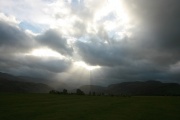
Nearby Images from Flickr
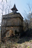
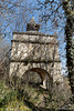
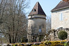
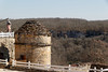
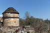
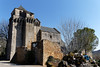
The above images may not be of the site on this page, but were taken nearby. They are loaded from Flickr so please click on them for image credits.
Click here to see more info for this site
Nearby sites
Click here to view sites on an interactive map of the areaKey: Red: member's photo, Blue: 3rd party photo, Yellow: other image, Green: no photo - please go there and take one, Grey: site destroyed
Download sites to:
KML (Google Earth)
GPX (GPS waypoints)
CSV (Garmin/Navman)
CSV (Excel)
To unlock full downloads you need to sign up as a Contributory Member. Otherwise downloads are limited to 50 sites.
Turn off the page maps and other distractions
Nearby sites listing. In the following links * = Image available
2.7km NNE 14° Dolmen de Crabole 2 Burial Chamber or Dolmen
2.8km NNE 14° Dolmen de Crabole 1* Burial Chamber or Dolmen
4.6km NNE 14° Grotte de la Perte de Cros Cave or Rock Shelter
5.3km SSW 205° Ciste de Poussou Cist
5.8km N 355° Saillac menhir* Standing Stone (Menhir)
6.5km NW 318° Menhir des Clouts Grands-2* Rock Art
6.6km NW 319° Menhir des Clouts Grands-1* Modern Stone Circle etc
6.8km NNW 338° Dolmen dit de Crouzeilles* Burial Chamber or Dolmen
6.9km NW 315° Dolmen dit les Clos Grands Burial Chamber or Dolmen
7.1km NNW 345° Dolmen des Sanguinades* Burial Chamber or Dolmen
7.2km S 178° Dolmen de Saillac* Burial Chamber or Dolmen
7.2km NNW 344° Dolmen des Vayssières* Burial Chamber or Dolmen
7.5km NNW 342° Dolmens de Dirau* Burial Chamber or Dolmen
9.1km NNW 344° Dolmen du Mas de Coti* Burial Chamber or Dolmen
9.3km N 2° Dolmen du Bois des Escures 1* Burial Chamber or Dolmen
9.5km N 1° Dolmen du Bois des Escures 2 Burial Chamber or Dolmen
9.7km N 359° Dolmen de la Combe de Pary Burial Chamber or Dolmen
9.9km N 4° Dolmen de la Combe du Cornier* Burial Chamber or Dolmen
10.0km ENE 57° Dolmen des Truffières 1 Burial Chamber or Dolmen
10.1km NE 39° Dolmen de Peyco Levado* Burial Chamber or Dolmen
10.1km ENE 56° Dolmen des Truffières 2 Burial Chamber or Dolmen
10.8km SSW 196° Dolmen de Pauvarel Burial Chamber or Dolmen
11.4km NE 38° Marsigaillet Dolmen 2 Burial Chamber or Dolmen
11.4km N 351° Dolmen de Ferrières-Haut* Burial Chamber or Dolmen
11.6km WNW 287° Menhir de Peyrerufe* Standing Stone (Menhir)
View more nearby sites and additional images


 We would like to know more about this location. Please feel free to add a brief description and any relevant information in your own language.
 Wir möchten mehr über diese Stätte erfahren. Bitte zögern Sie nicht, eine kurze Beschreibung und relevante Informationen in Deutsch hinzuzufügen.
 Nous aimerions en savoir encore un peu sur les lieux. S'il vous plaît n'hesitez pas à ajouter une courte description et tous les renseignements pertinents dans votre propre langue.
 Quisieramos informarnos un poco más de las lugares. No dude en añadir una breve descripción y otros datos relevantes en su propio idioma.