

<< Our Photo Pages >> La Mère aux Cailles - Standing Stone (Menhir) in France in Centre:Eure-et-Loire (28)
Submitted by TheCaptain on Saturday, 16 April 2005 Page Views: 5441
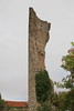
Neolithic and Bronze AgeSite Name: La Mère aux Cailles Alternative Name: La Pierre de Chantecoq, Chantecoq menhirCountry: France
NOTE: This site is 1.933 km away from the location you searched for.
Département: Centre:Eure-et-Loire (28) Type: Standing Stone (Menhir)
Nearest Town: Chartres Nearest Village: Ymeray
Latitude: 48.515600N Longitude: 1.705100E
Condition:
| 5 | Perfect |
| 4 | Almost Perfect |
| 3 | Reasonable but with some damage |
| 2 | Ruined but still recognisable as an ancient site |
| 1 | Pretty much destroyed, possibly visible as crop marks |
| 0 | No data. |
| -1 | Completely destroyed |
| 5 | Superb |
| 4 | Good |
| 3 | Ordinary |
| 2 | Not Good |
| 1 | Awful |
| 0 | No data. |
| 5 | Can be driven to, probably with disabled access |
| 4 | Short walk on a footpath |
| 3 | Requiring a bit more of a walk |
| 2 | A long walk |
| 1 | In the middle of nowhere, a nightmare to find |
| 0 | No data. |
| 5 | co-ordinates taken by GPS or official recorded co-ordinates |
| 4 | co-ordinates scaled from a detailed map |
| 3 | co-ordinates scaled from a bad map |
| 2 | co-ordinates of the nearest village |
| 1 | co-ordinates of the nearest town |
| 0 | no data |
Internal Links:
External Links:
I have visited· I would like to visit
TheCaptain visited on 7th Aug 2005 - their rating: Cond: 3 Amb: 3 Access: 3 Marked on my ign map near to the village of Ymeray is the Dolmen de Chantecoq. I had a good look around, but could find no obvious signs to a dolmen of any kind, but there was a trackway called "Sentier des Roches" which I found near to the railway bridge, so I went for a walk up there. After several hundred metres was a little area being turned into a little public parkland, with picnic tables etc. Here there is a big natural outcropping of rocks, which may have been used for dolmen making. There is lots of it, and it makes very good slabs, and in many ways reminds me of the rock outcrops / quarries at Tinkinswood. A bit further up the track, in a private orchard, is what I assume is a menhir, at least there is a 2.5 metre tall slab of rock standing upright. But without any more information, it was difficult to know exactly what there is here.
")
IMPORTANT NOTE: Positional co-ordinates taken from a gps receiver.
You may be viewing yesterday's version of this page. To see the most up to date information please register for a free account.
Do not use the above information on other web sites or publications without permission of the contributor.
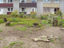
Nearby Images from Flickr

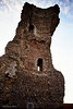

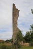
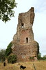
The above images may not be of the site on this page, but were taken nearby. They are loaded from Flickr so please click on them for image credits.
Click here to see more info for this site
Nearby sites
Click here to view sites on an interactive map of the areaKey: Red: member's photo, Blue: 3rd party photo, Yellow: other image, Green: no photo - please go there and take one, Grey: site destroyed
Download sites to:
KML (Google Earth)
GPX (GPS waypoints)
CSV (Garmin/Navman)
CSV (Excel)
To unlock full downloads you need to sign up as a Contributory Member. Otherwise downloads are limited to 50 sites.
Turn off the page maps and other distractions
Nearby sites listing. In the following links * = Image available
89m W 263° Chantecoq dolmen* Burial Chamber or Dolmen
401m NW 314° Menhir dit la Roche Burial Chamber or Dolmen
1.1km W 272° Pont sous Gallardon menhir Standing Stone (Menhir)
7.1km SE 140° Auneau tumulus Chambered Tomb
7.5km WNW 296° Pierre Fritte de Yermenonville* Burial Chamber or Dolmen
8.5km WNW 300° Mevoisins menhir* Modern Stone Circle etc
10.6km WNW 303° Dolmen de la Grenouille* Burial Chamber or Dolmen
10.7km WNW 303° Petit Dolmen (Changé)* Burial Chamber or Dolmen
10.7km WNW 303° Le Berceau* Burial Chamber or Dolmen
10.7km WNW 303° Petit Menhir (Changé)* Standing Stone (Menhir)
10.8km NW 304° Le But de Gargantua* Standing Stones
17.0km SW 219° Dolmens de la Pierre Complissé Burial Chamber or Dolmen
17.8km WSW 243° Musée des Sciences Naturelles et de Préhistoire* Museum
18.7km SSW 193° Grosse Pierre d'Ymorville Standing Stone (Menhir)
20.0km SSW 213° Dolmen dit la Pierre Nochat Burial Chamber or Dolmen
20.3km SW 230° La Pierre qui Tourne (Morancez)* Burial Chamber or Dolmen
20.7km SW 224° Dolmen de Pierre Bure Burial Chamber or Dolmen
20.8km W 268° Dolmen de la Pierre Poteron Burial Chamber or Dolmen
21.1km SW 214° La Pierre Carriau Standing Stone (Menhir)
22.2km SW 217° Puits de Saint-Martin* Polissoir
24.0km N 7° Dolmen de la Pierre Ardoue* Burial Chamber or Dolmen
25.3km SE 124° La Grosse Pierre Passage Grave
26.2km NW 305° Menhir de la Pierre Fitte (Boullay-Mivoie) Standing Stone (Menhir)
26.4km SE 128° Dolmen des Grès de Linas* Burial Chamber or Dolmen
26.9km ESE 106° Dolmen de Boutervilliers Burial Chamber or Dolmen
View more nearby sites and additional images


 We would like to know more about this location. Please feel free to add a brief description and any relevant information in your own language.
 Wir möchten mehr über diese Stätte erfahren. Bitte zögern Sie nicht, eine kurze Beschreibung und relevante Informationen in Deutsch hinzuzufügen.
 Nous aimerions en savoir encore un peu sur les lieux. S'il vous plaît n'hesitez pas à ajouter une courte description et tous les renseignements pertinents dans votre propre langue.
 Quisieramos informarnos un poco más de las lugares. No dude en añadir una breve descripción y otros datos relevantes en su propio idioma.