


<< Text Pages >> Roca Foradada del Collet dels Pastors 2 - Rock Cut Tomb in Spain in Cataluña
Submitted by holger_rix on Monday, 28 December 2015 Page Views: 829
Multi-periodSite Name: Roca Foradada del Collet dels Pastors 2Country: Spain
NOTE: This site is 6.114 km away from the location you searched for.
Region: Cataluña Type: Rock Cut Tomb
Latitude: 41.730038N Longitude: 1.573137E
Condition:
| 5 | Perfect |
| 4 | Almost Perfect |
| 3 | Reasonable but with some damage |
| 2 | Ruined but still recognisable as an ancient site |
| 1 | Pretty much destroyed, possibly visible as crop marks |
| 0 | No data. |
| -1 | Completely destroyed |
| 5 | Superb |
| 4 | Good |
| 3 | Ordinary |
| 2 | Not Good |
| 1 | Awful |
| 0 | No data. |
| 5 | Can be driven to, probably with disabled access |
| 4 | Short walk on a footpath |
| 3 | Requiring a bit more of a walk |
| 2 | A long walk |
| 1 | In the middle of nowhere, a nightmare to find |
| 0 | No data. |
| 5 | co-ordinates taken by GPS or official recorded co-ordinates |
| 4 | co-ordinates scaled from a detailed map |
| 3 | co-ordinates scaled from a bad map |
| 2 | co-ordinates of the nearest village |
| 1 | co-ordinates of the nearest town |
| 0 | no data |
Be the first person to rate this site - see the 'Contribute!' box in the right hand menu.
Internal Links:
External Links:
Rock Cut Tomb in Cataluña
Source: Dòlmens i Menhirs Pilar Blog
You may be viewing yesterday's version of this page. To see the most up to date information please register for a free account.
Do not use the above information on other web sites or publications without permission of the contributor.
Nearby Images from Flickr
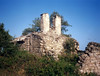

The above images may not be of the site on this page, but were taken nearby. They are loaded from Flickr so please click on them for image credits.
Click here to see more info for this site
Nearby sites
Click here to view sites on an interactive map of the areaKey: Red: member's photo, Blue: 3rd party photo, Yellow: other image, Green: no photo - please go there and take one, Grey: site destroyed
Download sites to:
KML (Google Earth)
GPX (GPS waypoints)
CSV (Garmin/Navman)
CSV (Excel)
To unlock full downloads you need to sign up as a Contributory Member. Otherwise downloads are limited to 50 sites.
Turn off the page maps and other distractions
Nearby sites listing. In the following links * = Image available
233m ESE 109° Roca Foradada del Collet dels Pastors 1 Rock Cut Tomb
1.1km ENE 61° Roca Foradada de Cal Damià Rock Cut Tomb
1.3km ESE 108° Fornot de Cal Sanç de Seguers Rock Cut Tomb
2.4km NE 47° Dolmen Can Serragallarda Burial Chamber or Dolmen
3.1km NE 49° Dolmen de Cal Biel Burial Chamber or Dolmen
3.6km ENE 70° Menhir de Can Giralt* Standing Stone (Menhir)
4.7km NNE 21° La Tomba del General Carlista Burial Chamber or Dolmen
5.1km S 174° Dolmen dels Tres Reis* Burial Chamber or Dolmen
5.4km NE 37° Paradolmen Cau de la Guineu Burial Chamber or Dolmen
6.0km ESE 122° Túmul del Dolmen de Serra Clarena 2 Burial Chamber or Dolmen
6.0km NE 35° Dolmen de les Esmoladores Burial Chamber or Dolmen
6.2km SE 124° Túmul del Dolmen de Serra Clarena 1 Burial Chamber or Dolmen
6.5km ESE 120° Dolmen Can Marquet de Gravelosa* Burial Chamber or Dolmen
7.3km SSE 166° Dolmen de Les Maioles* Burial Chamber or Dolmen
8.9km E 87° Menhir de Sant Amanç de Viladés* Standing Stone (Menhir)
9.5km SE 140° Cista de Cal Pessetero 1 Cist
9.5km SE 140° Cista de Cal Pessetero 2 Cist
9.5km SE 140° Cista de Cal Pessetero 3 Cist
10.4km NNE 21° Dolmen de La Cabana (Bages) Burial Chamber or Dolmen
11.2km NNE 19° Dolmen de la Fossa del General Burial Chamber or Dolmen
12.5km NNE 26° Dolmen de La Vena Burial Chamber or Dolmen
12.6km N 356° Dolmen de Can Cabot* Burial Chamber or Dolmen
12.6km NE 44° Dolmen de Figuera* Burial Chamber or Dolmen
12.7km N 352° Menhir de Pinós Standing Stone (Menhir)
12.8km ENE 64° Dolmen de Betlem Burial Chamber or Dolmen
View more nearby sites and additional images


 We would like to know more about this location. Please feel free to add a brief description and any relevant information in your own language.
 Wir möchten mehr über diese Stätte erfahren. Bitte zögern Sie nicht, eine kurze Beschreibung und relevante Informationen in Deutsch hinzuzufügen.
 Nous aimerions en savoir encore un peu sur les lieux. S'il vous plaît n'hesitez pas à ajouter une courte description et tous les renseignements pertinents dans votre propre langue.
 Quisieramos informarnos un poco más de las lugares. No dude en añadir una breve descripción y otros datos relevantes en su propio idioma.