


<< Our Photo Pages >> Pierre Plantée (Les Boules) - Standing Stone (Menhir) in France in Midi:Lot (46)
Submitted by TheCaptain on Friday, 06 May 2011 Page Views: 2113
Neolithic and Bronze AgeSite Name: Pierre Plantée (Les Boules) Alternative Name: Peyro LebadoCountry: France
NOTE: This site is 4.857 km away from the location you searched for.
Département: Midi:Lot (46) Type: Standing Stone (Menhir)
Nearest Town: Cahors Nearest Village: Nadillac
Latitude: 44.584560N Longitude: 1.514540E
Condition:
| 5 | Perfect |
| 4 | Almost Perfect |
| 3 | Reasonable but with some damage |
| 2 | Ruined but still recognisable as an ancient site |
| 1 | Pretty much destroyed, possibly visible as crop marks |
| 0 | No data. |
| -1 | Completely destroyed |
| 5 | Superb |
| 4 | Good |
| 3 | Ordinary |
| 2 | Not Good |
| 1 | Awful |
| 0 | No data. |
| 5 | Can be driven to, probably with disabled access |
| 4 | Short walk on a footpath |
| 3 | Requiring a bit more of a walk |
| 2 | A long walk |
| 1 | In the middle of nowhere, a nightmare to find |
| 0 | No data. |
| 5 | co-ordinates taken by GPS or official recorded co-ordinates |
| 4 | co-ordinates scaled from a detailed map |
| 3 | co-ordinates scaled from a bad map |
| 2 | co-ordinates of the nearest village |
| 1 | co-ordinates of the nearest town |
| 0 | no data |
Internal Links:
External Links:
I have visited· I would like to visit
johnstone visited on 27th Jun 2016 - their rating: Cond: 4 Amb: 3 Access: 5
 (PID:176705)")
You may be viewing yesterday's version of this page. To see the most up to date information please register for a free account.
 (PID:176706)")
 (PID:176704)")
Do not use the above information on other web sites or publications without permission of the contributor.
Nearby Images from Flickr

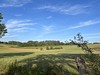
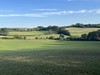
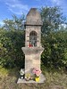
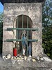
The above images may not be of the site on this page, but were taken nearby. They are loaded from Flickr so please click on them for image credits.
Click here to see more info for this site
Nearby sites
Click here to view sites on an interactive map of the areaKey: Red: member's photo, Blue: 3rd party photo, Yellow: other image, Green: no photo - please go there and take one, Grey: site destroyed
Download sites to:
KML (Google Earth)
GPX (GPS waypoints)
CSV (Garmin/Navman)
CSV (Excel)
To unlock full downloads you need to sign up as a Contributory Member. Otherwise downloads are limited to 50 sites.
Turn off the page maps and other distractions
Nearby sites listing. In the following links * = Image available
5.6km ESE 109° Pech de la Rominière dolmen* Burial Chamber or Dolmen
9.5km NE 48° Pierre Plantée des Clauzels-Serres Standing Stone (Menhir)
10.2km SSE 153° Dolmen de Trégantou* Burial Chamber or Dolmen
10.3km SE 144° Dolmen du Pech de la Barre Burial Chamber or Dolmen
10.8km ENE 69° Grotte de Pégourie Cave or Rock Shelter
11.0km ESE 110° Dolmen des Bouygues Burial Chamber or Dolmen
11.1km ESE 108° Dolmen dit la Pierre-Levée (Lentillac)* Burial Chamber or Dolmen
11.5km SSE 165° Pech Gibert dolmen* Burial Chamber or Dolmen
11.8km NNE 18° Dolmen de la Péchette Burial Chamber or Dolmen
12.4km NE 36° Dolmen de Pierre Basse* Burial Chamber or Dolmen
12.8km NE 41° Dolmen de Cambajou 1* Burial Chamber or Dolmen
12.9km SSE 155° Grotte de la Bigourdane Cave or Rock Shelter
12.9km NW 308° Dolmen de Carriol Burial Chamber or Dolmen
13.0km ENE 65° Dolmen de l'Igue de Planagrèze* Burial Chamber or Dolmen
13.1km SE 144° Grotte de Pargouzet Cave or Rock Shelter
13.3km N 353° Dolmen des Fosses Burial Chamber or Dolmen
13.4km SE 130° Grotte de Pech-Merle* Cave or Rock Shelter
13.8km NE 46° Dolmen de Combescure* Burial Chamber or Dolmen
14.0km SE 127° Dolmen du Pech de Tibouyé 3 Burial Chamber or Dolmen
14.1km SE 128° Grotte du Cantal Cave or Rock Shelter
14.2km SE 129° Musée Préhistoire Amédée-Lémozie* Museum
14.9km SE 132° Grottes de Marcenac* Cave or Rock Shelter
14.9km SE 137° Grotte Carriot* Cave or Rock Shelter
15.0km N 1° Pech des Batailles Burial Chamber or Dolmen
15.6km N 6° Dolmen des Cloups* Burial Chamber or Dolmen
View more nearby sites and additional images


 We would like to know more about this location. Please feel free to add a brief description and any relevant information in your own language.
 Wir möchten mehr über diese Stätte erfahren. Bitte zögern Sie nicht, eine kurze Beschreibung und relevante Informationen in Deutsch hinzuzufügen.
 Nous aimerions en savoir encore un peu sur les lieux. S'il vous plaît n'hesitez pas à ajouter une courte description et tous les renseignements pertinents dans votre propre langue.
 Quisieramos informarnos un poco más de las lugares. No dude en añadir una breve descripción y otros datos relevantes en su propio idioma.