


<< Text Pages >> Dolmen de Pech Curet - Burial Chamber or Dolmen in France in Midi:Lot (46)
Submitted by TheCaptain on Friday, 06 May 2011 Page Views: 2319
Neolithic and Bronze AgeSite Name: Dolmen de Pech CuretCountry: France
NOTE: This site is 4.074 km away from the location you searched for.
Département: Midi:Lot (46) Type: Burial Chamber or Dolmen
Nearest Town: Cahors Nearest Village: Salviac
Latitude: 44.695840N Longitude: 1.286970E
Condition:
| 5 | Perfect |
| 4 | Almost Perfect |
| 3 | Reasonable but with some damage |
| 2 | Ruined but still recognisable as an ancient site |
| 1 | Pretty much destroyed, possibly visible as crop marks |
| 0 | No data. |
| -1 | Completely destroyed |
| 5 | Superb |
| 4 | Good |
| 3 | Ordinary |
| 2 | Not Good |
| 1 | Awful |
| 0 | No data. |
| 5 | Can be driven to, probably with disabled access |
| 4 | Short walk on a footpath |
| 3 | Requiring a bit more of a walk |
| 2 | A long walk |
| 1 | In the middle of nowhere, a nightmare to find |
| 0 | No data. |
| 5 | co-ordinates taken by GPS or official recorded co-ordinates |
| 4 | co-ordinates scaled from a detailed map |
| 3 | co-ordinates scaled from a bad map |
| 2 | co-ordinates of the nearest village |
| 1 | co-ordinates of the nearest town |
| 0 | no data |
Internal Links:
External Links:
burial chamber in Midi-Pyrénées:Lot
Dolmen de Pech Curet is a burial chamber in the community of Salviac, Departement of Lot, Region of Midi-Pyrénées
Location Source: T4T35.fr
Dfferent loc:
44,6960242, 1,2885057
Location Source: OpenStreetMap
You may be viewing yesterday's version of this page. To see the most up to date information please register for a free account.
Do not use the above information on other web sites or publications without permission of the contributor.
Nearby Images from Flickr
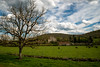
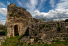
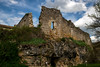
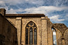
The above images may not be of the site on this page, but were taken nearby. They are loaded from Flickr so please click on them for image credits.
Click here to see more info for this site
Nearby sites
Click here to view sites on an interactive map of the areaKey: Red: member's photo, Blue: 3rd party photo, Yellow: other image, Green: no photo - please go there and take one, Grey: site destroyed
Download sites to:
KML (Google Earth)
GPX (GPS waypoints)
CSV (Garmin/Navman)
CSV (Excel)
To unlock full downloads you need to sign up as a Contributory Member. Otherwise downloads are limited to 50 sites.
Turn off the page maps and other distractions
Nearby sites listing. In the following links * = Image available
4.6km ENE 76° Dolmen de Costeraste Burial Chamber or Dolmen
5.5km NNE 25° Dolmen du Carrefour des 3 Pierres* Burial Chamber or Dolmen
6.1km NNE 15° Menhir de Peyregrosse* Standing Stone (Menhir)
6.2km NNE 13° Le Ro de Jacques* Burial Chamber or Dolmen
8.3km S 174° Dolmen de Touron Burial Chamber or Dolmen
8.5km S 171° Dolmen de Surgès Burial Chamber or Dolmen
9.0km ESE 119° Dolmen de Carriol Burial Chamber or Dolmen
9.8km NE 46° Grotte de Cougnac* Cave or Rock Shelter
10.1km S 181° Peyrefiche Standing Stones
12.6km NNW 339° Grotte du Mammouth Cave or Rock Shelter
13.1km NNW 330° Falaise du Conte Ancient Village or Settlement
13.2km NNW 339° Grotte du Pigeonnier Cave or Rock Shelter
13.2km NNW 346° Giverzac Dolmen* Burial Chamber or Dolmen
13.2km NNW 334° Grotte de la Martine Cave or Rock Shelter
14.1km SW 226° Dolmen dit les Pierres du Loup Burial Chamber or Dolmen
14.2km S 175° Menhir de Courtis* Standing Stone (Menhir)
14.7km WSW 255° Roc Travers* Natural Stone / Erratic / Other Natural Feature
15.2km WSW 255° Cromlech de Besse 1* Stone Circle
15.2km NW 322° Peyre Pincade* Standing Stone (Menhir)
15.2km WNW 297° Dolmen de Pomarède* Burial Chamber or Dolmen
15.4km NW 317° Menhir de Lacoste n°1* Standing Stone (Menhir)
15.4km NW 319° Menhir de Lacoste n°2* Standing Stone (Menhir)
15.4km SSW 201° Dolmen des Trois Pierres Burial Chamber or Dolmen
16.0km WNW 287° Menhir de Peyre longue* Standing Stone (Menhir)
16.3km E 87° Dolmen des Fosses Burial Chamber or Dolmen
View more nearby sites and additional images


 We would like to know more about this location. Please feel free to add a brief description and any relevant information in your own language.
 Wir möchten mehr über diese Stätte erfahren. Bitte zögern Sie nicht, eine kurze Beschreibung und relevante Informationen in Deutsch hinzuzufügen.
 Nous aimerions en savoir encore un peu sur les lieux. S'il vous plaît n'hesitez pas à ajouter une courte description et tous les renseignements pertinents dans votre propre langue.
 Quisieramos informarnos un poco más de las lugares. No dude en añadir una breve descripción y otros datos relevantes en su propio idioma.