


<< Our Photo Pages >> Kesgrave Barrow - Round Barrow(s) in England in Suffolk
Submitted by coldrum on Monday, 18 June 2012 Page Views: 3084
Neolithic and Bronze AgeSite Name: Kesgrave BarrowCountry: England
NOTE: This site is 6.552 km away from the location you searched for.
County: Suffolk Type: Round Barrow(s)
Map Ref: TM22074591
Latitude: 52.067017N Longitude: 1.238540E
Condition:
| 5 | Perfect |
| 4 | Almost Perfect |
| 3 | Reasonable but with some damage |
| 2 | Ruined but still recognisable as an ancient site |
| 1 | Pretty much destroyed, possibly visible as crop marks |
| 0 | No data. |
| -1 | Completely destroyed |
| 5 | Superb |
| 4 | Good |
| 3 | Ordinary |
| 2 | Not Good |
| 1 | Awful |
| 0 | No data. |
| 5 | Can be driven to, probably with disabled access |
| 4 | Short walk on a footpath |
| 3 | Requiring a bit more of a walk |
| 2 | A long walk |
| 1 | In the middle of nowhere, a nightmare to find |
| 0 | No data. |
| 5 | co-ordinates taken by GPS or official recorded co-ordinates |
| 4 | co-ordinates scaled from a detailed map |
| 3 | co-ordinates scaled from a bad map |
| 2 | co-ordinates of the nearest village |
| 1 | co-ordinates of the nearest town |
| 0 | no data |
Be the first person to rate this site - see the 'Contribute!' box in the right hand menu.
Internal Links:
External Links:
")
From Pastscape:
"'A' The site of this barrow is indicated by a vague, hummocky mound with trees growing upon it. It has a diameter of 15.0 m., and a maximum height of 0.2 m. There is no visible ditch.
'B' A bowl barrow in fair condition, with an average diameter of 17.5 m. (the perimeter has been much reduced by ploughing) and a height of 0.8 m. It is bracken and tree-covered. There is no visible ditch. "
Source: Pastscape.
You may be viewing yesterday's version of this page. To see the most up to date information please register for a free account.
Do not use the above information on other web sites or publications without permission of the contributor.
Nearby Images from Geograph Britain and Ireland:
©2015(licence)
©2014(licence)
©2009(licence)
©2009(licence)
©2009(licence)
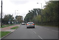
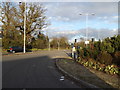
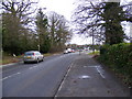
The above images may not be of the site on this page, they are loaded from Geograph.
Please Submit an Image of this site or go out and take one for us!
Click here to see more info for this site
Nearby sites
Key: Red: member's photo, Blue: 3rd party photo, Yellow: other image, Green: no photo - please go there and take one, Grey: site destroyed
Download sites to:
KML (Google Earth)
GPX (GPS waypoints)
CSV (Garmin/Navman)
CSV (Excel)
To unlock full downloads you need to sign up as a Contributory Member. Otherwise downloads are limited to 50 sites.
Turn off the page maps and other distractions
Nearby sites listing. In the following links * = Image available
250m N 3° Kesgrave Bowl Barrow 1* Round Barrow(s) (TM22074616)
1.8km ESE 121° Brightwell Heath* Barrow Cemetery (TM23634505)
1.8km E 94° Martlesham Bowl Barrow 1* Round Barrow(s) (TM23864587)
1.8km E 90° Martlesham Bowl Barrow 2* Round Barrow(s) (TM23874598)
1.9km ENE 65° Martlesham Heath* Round Barrow(s) (TM238468)
2.2km E 86° Martlesham Airfield Round Barrow(s) (TM24224616)
3.2km ESE 117° The Swale Round Barrow(s) (TM24954459)
3.2km ESE 117° Sheep Drift Farm Round Barrow(s) (TM2495444591)
3.5km ESE 102° Falcon Park Round Barrow(s) (TM25504534)
4.6km S 186° Purdis Farm Cursus Cursus (TM218413)
4.6km S 177° Seven Hills* Barrow Cemetery (TM225413)
5.5km SSE 164° Levington Ring Ditches Barrow Cemetery (TM23864073)
5.9km SSE 159° Levington Heath* Round Barrow(s) (TM244405)
6.4km N 5° Burgh Enclosure Ancient Village or Settlement (TM224523)
7.3km ENE 70° Sutton Hoo* Artificial Mound (TM288487)
9.9km E 98° Shottisham Monument Complex Henge (TM32004505)
18.4km WNW 303° Lady Well, Badley Holy Well or Sacred Spring (TM06135517)
19.9km SW 221° Lawford Cursus (TM097303)
20.0km SW 221° Lawford C Cursus Cursus (TM095303)
20.1km SW 224° Lawford Timber Circle (TM088308)
20.1km SW 221° Lawford 2 Long Barrow (TM095302)
20.3km SW 221° Lawford Cursus (TM093301)
20.4km WSW 238° Stratford St. Mary B Cursus Cursus (TM05253425)
20.5km SW 232° Dedham Cursus (TM064326)
20.7km WSW 238° Stratford St. Mary A Cursus Cursus (TM049343)
View more nearby sites and additional images


 We would like to know more about this location. Please feel free to add a brief description and any relevant information in your own language.
 Wir möchten mehr über diese Stätte erfahren. Bitte zögern Sie nicht, eine kurze Beschreibung und relevante Informationen in Deutsch hinzuzufügen.
 Nous aimerions en savoir encore un peu sur les lieux. S'il vous plaît n'hesitez pas à ajouter une courte description et tous les renseignements pertinents dans votre propre langue.
 Quisieramos informarnos un poco más de las lugares. No dude en añadir una breve descripción y otros datos relevantes en su propio idioma.