


<< Other Photo Pages >> Menhir de Montmagastre - Standing Stone (Menhir) in Spain in Cataluña
Submitted by holger_rix on Thursday, 05 November 2015 Page Views: 1464
Neolithic and Bronze AgeSite Name: Menhir de Montmagastre Alternative Name: Artesa de Segre, La NogueraCountry: Spain
NOTE: This site is 2.44 km away from the location you searched for.
Region: Cataluña Type: Standing Stone (Menhir)
Latitude: 41.971133N Longitude: 1.124182E
Condition:
| 5 | Perfect |
| 4 | Almost Perfect |
| 3 | Reasonable but with some damage |
| 2 | Ruined but still recognisable as an ancient site |
| 1 | Pretty much destroyed, possibly visible as crop marks |
| 0 | No data. |
| -1 | Completely destroyed |
| 5 | Superb |
| 4 | Good |
| 3 | Ordinary |
| 2 | Not Good |
| 1 | Awful |
| 0 | No data. |
| 5 | Can be driven to, probably with disabled access |
| 4 | Short walk on a footpath |
| 3 | Requiring a bit more of a walk |
| 2 | A long walk |
| 1 | In the middle of nowhere, a nightmare to find |
| 0 | No data. |
| 5 | co-ordinates taken by GPS or official recorded co-ordinates |
| 4 | co-ordinates scaled from a detailed map |
| 3 | co-ordinates scaled from a bad map |
| 2 | co-ordinates of the nearest village |
| 1 | co-ordinates of the nearest town |
| 0 | no data |
Internal Links:
External Links:
Standing Stone (Menhir) in Cataluña
You may be viewing yesterday's version of this page. To see the most up to date information please register for a free account.
Do not use the above information on other web sites or publications without permission of the contributor.
Nearby Images from Flickr
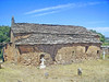
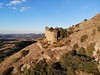
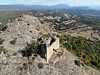
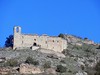
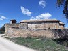
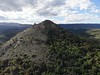
The above images may not be of the site on this page, but were taken nearby. They are loaded from Flickr so please click on them for image credits.
Click here to see more info for this site
Nearby sites
Click here to view sites on an interactive map of the areaKey: Red: member's photo, Blue: 3rd party photo, Yellow: other image, Green: no photo - please go there and take one, Grey: site destroyed
Download sites to:
KML (Google Earth)
GPX (GPS waypoints)
CSV (Garmin/Navman)
CSV (Excel)
To unlock full downloads you need to sign up as a Contributory Member. Otherwise downloads are limited to 50 sites.
Turn off the page maps and other distractions
Nearby sites listing. In the following links * = Image available
417m ENE 75° Dolmen de Montmagastre* Burial Chamber or Dolmen
6.7km ENE 78° Dolmen de Sols de Riu* Burial Chamber or Dolmen
6.7km NW 306° Dolmen de la Costa Llobera Burial Chamber or Dolmen
7.5km WNW 295° Dolmen del Cogulló* Burial Chamber or Dolmen
8.6km NNW 330° Dolmen Montadó Burial Chamber or Dolmen
9.9km WNW 298° Dolmen de Paús Burial Chamber or Dolmen
10.1km WNW 297° Dolmen Sòl Joaquim Burial Chamber or Dolmen
10.7km S 187° Reguers de Seró* Rock Art
10.9km WNW 293° Dolmen Lloella del Llop 2* Burial Chamber or Dolmen
11.2km WNW 293° Dolmen Lloella del Llop 1* Burial Chamber or Dolmen
11.2km E 83° Dolmen de Perotillo Burial Chamber or Dolmen
14.3km ENE 76° Dolmen d'Estracs Burial Chamber or Dolmen
15.4km ENE 66° Dolmen Caixa del moro del Coll del Pauet* Burial Chamber or Dolmen
15.6km WNW 287° Dolmen de Reguer Burial Chamber or Dolmen
15.9km E 91° Cista Camí de Madrona Cist
15.9km E 91° Cista de les Santes Masses Cist
15.9km E 100° Cista Serrat de la Fossa Cist
16.4km NNE 31° Cista Coll de Creus 1 Burial Chamber or Dolmen
16.4km NNE 31° Cista Coll de Creus 2 Burial Chamber or Dolmen
16.4km NNE 31° Cista Coll de Creus 3 Burial Chamber or Dolmen
17.0km E 87° Menhir dels Trossos de l´Estany Standing Stone (Menhir)
17.2km WNW 287° Dolmen de Rúbies* Burial Chamber or Dolmen
17.8km E 86° Cista Costa dels Garrics de Caballol 1 Cist
17.9km E 86° Cista Costa dels Garrics de Caballol 2 Cist
17.9km E 86° Menhir Costa dels Garrics de Caballol Standing Stone (Menhir)
View more nearby sites and additional images


 We would like to know more about this location. Please feel free to add a brief description and any relevant information in your own language.
 Wir möchten mehr über diese Stätte erfahren. Bitte zögern Sie nicht, eine kurze Beschreibung und relevante Informationen in Deutsch hinzuzufügen.
 Nous aimerions en savoir encore un peu sur les lieux. S'il vous plaît n'hesitez pas à ajouter une courte description et tous les renseignements pertinents dans votre propre langue.
 Quisieramos informarnos un poco más de las lugares. No dude en añadir una breve descripción y otros datos relevantes en su propio idioma.