

<< Text Pages >> St Rhadegund's Bath - Holy Well or Sacred Spring in England in Kent
Submitted by HOLYWELL on Monday, 28 February 2011 Page Views: 5165
Springs and Holy WellsSite Name: St Rhadegund's BathCountry: England
NOTE: This site is 0.173 km away from the location you searched for.
County: Kent Type: Holy Well or Sacred Spring
Nearest Town: Canterbury
Map Ref: TR150583
Latitude: 51.283245N Longitude: 1.081660E
Condition:
| 5 | Perfect |
| 4 | Almost Perfect |
| 3 | Reasonable but with some damage |
| 2 | Ruined but still recognisable as an ancient site |
| 1 | Pretty much destroyed, possibly visible as crop marks |
| 0 | No data. |
| -1 | Completely destroyed |
| 5 | Superb |
| 4 | Good |
| 3 | Ordinary |
| 2 | Not Good |
| 1 | Awful |
| 0 | No data. |
| 5 | Can be driven to, probably with disabled access |
| 4 | Short walk on a footpath |
| 3 | Requiring a bit more of a walk |
| 2 | A long walk |
| 1 | In the middle of nowhere, a nightmare to find |
| 0 | No data. |
| 5 | co-ordinates taken by GPS or official recorded co-ordinates |
| 4 | co-ordinates scaled from a detailed map |
| 3 | co-ordinates scaled from a bad map |
| 2 | co-ordinates of the nearest village |
| 1 | co-ordinates of the nearest town |
| 0 | no data |
Internal Links:
External Links:
St. Radegund’s Bath which is believed to have originated as a Roman bath, and latterly possibly associated with the cult of St. Radegund. Why it should be associated with this Sixth Century saint and queen is unclear, although it is known that her cult was present in the area, as there is a monastic site near Dover dedicated to her.
It is first noted by Gosling (1777), when it was adapted to cold bath and thus it is worth recording the description in full:
“St. Radegund's Bath, a fine spring built over and fitted for cold bathing....in altering a very ancient dwelling house near the bath some hollows or pipes were discovered, carried along in the thickness of an old stone wall, which seemed a contrivance for heating the room in former times, and making a sudatly or sweating room of it.”
Records do show that the City Corporation bought this bath in 1793, and it was consequently leased to Messrs. Simmons and Royle for 28 years. This bath house was extensively repaired in 1794, and its basin was enlarged and divided in two. The baths were originally covered by arched roofs and lighted from above by two turrets. Separate dressing and waiting rooms were also installed to facilitate the customs. Yet by 1825, sadly both the building and the bath became dilapidated, and hence only occasionally used. The Dolphin Inn, lay above the bath and its popularity undoubtedly precipitated its destruction. By the 1930s the site was only remembered by the ruins of the Bath house cottages and as Gardiner (1940) notes that the:
“Healing waters in the adjacent well or bath of St. Radegund recently (most deplorably) filled in, in making a car park.”
Hence regrettably nothing remains of the site to record what appears to have been a historically fascinating site.
You may be viewing yesterday's version of this page. To see the most up to date information please register for a free account.
Do not use the above information on other web sites or publications without permission of the contributor.
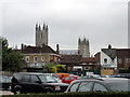
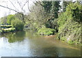
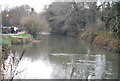
Nearby Images from Geograph Britain and Ireland:
©2011(licence)
©2009(licence)
![TR1558 : Canterbury houses [159] by Michael Dibb](https://s2.geograph.org.uk/geophotos/07/09/98/7099854_d30e55a4_120x120.jpg)
©2022(licence)
©2012(licence)
©2011(licence)
The above images may not be of the site on this page, they are loaded from Geograph.
Please Submit an Image of this site or go out and take one for us!
Click here to see more info for this site
Nearby sites
Key: Red: member's photo, Blue: 3rd party photo, Yellow: other image, Green: no photo - please go there and take one, Grey: site destroyed
Download sites to:
KML (Google Earth)
GPX (GPS waypoints)
CSV (Garmin/Navman)
CSV (Excel)
To unlock full downloads you need to sign up as a Contributory Member. Otherwise downloads are limited to 50 sites.
Turn off the page maps and other distractions
Nearby sites listing. In the following links * = Image available
400m S 182° St. Thomas Becket's Well Holy Well or Sacred Spring (TR150579)
460m S 181° Sunwin's Well Holy Well or Sacred Spring (TR15015784)
510m S 171° St Thomas's Well (Canterbury)* Holy Well or Sacred Spring (TR151578)
600m SSW 210° Museum of Canterbury* Museum (TR1472257767)
686m SE 145° St Augustine's Abbey Standing Stone* Ancient Cross (TR1541857755)
955m SSW 196° Dane John Mound* Artificial Mound (TR14785737)
2.1km W 267° Black Prince's Well* Holy Well or Sacred Spring (TR129581)
3.1km E 79° Fordwich Paleolithic Site Not Known (by us) (TR180590)
3.5km W 261° Bigbury Camp* Hillfort (TR116576)
3.5km ENE 69° Our Lady's Well (Fordwich) Holy Well or Sacred Spring (TR18225970)
4.5km SSE 149° Bridge Iron Age Settlement* Ancient Village or Settlement (TR175545)
4.5km SSW 204° Iffin Wood Bowl Barrow Round Barrow(s) (TR13335407)
4.8km S 175° Whitehill Wood Barrow Round Barrow(s) (TR156535)
5.1km E 86° Arrianes Well Holy Well or Sacred Spring (TR201589)
5.3km ESE 113° Bekesbourne* Holy Well or Sacred Spring (TR20005646)
5.9km NNW 340° Clowes Wood Barrows* Round Barrow(s) (TR12746378)
6.0km SE 144° Hanging Hill Barrow Cemetary Barrow Cemetery (TR18725363)
6.6km SSE 164° Gorsley Wood Barrows Round Barrow(s) (TR17095201)
6.6km SE 142° Barham Downs Barrow Round Barrow(s) (TR19295324)
6.7km WSW 245° Pilgrims Way 9 Ancient Trackway (TR090552)
6.8km SE 144° Bishopsbourne Barrows Barrow Cemetery (TR19225296)
6.9km SSE 168° Gorsley Wood Mound Artificial Mound (TR167516)
7.9km SSW 209° Mounts Wood Barrow* Round Barrow(s) (TR11455126)
8.0km SW 226° Denge Wood Earthworks Misc. Earthwork (TR095525)
8.0km S 173° Bursted Wood Barrow Round Barrow(s) (TR16345036)
View more nearby sites and additional images


 We would like to know more about this location. Please feel free to add a brief description and any relevant information in your own language.
 Wir möchten mehr über diese Stätte erfahren. Bitte zögern Sie nicht, eine kurze Beschreibung und relevante Informationen in Deutsch hinzuzufügen.
 Nous aimerions en savoir encore un peu sur les lieux. S'il vous plaît n'hesitez pas à ajouter une courte description et tous les renseignements pertinents dans votre propre langue.
 Quisieramos informarnos un poco más de las lugares. No dude en añadir una breve descripción y otros datos relevantes en su propio idioma.