 with our Megalithic Portal iPhone app")


<< Text Pages >> Blakeney Downs Barrows - Round Barrow(s) in England in Norfolk
Submitted by coldrum on Monday, 18 June 2012 Page Views: 3554
Neolithic and Bronze AgeSite Name: Blakeney Downs BarrowsCountry: England
NOTE: This site is 3.545 km away from the location you searched for.
County: Norfolk Type: Round Barrow(s)
Nearest Town: Blakeney
Map Ref: TG01864365
Latitude: 52.952234N Longitude: 1.003406E
Condition:
| 5 | Perfect |
| 4 | Almost Perfect |
| 3 | Reasonable but with some damage |
| 2 | Ruined but still recognisable as an ancient site |
| 1 | Pretty much destroyed, possibly visible as crop marks |
| 0 | No data. |
| -1 | Completely destroyed |
| 5 | Superb |
| 4 | Good |
| 3 | Ordinary |
| 2 | Not Good |
| 1 | Awful |
| 0 | No data. |
| 5 | Can be driven to, probably with disabled access |
| 4 | Short walk on a footpath |
| 3 | Requiring a bit more of a walk |
| 2 | A long walk |
| 1 | In the middle of nowhere, a nightmare to find |
| 0 | No data. |
| 5 | co-ordinates taken by GPS or official recorded co-ordinates |
| 4 | co-ordinates scaled from a detailed map |
| 3 | co-ordinates scaled from a bad map |
| 2 | co-ordinates of the nearest village |
| 1 | co-ordinates of the nearest town |
| 0 | no data |
Be the first person to rate this site - see the 'Contribute!' box in the right hand menu.
Internal Links:
External Links:
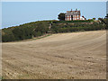
Two bowl barrows in Norfolk
From Pastscape:
"Two bowl barrows situated on Blakeney Downs. The barrows are visible as earthern mounds, surrounded by hollows in the ground surface which mark the presence of quarry ditches, now largely infilled."
Read More at Pastscape.
You may be viewing yesterday's version of this page. To see the most up to date information please register for a free account.
Do not use the above information on other web sites or publications without permission of the contributor.
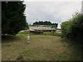
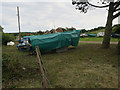
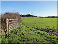
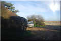
Nearby Images from Geograph Britain and Ireland:
©2016(licence)
©2016(licence)
©2009(licence)
©2018(licence)
©2014(licence)
The above images may not be of the site on this page, they are loaded from Geograph.
Please Submit an Image of this site or go out and take one for us!
Click here to see more info for this site
Nearby sites
Key: Red: member's photo, Blue: 3rd party photo, Yellow: other image, Green: no photo - please go there and take one, Grey: site destroyed
Download sites to:
KML (Google Earth)
GPX (GPS waypoints)
CSV (Garmin/Navman)
CSV (Excel)
To unlock full downloads you need to sign up as a Contributory Member. Otherwise downloads are limited to 50 sites.
Turn off the page maps and other distractions
Nearby sites listing. In the following links * = Image available
4.5km ESE 105° The Hangs* Round Barrow(s) (TG06304270)
6.2km ESE 104° Salthouse Heath* Barrow Cemetery (TG07974241)
6.3km WSW 248° Fiddler's Hill (Norfolk)* Round Barrow(s) (TF96134105)
8.0km WSW 252° Warham Camp* Hillfort (TF94374089)
10.7km SW 233° Our Lady of Walsingham Holy Well* Holy Well or Sacred Spring (TF9355136894)
10.7km SW 233° Little Walsingham Holy Well* Holy Well or Sacred Spring (TF93603678)
11.8km ESE 105° Howe’s Hill Oval Barrow* Round Barrow(s) (TG1340941007)
12.6km E 101° Church Conduit* Holy Well or Sacred Spring (TG144418)
14.3km W 275° Holkham Camp* Hillfort (TF875443)
15.2km E 99° Calves Well* Holy Well or Sacred Spring (TG170419)
16.6km W 269° Leath House Roman Barrow* Barrow Cemetery (TF852427)
16.9km ESE 109° Aylmerton Cross* Ancient Cross (TG18073879)
17.0km ESE 108° Aylmerton Shrieking Pits* Misc. Earthwork (TG1823939072)
19.0km WSW 246° South Creake* Hillfort (TF848352)
19.3km W 268° Burnham Market* Round Barrow(s) (TF826421)
21.4km W 274° Burnham Deepdale* Early Christian Sculptured Stone (TF804443)
21.7km SSE 164° Pettywell* Holy Well or Sacred Spring (TG086230)
21.8km ESE 114° Roughton Cursus Cursus (TG222355)
22.0km WSW 237° Wicken Covert Barrow Round Barrow(s) (TF83973081)
22.2km S 190° North Elmham Chapel* Ancient Temple (TF9888121640)
22.4km WSW 237° Coxford Heath Barrow Round Barrow(s) (TF83493070)
22.6km SSW 208° Whissonsett wheel-head cross* Ancient Cross (TF91922334)
23.6km W 273° Branodunum Stone Fort or Dun (TF78214402)
24.8km SE 143° Maiden's Head* Holy Well or Sacred Spring (TG178246)
27.0km SW 233° West Rudham North* Long Barrow (TF810264)
View more nearby sites and additional images


 We would like to know more about this location. Please feel free to add a brief description and any relevant information in your own language.
 Wir möchten mehr über diese Stätte erfahren. Bitte zögern Sie nicht, eine kurze Beschreibung und relevante Informationen in Deutsch hinzuzufügen.
 Nous aimerions en savoir encore un peu sur les lieux. S'il vous plaît n'hesitez pas à ajouter une courte description et tous les renseignements pertinents dans votre propre langue.
 Quisieramos informarnos un poco más de las lugares. No dude en añadir una breve descripción y otros datos relevantes en su propio idioma.