


<< Text Pages >> Font des ses Torres - Holy Well or Sacred Spring in Spain in Balearic Isles (Ibiza)
Submitted by zaax on Saturday, 12 July 2014 Page Views: 1398
Springs and Holy WellsSite Name: Font des ses TorresCountry: Spain
NOTE: This site is 53.479 km away from the location you searched for.
Region: Balearic Isles (Ibiza) Type: Holy Well or Sacred Spring
Nearest Town: San Miguel Nearest Village: San Miguel
Latitude: 39.065563N Longitude: 1.424377E
Condition:
| 5 | Perfect |
| 4 | Almost Perfect |
| 3 | Reasonable but with some damage |
| 2 | Ruined but still recognisable as an ancient site |
| 1 | Pretty much destroyed, possibly visible as crop marks |
| 0 | No data. |
| -1 | Completely destroyed |
| 5 | Superb |
| 4 | Good |
| 3 | Ordinary |
| 2 | Not Good |
| 1 | Awful |
| 0 | No data. |
| 5 | Can be driven to, probably with disabled access |
| 4 | Short walk on a footpath |
| 3 | Requiring a bit more of a walk |
| 2 | A long walk |
| 1 | In the middle of nowhere, a nightmare to find |
| 0 | No data. |
| 5 | co-ordinates taken by GPS or official recorded co-ordinates |
| 4 | co-ordinates scaled from a detailed map |
| 3 | co-ordinates scaled from a bad map |
| 2 | co-ordinates of the nearest village |
| 1 | co-ordinates of the nearest town |
| 0 | no data |
Be the first person to rate this site - see the 'Contribute!' box in the right hand menu.
Internal Links:
External Links:
Holy Well or Sacred Spring in Balearic Isles (Ibiza)
Font in Ibiza includes Quern
You may be viewing yesterday's version of this page. To see the most up to date information please register for a free account.
Do not use the above information on other web sites or publications without permission of the contributor.
Nearby Images from Flickr

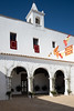


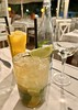
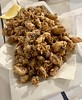
The above images may not be of the site on this page, but were taken nearby. They are loaded from Flickr so please click on them for image credits.
Click here to see more info for this site
Nearby sites
Click here to view sites on an interactive map of the areaKey: Red: member's photo, Blue: 3rd party photo, Yellow: other image, Green: no photo - please go there and take one, Grey: site destroyed
Download sites to:
KML (Google Earth)
GPX (GPS waypoints)
CSV (Garmin/Navman)
CSV (Excel)
To unlock full downloads you need to sign up as a Contributory Member. Otherwise downloads are limited to 50 sites.
Turn off the page maps and other distractions
Nearby sites listing. In the following links * = Image available
5.0km SE 136° Pou d’Albarqueta Holy Well or Sacred Spring
5.9km E 88° Pou de Labritja* Holy Well or Sacred Spring
6.3km SE 125° Font de Balafi* Holy Well or Sacred Spring
8.2km ENE 76° Pou des Baladre* Holy Well or Sacred Spring
9.5km SSW 212° Pou de Forada* Holy Well or Sacred Spring
12.7km ESE 107° Font de Peralta* Holy Well or Sacred Spring
13.6km E 82° Cova d'Es Cuieram Cave or Rock Shelter
17.6km S 179° Puig Des Molins* Museum
18.2km SSW 211° Font de Verger* Holy Well or Sacred Spring
19.6km S 187° Pou Roig* Holy Well or Sacred Spring
23.4km SSW 199° Sa Caleta Ancient Village or Settlement
24.3km SSW 213° Font den Xiquet* Holy Well or Sacred Spring
37.7km S 177° Ca Na Costa* Passage Grave
103.3km ENE 61° Poblat del Puig de sa Morisca* Ancient Village or Settlement
103.6km ENE 62° Talayot de Son Miralles* Broch or Nuraghe
103.7km ENE 62° Túmulo de Son Miralles* Artificial Mound
103.7km ENE 61° Santa Ponça 5* Ancient Village or Settlement
103.9km ENE 61° Santa Ponça 20* Ancient Village or Settlement
104.0km ENE 62° Túmulo de Son Ferrer* Round Barrow(s)
106.3km ENE 63° Naveta Alemany* Ancient Village or Settlement
119.3km ENE 62° Museu de Mallorca* Museum
122.4km NE 54° Son Oleza Ancient Village or Settlement
122.7km ENE 64° Son Oms santuario* Ancient Temple
124.1km NE 54° The Maze, Mallorca Ancient Village or Settlement
124.4km NE 54° Son Mas* Ancient Temple
View more nearby sites and additional images


 We would like to know more about this location. Please feel free to add a brief description and any relevant information in your own language.
 Wir möchten mehr über diese Stätte erfahren. Bitte zögern Sie nicht, eine kurze Beschreibung und relevante Informationen in Deutsch hinzuzufügen.
 Nous aimerions en savoir encore un peu sur les lieux. S'il vous plaît n'hesitez pas à ajouter une courte description et tous les renseignements pertinents dans votre propre langue.
 Quisieramos informarnos un poco más de las lugares. No dude en añadir una breve descripción y otros datos relevantes en su propio idioma.