


<< Our Photo Pages >> Tumulus de Biron - Artificial Mound in France in Aquitaine:Dordogne (24)
Submitted by LaDragonne on Monday, 11 July 2022 Page Views: 326
Multi-periodSite Name: Tumulus de BironCountry: France Département: Aquitaine:Dordogne (24) Type: Artificial Mound
Nearest Town: Monpazier Nearest Village: Biron
Latitude: 44.631310N Longitude: 0.874790E
Condition:
| 5 | Perfect |
| 4 | Almost Perfect |
| 3 | Reasonable but with some damage |
| 2 | Ruined but still recognisable as an ancient site |
| 1 | Pretty much destroyed, possibly visible as crop marks |
| 0 | No data. |
| -1 | Completely destroyed |
| 5 | Superb |
| 4 | Good |
| 3 | Ordinary |
| 2 | Not Good |
| 1 | Awful |
| 0 | No data. |
| 5 | Can be driven to, probably with disabled access |
| 4 | Short walk on a footpath |
| 3 | Requiring a bit more of a walk |
| 2 | A long walk |
| 1 | In the middle of nowhere, a nightmare to find |
| 0 | No data. |
| 5 | co-ordinates taken by GPS or official recorded co-ordinates |
| 4 | co-ordinates scaled from a detailed map |
| 3 | co-ordinates scaled from a bad map |
| 2 | co-ordinates of the nearest village |
| 1 | co-ordinates of the nearest town |
| 0 | no data |
Internal Links:
External Links:
")
Imposante butte de terre en contrebas du château de la commune. Il s'agit probablement d'un tertre ou tumulus funéraire ayant subi l’arasement du temps.
Une légende non vérifiée fait état d'un souterrain reliant cette butte à l'enceinte féodale du château.
Accessible en marchant dans la pâture privée et en évitant les génisses joueuses!
You may be viewing yesterday's version of this page. To see the most up to date information please register for a free account.
Do not use the above information on other web sites or publications without permission of the contributor.
Nearby Images from Flickr
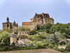
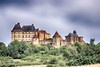
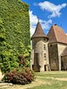
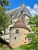
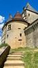
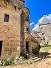
The above images may not be of the site on this page, but were taken nearby. They are loaded from Flickr so please click on them for image credits.
Click here to see more info for this site
Nearby sites
Click here to view sites on an interactive map of the areaKey: Red: member's photo, Blue: 3rd party photo, Yellow: other image, Green: no photo - please go there and take one, Grey: site destroyed
Download sites to:
KML (Google Earth)
GPX (GPS waypoints)
CSV (Garmin/Navman)
CSV (Excel)
To unlock full downloads you need to sign up as a Contributory Member. Otherwise downloads are limited to 50 sites.
Turn off the page maps and other distractions
Nearby sites listing. In the following links * = Image available
3.6km NW 305° Point du Jour dolmen* Burial Chamber or Dolmen
4.8km SW 230° Peyrelevade de Paulhiac* Burial Chamber or Dolmen
5.0km WSW 245° Peyrelevade de Dévillac* Burial Chamber or Dolmen
5.2km ENE 61° Pech Decunt* Standing Stone (Menhir)
5.4km SW 234° Dolmen Las Tres Peyres de Dévillac* Burial Chamber or Dolmen
5.8km NW 324° Allée Couverte de la Courrège* Passage Grave
6.1km W 278° Peyre Traoucade 1 Holed Stone
6.2km W 276° Peyre Traoucade 3* Holed Stone
6.3km NNW 332° Polissoir des Charrieux* Polissoir
6.3km W 277° Peyre Traoucade 2 Holed Stone
7.1km NNW 339° Allée couverte du Coustalou* Passage Grave
7.3km ENE 57° Clot de la Birme* Standing Stone (Menhir)
8.1km N 351° Peyregude menhir* Standing Stone (Menhir)
8.2km ENE 66° Menhirs de la Motte* Standing Stones
8.4km NNE 14° Maison du Loup dolmen 1* Passage Grave
8.5km NNE 16° Maison du Loup dolmen 2* Passage Grave
8.5km NE 38° Source de Pechegut* Holy Well or Sacred Spring
8.6km NE 36° Menhir de Pechegut* Standing Stone (Menhir)
8.9km NE 35° Motte du Maréchal* Artificial Mound
9.2km NE 55° Le Roc Pointu de Capdrot* Natural Stone / Erratic / Other Natural Feature
9.4km NNE 32° Menhir de Peyrecourt* Standing Stone (Menhir)
9.7km ENE 58° Roc de l'Aigue* Polissoir
9.7km N 1° Roc de Nanty* Standing Stone (Menhir)
10.0km NNW 327° Mayne del Rey* Passage Grave
10.0km ENE 73° Pierre de Fécondité (Mazeyrolles)* Natural Stone / Erratic / Other Natural Feature
View more nearby sites and additional images


 We would like to know more about this location. Please feel free to add a brief description and any relevant information in your own language.
 Wir möchten mehr über diese Stätte erfahren. Bitte zögern Sie nicht, eine kurze Beschreibung und relevante Informationen in Deutsch hinzuzufügen.
 Nous aimerions en savoir encore un peu sur les lieux. S'il vous plaît n'hesitez pas à ajouter une courte description et tous les renseignements pertinents dans votre propre langue.
 Quisieramos informarnos un poco más de las lugares. No dude en añadir una breve descripción y otros datos relevantes en su propio idioma.