


<< Text Pages >> Oppidum de la Sioutat - Ancient Village or Settlement in France in Midi:Gers (32)
Submitted by holger_rix on Thursday, 28 April 2016 Page Views: 993
Multi-periodSite Name: Oppidum de la SioutatCountry: France Département: Midi:Gers (32) Type: Ancient Village or Settlement
Nearest Town: Auch Nearest Village: Roquelaure
Latitude: 43.718109N Longitude: 0.583962E
Condition:
| 5 | Perfect |
| 4 | Almost Perfect |
| 3 | Reasonable but with some damage |
| 2 | Ruined but still recognisable as an ancient site |
| 1 | Pretty much destroyed, possibly visible as crop marks |
| 0 | No data. |
| -1 | Completely destroyed |
| 5 | Superb |
| 4 | Good |
| 3 | Ordinary |
| 2 | Not Good |
| 1 | Awful |
| 0 | No data. |
| 5 | Can be driven to, probably with disabled access |
| 4 | Short walk on a footpath |
| 3 | Requiring a bit more of a walk |
| 2 | A long walk |
| 1 | In the middle of nowhere, a nightmare to find |
| 0 | No data. |
| 5 | co-ordinates taken by GPS or official recorded co-ordinates |
| 4 | co-ordinates scaled from a detailed map |
| 3 | co-ordinates scaled from a bad map |
| 2 | co-ordinates of the nearest village |
| 1 | co-ordinates of the nearest town |
| 0 | no data |
Be the first person to rate this site - see the 'Contribute!' box in the right hand menu.
Internal Links:
External Links:
Ancient Village or Settlement in Midi:Gers (32)
Roquelaure, Auch, Gers, Languedoc-Roussillon-Midi-Pyrénées
Source: T4T35.fr
You may be viewing yesterday's version of this page. To see the most up to date information please register for a free account.
Do not use the above information on other web sites or publications without permission of the contributor.
Nearby Images from Flickr
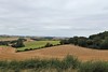
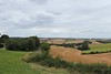
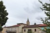
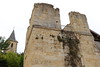
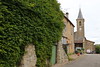
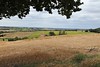
The above images may not be of the site on this page, but were taken nearby. They are loaded from Flickr so please click on them for image credits.
Click here to see more info for this site
Nearby sites
Click here to view sites on an interactive map of the areaKey: Red: member's photo, Blue: 3rd party photo, Yellow: other image, Green: no photo - please go there and take one, Grey: site destroyed
Download sites to:
KML (Google Earth)
GPX (GPS waypoints)
CSV (Garmin/Navman)
CSV (Excel)
To unlock full downloads you need to sign up as a Contributory Member. Otherwise downloads are limited to 50 sites.
Turn off the page maps and other distractions
Nearby sites listing. In the following links * = Image available
7.5km W 272° La pile de Saint-Lary* Ancient Temple
9.5km WSW 259° La Pile d'Ordan-Larroque* Ancient Temple
33.5km N 9° Sempesserre tumulus Chambered Tomb
34.0km W 279° Dému Tumulus* Artificial Mound
34.8km W 268° La Salle* Misc. Earthwork
40.9km NW 308° Seviac Villa gallo-romaine* Ancient Village or Settlement
44.7km W 265° St-Go Tumulus* Artificial Mound
44.7km N 10° Menhir Grand Peyro* Standing Stone (Menhir)
45.9km N 10° Dolmen As Peyrès Burial Chamber or Dolmen
46.8km W 279° Motte de Ste Christie d'Armagnac* Misc. Earthwork
48.3km W 266° La Motte castrale de Monterran* Hillfort
51.2km SSW 201° Oppidum du Tépé du Meur Hillfort
51.4km SW 234° Butte temoin de Lafitole* Hillfort
52.2km N 353° Menhir de Higaros* Standing Stone (Menhir)
52.6km NNW 343° Menhir de La Honrède* Standing Stone (Menhir)
52.8km NNW 344° Allée funéraire de Honrède* Passage Grave
52.9km N 352° Allée de Chanteloube* Passage Grave
53.1km N 353° Menhir de l'Eglise de Mourrens* Standing Stone (Menhir)
53.5km NNW 334° Allée couverte du Passage de Serbat* Passage Grave
53.5km WSW 240° Oppidum de Sombrum* Hillfort
53.8km S 173° Grotte des Harpons* Cave or Rock Shelter
53.9km SSW 197° Oppidum de Libaros Hillfort
54.1km S 173° Grotte des Rideaux* Cave or Rock Shelter
54.3km S 174° Grottes et abris préhistoriques de la vallée de la Save* Cave or Rock Shelter
54.4km S 173° Musée de Lespugue* Museum
View more nearby sites and additional images


 We would like to know more about this location. Please feel free to add a brief description and any relevant information in your own language.
 Wir möchten mehr über diese Stätte erfahren. Bitte zögern Sie nicht, eine kurze Beschreibung und relevante Informationen in Deutsch hinzuzufügen.
 Nous aimerions en savoir encore un peu sur les lieux. S'il vous plaît n'hesitez pas à ajouter une courte description et tous les renseignements pertinents dans votre propre langue.
 Quisieramos informarnos un poco más de las lugares. No dude en añadir una breve descripción y otros datos relevantes en su propio idioma.