

<< Text Pages >> Oppidum de Château-Chevrier - Ancient Village or Settlement in France in Centre:Indre-et-Loire (37)
Submitted by TheCaptain on Saturday, 16 April 2005 Page Views: 3653
Multi-periodSite Name: Oppidum de Château-ChevrierCountry: France
NOTE: This site is 5.058 km away from the location you searched for.
Département: Centre:Indre-et-Loire (37) Type: Ancient Village or Settlement
Nearest Town: Tours Nearest Village: Rochecorbon
Latitude: 47.412073N Longitude: 0.760489E
Condition:
| 5 | Perfect |
| 4 | Almost Perfect |
| 3 | Reasonable but with some damage |
| 2 | Ruined but still recognisable as an ancient site |
| 1 | Pretty much destroyed, possibly visible as crop marks |
| 0 | No data. |
| -1 | Completely destroyed |
| 5 | Superb |
| 4 | Good |
| 3 | Ordinary |
| 2 | Not Good |
| 1 | Awful |
| 0 | No data. |
| 5 | Can be driven to, probably with disabled access |
| 4 | Short walk on a footpath |
| 3 | Requiring a bit more of a walk |
| 2 | A long walk |
| 1 | In the middle of nowhere, a nightmare to find |
| 0 | No data. |
| 5 | co-ordinates taken by GPS or official recorded co-ordinates |
| 4 | co-ordinates scaled from a detailed map |
| 3 | co-ordinates scaled from a bad map |
| 2 | co-ordinates of the nearest village |
| 1 | co-ordinates of the nearest town |
| 0 | no data |
Be the first person to rate this site - see the 'Contribute!' box in the right hand menu.
Internal Links:
External Links:
Oppidum in Indre-et-Loire
Location Source: T4T35.fr
You may be viewing yesterday's version of this page. To see the most up to date information please register for a free account.
Do not use the above information on other web sites or publications without permission of the contributor.
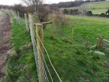
Nearby Images from Flickr


The above images may not be of the site on this page, but were taken nearby. They are loaded from Flickr so please click on them for image credits.
Click here to see more info for this site
Nearby sites
Click here to view sites on an interactive map of the areaKey: Red: member's photo, Blue: 3rd party photo, Yellow: other image, Green: no photo - please go there and take one, Grey: site destroyed
Download sites to:
KML (Google Earth)
GPX (GPS waypoints)
CSV (Garmin/Navman)
CSV (Excel)
To unlock full downloads you need to sign up as a Contributory Member. Otherwise downloads are limited to 50 sites.
Turn off the page maps and other distractions
Nearby sites listing. In the following links * = Image available
5.9km WSW 246° Musée Archéologique (Tours) Museum
7.2km W 259° Polissoir de Bois Livière Polissoir
8.0km NNW 327° Polissoir du Bois de Baudry Polissoir
9.8km WNW 299° Menhir de Toulifault Standing Stone (Menhir)
10.0km NW 304° La Grotte aux Fées* Burial Chamber or Dolmen
10.4km NNW 331° Menhir dit la Grosse Pierre (Cérelles) Standing Stone (Menhir)
10.6km SW 225° Le Menhir de l’Alouette Standing Stone (Menhir)
13.9km N 349° Menhir de la Pierre à Vinaigre Standing Stone (Menhir)
16.0km NNE 21° Menhir dit le Gros Perron Standing Stone (Menhir)
16.1km S 171° Dolmen du Moulin Sauquet Burial Chamber or Dolmen
17.2km E 89° Oppidum des Châteliers* Ancient Village or Settlement
17.6km NE 41° Dolmen du Château de Pierrefitte* Burial Chamber or Dolmen
17.6km NE 41° Château de Pierrefitte menhir Standing Stone (Menhir)
17.7km E 89° Le Rempart* Misc. Earthwork
19.4km NNW 331° Pierre du Pont-Champion* Standing Stone (Menhir)
19.8km SW 218° Dolmen du bois des plantes Burial Chamber or Dolmen
20.2km NNW 329° Dolmen de la Haute Barde* Burial Chamber or Dolmen
22.1km WSW 245° La Pierre aux Joncs* Standing Stone (Menhir)
22.4km SSW 211° La Pierre Levée (Thilouze) Standing Stone (Menhir)
22.4km SSE 151° Dolmen de Reignac Burial Chamber or Dolmen
22.4km SE 130° Pierre du pas de Saint-Martin* Polissoir
23.0km SE 130° Dolmen de Villaine Burial Chamber or Dolmen
23.3km ENE 75° La Pierre David* Standing Stone (Menhir)
24.7km NNW 330° Polissoir du Bois du Gué Polissoir
24.7km SE 138° Menhir dit Pierre Bachelière Standing Stone (Menhir)
View more nearby sites and additional images


 We would like to know more about this location. Please feel free to add a brief description and any relevant information in your own language.
 Wir möchten mehr über diese Stätte erfahren. Bitte zögern Sie nicht, eine kurze Beschreibung und relevante Informationen in Deutsch hinzuzufügen.
 Nous aimerions en savoir encore un peu sur les lieux. S'il vous plaît n'hesitez pas à ajouter une courte description et tous les renseignements pertinents dans votre propre langue.
 Quisieramos informarnos un poco más de las lugares. No dude en añadir una breve descripción y otros datos relevantes en su propio idioma.