


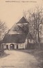
<< Our Photo Pages >> Chillou du Feuillet Dolmen - Burial Chamber or Dolmen in France in Centre:Indre-et-Loire (37)
Submitted by TheCaptain on Saturday, 16 April 2005 Page Views: 4130
Neolithic and Bronze AgeSite Name: Chillou du Feuillet DolmenCountry: France Département: Centre:Indre-et-Loire (37) Type: Burial Chamber or Dolmen
Nearest Town: Chatellerault Nearest Village: Descartes
Latitude: 47.018289N Longitude: 0.674432E
Condition:
| 5 | Perfect |
| 4 | Almost Perfect |
| 3 | Reasonable but with some damage |
| 2 | Ruined but still recognisable as an ancient site |
| 1 | Pretty much destroyed, possibly visible as crop marks |
| 0 | No data. |
| -1 | Completely destroyed |
| 5 | Superb |
| 4 | Good |
| 3 | Ordinary |
| 2 | Not Good |
| 1 | Awful |
| 0 | No data. |
| 5 | Can be driven to, probably with disabled access |
| 4 | Short walk on a footpath |
| 3 | Requiring a bit more of a walk |
| 2 | A long walk |
| 1 | In the middle of nowhere, a nightmare to find |
| 0 | No data. |
| 5 | co-ordinates taken by GPS or official recorded co-ordinates |
| 4 | co-ordinates scaled from a detailed map |
| 3 | co-ordinates scaled from a bad map |
| 2 | co-ordinates of the nearest village |
| 1 | co-ordinates of the nearest town |
| 0 | no data |
Internal Links:
External Links:
")
You may be viewing yesterday's version of this page. To see the most up to date information please register for a free account.
")
")
Do not use the above information on other web sites or publications without permission of the contributor.
Nearby Images from Flickr
The above images may not be of the site on this page, but were taken nearby. They are loaded from Flickr so please click on them for image credits.
Click here to see more info for this site
Nearby sites
Click here to view sites on an interactive map of the areaKey: Red: member's photo, Blue: 3rd party photo, Yellow: other image, Green: no photo - please go there and take one, Grey: site destroyed
Download sites to:
KML (Google Earth)
GPX (GPS waypoints)
CSV (Garmin/Navman)
CSV (Excel)
To unlock full downloads you need to sign up as a Contributory Member. Otherwise downloads are limited to 50 sites.
Turn off the page maps and other distractions
Nearby sites listing. In the following links * = Image available
7.9km NW 320° Pierre Percée (Draché)* Standing Stone (Menhir)
8.0km WNW 297° La Pierre Levée (Maillé) Burial Chamber or Dolmen
8.4km WSW 250° Dolmen de Doux Burial Chamber or Dolmen
8.4km WSW 250° Menhir de Doulx Standing Stone (Menhir)
9.3km NW 322° La Pierre Fondue* Burial Chamber or Dolmen
9.6km SSE 155° Archéolab Museum
10.0km ESE 118° Polissoir du Camp de Brenne Polissoir
10.2km WNW 290° Menhir de la Pierre Fitte (Nouâtre) Standing Stone (Menhir)
10.7km ESE 114° Pierre Chaude* Burial Chamber or Dolmen
11.1km NNW 338° Deux Manses Oppidum Hillfort
11.2km WNW 301° Dolmen de la Pierre Levée (Pouzay) Burial Chamber or Dolmen
12.4km WSW 249° Dolmen de Doux Burial Chamber or Dolmen
13.1km ESE 108° Polissoir de La Chauvelière Polissoir
14.5km SE 138° Grand-Pressigny Musée de la Préhistoire* Museum
14.5km SE 138° Coeur de Birette* Polissoir
14.8km SE 138° Le Grand-Pressigny flint mines Ancient Mine, Quarry or other Industry
17.7km WNW 299° Dolmen de la Brèche Burial Chamber or Dolmen
20.3km WNW 288° Menhir du Chillou Standing Stone (Menhir)
21.4km ESE 120° La Pierre Birette* Polissoir
21.7km WNW 303° Le Pavé de Saint Lazare* Burial Chamber or Dolmen
21.8km SE 139° Menhir de La Touche Standing Stone (Menhir)
23.6km ENE 58° Menhir dit la Grande Borne (Chanceaux-près-Loches)* Standing Stone (Menhir)
23.8km WNW 293° Dolmen dit le Palet de Gargantua (Brizay)* Burial Chamber or Dolmen
24.9km NNW 335° La Pierre à Vinaigre Standing Stone (Menhir)
25.2km NNW 348° La Pierre Levée (Thilouze) Standing Stone (Menhir)
View more nearby sites and additional images


 We would like to know more about this location. Please feel free to add a brief description and any relevant information in your own language.
 Wir möchten mehr über diese Stätte erfahren. Bitte zögern Sie nicht, eine kurze Beschreibung und relevante Informationen in Deutsch hinzuzufügen.
 Nous aimerions en savoir encore un peu sur les lieux. S'il vous plaît n'hesitez pas à ajouter une courte description et tous les renseignements pertinents dans votre propre langue.
 Quisieramos informarnos un poco más de las lugares. No dude en añadir una breve descripción y otros datos relevantes en su propio idioma.