
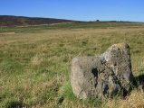

<< Our Photo Pages >> Pierre Teule - Marker Stone in France in Aquitaine:Dordogne (24)
Submitted by LaDragonne on Sunday, 23 April 2023 Page Views: 285
Modern SitesSite Name: Pierre TeuleCountry: France
NOTE: This site is 3.563 km away from the location you searched for.
Département: Aquitaine:Dordogne (24) Type: Marker Stone
Nearest Town: Bergerac Nearest Village: Beleymas
Latitude: 44.963810N Longitude: 0.492480E
Condition:
| 5 | Perfect |
| 4 | Almost Perfect |
| 3 | Reasonable but with some damage |
| 2 | Ruined but still recognisable as an ancient site |
| 1 | Pretty much destroyed, possibly visible as crop marks |
| 0 | No data. |
| -1 | Completely destroyed |
| 5 | Superb |
| 4 | Good |
| 3 | Ordinary |
| 2 | Not Good |
| 1 | Awful |
| 0 | No data. |
| 5 | Can be driven to, probably with disabled access |
| 4 | Short walk on a footpath |
| 3 | Requiring a bit more of a walk |
| 2 | A long walk |
| 1 | In the middle of nowhere, a nightmare to find |
| 0 | No data. |
| 5 | co-ordinates taken by GPS or official recorded co-ordinates |
| 4 | co-ordinates scaled from a detailed map |
| 3 | co-ordinates scaled from a bad map |
| 2 | co-ordinates of the nearest village |
| 1 | co-ordinates of the nearest town |
| 0 | no data |
Internal Links:
External Links:
")
Elle est visible au milieu du chemin pare-feu.
You may be viewing yesterday's version of this page. To see the most up to date information please register for a free account.
Do not use the above information on other web sites or publications without permission of the contributor.
Nearby Images from Flickr
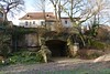
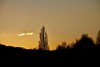
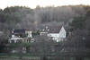
The above images may not be of the site on this page, but were taken nearby. They are loaded from Flickr so please click on them for image credits.
Click here to see more info for this site
Nearby sites
Click here to view sites on an interactive map of the areaKey: Red: member's photo, Blue: 3rd party photo, Yellow: other image, Green: no photo - please go there and take one, Grey: site destroyed
Download sites to:
KML (Google Earth)
GPX (GPS waypoints)
CSV (Garmin/Navman)
CSV (Excel)
To unlock full downloads you need to sign up as a Contributory Member. Otherwise downloads are limited to 50 sites.
Turn off the page maps and other distractions
Nearby sites listing. In the following links * = Image available
1.3km N 356° Le Roc del Cayre* Natural Stone / Erratic / Other Natural Feature
1.4km N 355° Dolmen Le Cayre de Beleymas* Burial Chamber or Dolmen
2.3km SSW 193° Le rocher pointu* Standing Stone (Menhir)
4.4km N 3° Dolmen Peyrelevade de Beleymas* Burial Chamber or Dolmen
6.0km NW 323° Menhir dit La Peyre-Chaume* Standing Stone (Menhir)
6.8km NE 41° Menhir de Pierrefiche (Villamblard)* Standing Stone (Menhir)
8.7km NW 306° Dolmen de La Caze* Burial Chamber or Dolmen
8.9km WNW 289° Menhir de Les Leyches* Standing Stone (Menhir)
9.9km NE 43° Dolmen de Peyrelevade (Villamblard)* Burial Chamber or Dolmen
10.0km NE 44° Pierre philosophale de Peyrelevade* Natural Stone / Erratic / Other Natural Feature
11.1km SSE 165° Dolmen Peyrelevade de Pecharmant* Burial Chamber or Dolmen
11.2km SSE 164° Menhir Peyrelevade de Pecharmant* Standing Stone (Menhir)
11.4km ENE 75° Dolmen dit Pierre Levée (Beauregard-et-Bassac)* Burial Chamber or Dolmen
11.9km S 181° La Peyre du Pont de la Peyre* Standing Stone (Menhir)
12.2km WNW 303° Dolmen de Drouillas* Burial Chamber or Dolmen
12.2km NW 314° Grotte de Las Agnelas* Cave or Rock Shelter
12.4km NW 315° Source des Pierres* Holy Well or Sacred Spring
12.5km S 183° La Peyre de Fonpeyre* Stone Circle
12.6km S 183° Peyre Levade Intramuros* Burial Chamber or Dolmen
13.4km SSE 154° Gisements de Creysse Cave or Rock Shelter
13.7km SE 145° Dolmen de Saint Sauveur Burial Chamber or Dolmen
14.8km NW 314° Menhir de la Croix Blanche* Standing Stone (Menhir)
15.4km ESE 123° Rochers de la Vierge* Natural Stone / Erratic / Other Natural Feature
15.5km ESE 122° Dolmen Roc Leva* Burial Chamber or Dolmen
16.3km NW 308° Dolmen de la Joncasse* Burial Chamber or Dolmen
View more nearby sites and additional images


 We would like to know more about this location. Please feel free to add a brief description and any relevant information in your own language.
 Wir möchten mehr über diese Stätte erfahren. Bitte zögern Sie nicht, eine kurze Beschreibung und relevante Informationen in Deutsch hinzuzufügen.
 Nous aimerions en savoir encore un peu sur les lieux. S'il vous plaît n'hesitez pas à ajouter une courte description et tous les renseignements pertinents dans votre propre langue.
 Quisieramos informarnos un poco más de las lugares. No dude en añadir una breve descripción y otros datos relevantes en su propio idioma.