


<< Text Pages >> Blue Bell Hill Sarsons - Burial Chamber or Dolmen in England in Kent
Submitted by coldrum on Wednesday, 23 July 2008 Page Views: 9045
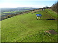
Neolithic and Bronze AgeSite Name: Blue Bell Hill SarsonsCountry: England County: Kent Type: Burial Chamber or Dolmen
Nearest Village: Blue Bell Hill
Map Ref: TQ740620
Latitude: 51.330475N Longitude: 0.496203E
Condition:
| 5 | Perfect |
| 4 | Almost Perfect |
| 3 | Reasonable but with some damage |
| 2 | Ruined but still recognisable as an ancient site |
| 1 | Pretty much destroyed, possibly visible as crop marks |
| 0 | No data. |
| -1 | Completely destroyed |
| 5 | Superb |
| 4 | Good |
| 3 | Ordinary |
| 2 | Not Good |
| 1 | Awful |
| 0 | No data. |
| 5 | Can be driven to, probably with disabled access |
| 4 | Short walk on a footpath |
| 3 | Requiring a bit more of a walk |
| 2 | A long walk |
| 1 | In the middle of nowhere, a nightmare to find |
| 0 | No data. |
| 5 | co-ordinates taken by GPS or official recorded co-ordinates |
| 4 | co-ordinates scaled from a detailed map |
| 3 | co-ordinates scaled from a bad map |
| 2 | co-ordinates of the nearest village |
| 1 | co-ordinates of the nearest town |
| 0 | no data |
Internal Links:
External Links:
Information from Pastscape:
"Alleged site of a Neolithic chambered tomb, skeleton and pottery found in the 19th century. Many sarson stones lie in the area, probably a mixture of natural outcrops and field clearance. Pits of unknown date have been found in the area".
Pastscape.
From Exploring Kent's Past:
"Groups of sarsen stones lie in several places on the lower slopes of Blue Bell Hill, spreading across to Westfield Wood. Previously thought to be the remains of avenues and circles, they have no known prehistoric associations. They may be in their natural geological positions and, if in groups, could be the results of farmers clearing fields.
In the nineteenth century Thomas Wright thought several of the scattered stones were coverings or entrances to burial chambers. In 1844 excavations around some of the stones showed that one was laid across the mouth of a round pit cut in the chalk and filled with flints. According to local residents at the time, pits filled with flints were common in the area. The flints were often used as road metal when a new road was made.
The Blue Bell Hill Dolmen is shown on a sketch in Maidstone Museum with the following measurements.
North stone 7ft x 1ft 1in x 4ft 9ins (2.25m x .32m x 1.45m)
South stone 7ft x 2ft 3ins x 5ft 9ins (2.13m x .68m x 1.74m)
West stone 3ft x 4ft x 1ft 6ins ( 0.91m x 1.22m x .45m)
Centre stone 1ft x 2ft (.30m x .61m)
A skeleton of a man and fragments of red pottery were reportedly found but no records were kept.
The Blue Bell Hill Dolmen, Kent, destroyed. A sketch in the Maidstone Museum gives these measurements: N stone 7.5 feet x 1 foot 1 inch x 4 feet 9 inches.S stone 7.0 feet x 2 feet 3 inches x5 feet 9 inches. W stone 3.0 feet x 4 feet x 1 foot6 inches. Centre stone 1.0 feet x 2 feet. Burial place, originally in a barrow. A skeleton of a man and fragments of red pottery were found, but no record seems to have been kept. On either side of the ancient way which runs through the wood onBlue Bell Hill are a vast number of sarsens, seemingly the remains of avenues and circles. Bensted's map, however, gives them as all naturalor scattered boulders.
Description of the megaliths on Blue Bell Hill.
Several sarsens were seen on the edge of Warren Road in the vicinity of TQ 748 611 but none approaching the size of the largest .
Blue Bell Hill cTQ 75 61. Groups of sarsens lie in several places around the lower slopes of Blue Bell Hill, spreading across to Westfield Wood. None of these have known prehistoric associations. The sarsens may be in their natural geological positions, and where gathered in a group merely represent the efforts of a local farmer to clear his fields.
Stones of Blue Bell Hill. Several scattered stones considered by the late Mr Thomas Wright to be the coverings or entrances to sepulchral chambers. It was found that each group of stones was surrounded by a small circle of stones, and excavations carried out in 1844 showed that one of these stones was laid across what was apparently the mouth of a round pit cut in the chalk and filled with flints. According to the reports of the inhabitants of the district many similar pits had been found on the hill in former times, and generally one or two large stones were found on the pit's mouth. Enormous numbers of flints were found in the pits, and many of them were utilized as road metal when a new road was made. "
Exploring Kent's Past.
You may be viewing yesterday's version of this page. To see the most up to date information please register for a free account.
Do not use the above information on other web sites or publications without permission of the contributor.
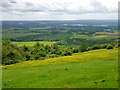
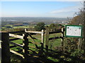
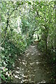
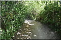
Nearby Images from Geograph Britain and Ireland:
©2012(licence)
©2010(licence)
©2021(licence)
©2021(licence)
©2013(licence)
The above images may not be of the site on this page, they are loaded from Geograph.
Please Submit an Image of this site or go out and take one for us!
Click here to see more info for this site
Nearby sites
Key: Red: member's photo, Blue: 3rd party photo, Yellow: other image, Green: no photo - please go there and take one, Grey: site destroyed
Download sites to:
KML (Google Earth)
GPX (GPS waypoints)
CSV (Garmin/Navman)
CSV (Excel)
To unlock full downloads you need to sign up as a Contributory Member. Otherwise downloads are limited to 50 sites.
Turn off the page maps and other distractions
Nearby sites listing. In the following links * = Image available
600m S 184° Pilgrim Spring* Holy Well or Sacred Spring (TQ73986140)
1.1km WSW 238° Haly Garden (Burham) Holy Well or Sacred Spring (TQ731614)
1.2km SSE 159° Kit's Coty.* Burial Chamber or Dolmen (TQ7448660856)
1.3km S 186° Pilgrims Way 4 Ancient Trackway (TQ739607)
1.4km S 182° Coffin Stone* Standing Stone (Menhir) (TQ74016059)
1.6km S 184° Great Tottington Farm Natural Stone / Erratic / Other Natural Feature (TQ73956038)
1.7km SSE 167° Little Kit's Coty* Burial Chamber or Dolmen (TQ74426040)
1.8km S 176° Tottington Stone* Standing Stone (Menhir) (TQ7418660231)
2.0km SE 141° Smythe's Megalith Chambered Tomb (TQ753605)
2.0km E 98° Stones off Impton Lane* Natural Stone / Erratic / Other Natural Feature (TQ7601561793)
2.1km SSE 150° Lower White Horse Stone* Standing Stone (Menhir) (TQ75126022)
2.1km E 84° Walderslade Wood Sarsons* Natural Stone / Erratic / Other Natural Feature (TQ761623)
2.1km SSE 146° White Horse Stone Neolithic Longhouse Ancient Village or Settlement (TQ7525060250)
2.2km SE 143° White Horse Stone* Chambered Tomb (TQ75356032)
2.2km SSE 169° Cossington Spring* Holy Well or Sacred Spring (TQ745599)
2.2km SSE 155° Aylesford Megalith Long Barrow (TQ750600)
2.4km W 281° Burham causewayed enclosure* Causewayed Enclosure (TQ71666238)
2.5km SE 135° White Horse Spring* Holy Well or Sacred Spring (TQ758603)
2.9km NNW 330° Wouldham Barrow Round Barrow(s) (TQ72456445)
3.0km W 270° Battle of the Medway Stone* Modern Stone Circle etc (TQ710619)
3.2km NW 323° Pilgrims Way 3 Ancient Trackway (TQ720645)
3.5km NNW 340° Shoulder of Mutton Wood Bowl Barrow* Round Barrow(s) (TQ72716525)
3.6km E 89° Lordswood Sarsen Stones (Buxton/Iona Close)* Natural Stone / Erratic / Other Natural Feature (TQ7762262215)
3.7km E 86° Lordswood Sarsen Stones* Natural Stone / Erratic / Other Natural Feature (TQ7771162358)
4.1km ENE 64° Lordswood Barrow Round Barrow(s) (TQ776639)
View more nearby sites and additional images


 We would like to know more about this location. Please feel free to add a brief description and any relevant information in your own language.
 Wir möchten mehr über diese Stätte erfahren. Bitte zögern Sie nicht, eine kurze Beschreibung und relevante Informationen in Deutsch hinzuzufügen.
 Nous aimerions en savoir encore un peu sur les lieux. S'il vous plaît n'hesitez pas à ajouter une courte description et tous les renseignements pertinents dans votre propre langue.
 Quisieramos informarnos un poco más de las lugares. No dude en añadir una breve descripción y otros datos relevantes en su propio idioma.