 with our Megalithic Portal iPhone app")

<< Text Pages >> Felsted - Misc. Earthwork in England in Essex
Submitted by Andy B on Sunday, 18 December 2005 Page Views: 5536
Multi-periodSite Name: FelstedCountry: England
NOTE: This site is 1.413 km away from the location you searched for.
County: Essex Type: Misc. Earthwork
Nearest Town: Great Dunmow Nearest Village: Felsted
Map Ref: TL677193
Latitude: 51.847110N Longitude: 0.433218E
Condition:
| 5 | Perfect |
| 4 | Almost Perfect |
| 3 | Reasonable but with some damage |
| 2 | Ruined but still recognisable as an ancient site |
| 1 | Pretty much destroyed, possibly visible as crop marks |
| 0 | No data. |
| -1 | Completely destroyed |
| 5 | Superb |
| 4 | Good |
| 3 | Ordinary |
| 2 | Not Good |
| 1 | Awful |
| 0 | No data. |
| 5 | Can be driven to, probably with disabled access |
| 4 | Short walk on a footpath |
| 3 | Requiring a bit more of a walk |
| 2 | A long walk |
| 1 | In the middle of nowhere, a nightmare to find |
| 0 | No data. |
| 5 | co-ordinates taken by GPS or official recorded co-ordinates |
| 4 | co-ordinates scaled from a detailed map |
| 3 | co-ordinates scaled from a bad map |
| 2 | co-ordinates of the nearest village |
| 1 | co-ordinates of the nearest town |
| 0 | no data |
Internal Links:
External Links:
Pastscape says: A circular enclosure is visible as a cropmark on air photographs at Felsted, representing a rare cropmark site on the boulder clays. Circa 50 metres in diameter, there is a possible causeway on the western side.
An irregular linear feature apparently runs off to the east. The site has been considered a possible henge, although more recent discussion seems to favour a Late Bronze Age date by comparison with other circular enclosures in Essex such as those at Mucking and Springfield Lyons.
Source: Pastscape Visible as a crop mark. Do you have any further information to add?
You may be viewing yesterday's version of this page. To see the most up to date information please register for a free account.
Do not use the above information on other web sites or publications without permission of the contributor.
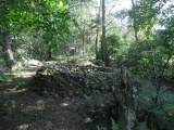
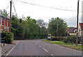
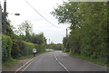
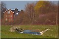
Nearby Images from Geograph Britain and Ireland:
©2015(licence)
©2015(licence)
©2007(licence)
©2008(licence)
©2005(licence)
The above images may not be of the site on this page, they are loaded from Geograph.
Please Submit an Image of this site or go out and take one for us!
Click here to see more info for this site
Nearby sites
Key: Red: member's photo, Blue: 3rd party photo, Yellow: other image, Green: no photo - please go there and take one, Grey: site destroyed
Download sites to:
KML (Google Earth)
GPX (GPS waypoints)
CSV (Garmin/Navman)
CSV (Excel)
To unlock full downloads you need to sign up as a Contributory Member. Otherwise downloads are limited to 50 sites.
Turn off the page maps and other distractions
Nearby sites listing. In the following links * = Image available
9.3km SSE 164° Broomfield Puddingstone* Marker Stone (TL705104)
9.8km SSW 194° Roxwell Puddingstone Marker Stone (TL657097)
10.5km NW 314° Tilty Puddingstone* Natural Stone / Erratic / Other Natural Feature (TL599264)
11.0km E 89° Cressing Henge Henge (TL787199)
11.2km E 100° White Notley Puddingstone* Marker Stone (TL7880517722)
11.7km W 281° Stansted Airport Stone* Natural Stone / Erratic / Other Natural Feature (TL561212)
12.6km SSE 155° Springfield Lyons Enclosure* Misc. Earthwork (TL735081)
13.3km SSE 157° Springfield Timber Circle (TL733072)
13.5km SSE 161° Springfield Cursus Cursus (TL725067)
13.5km SSE 158° Springfield Cursus Cursus (TL731069)
13.6km SSE 161° Chelmer Cursus (TL725066)
13.6km W 274° Hatfield Forest Puddingstones* Natural Stone / Erratic / Other Natural Feature (TL541198)
13.7km SW 228° Beauchamp Roding Puddingstone* Marker Stone (TL578098)
14.0km S 172° Chelmsford Stone* Natural Stone / Erratic / Other Natural Feature (TL702055)
14.5km SE 140° Little Baddow Henge (TL774085)
14.5km W 276° Hatfield Forest* Ancient Village or Settlement (TL532204)
14.5km ESE 115° Ivy Chimneys (Witham) Ancient Village or Settlement (TL8111513611)
14.6km SSW 209° Watling Street* Ancient Trackway (TL611063)
14.8km ESE 108° Chipping Hill Enclosure Misc. Earthwork (TL819151)
16.5km ENE 64° Perces (Halstead) Cairn (TL82282704)
16.5km ESE 104° Witham Cursus Cursus (TL839157)
16.9km E 101° Rivenhall Long Barrow (TL845167)
17.1km ESE 101° Rivenhall Henge (TL846165)
17.1km WNW 299° Ugley Green Puddingstone* Natural Stone / Erratic / Other Natural Feature (TL5242327126)
17.2km E 101° Rivenhall Cursus Cursus (TL847166)
View more nearby sites and additional images


 We would like to know more about this location. Please feel free to add a brief description and any relevant information in your own language.
 Wir möchten mehr über diese Stätte erfahren. Bitte zögern Sie nicht, eine kurze Beschreibung und relevante Informationen in Deutsch hinzuzufügen.
 Nous aimerions en savoir encore un peu sur les lieux. S'il vous plaît n'hesitez pas à ajouter une courte description et tous les renseignements pertinents dans votre propre langue.
 Quisieramos informarnos un poco más de las lugares. No dude en añadir una breve descripción y otros datos relevantes en su propio idioma.