


<< Our Photo Pages >> The Burwells - Holy Well or Sacred Spring in England in Cambridgeshire
Submitted by HOLYWELL on Wednesday, 27 February 2008 Page Views: 4932
Springs and Holy WellsSite Name: The BurwellsCountry: England
NOTE: This site is 3.262 km away from the location you searched for.
County: Cambridgeshire Type: Holy Well or Sacred Spring
Nearest Village: Burwell
Map Ref: TL5866
Latitude: 52.269458N Longitude: 0.314108E
Condition:
| 5 | Perfect |
| 4 | Almost Perfect |
| 3 | Reasonable but with some damage |
| 2 | Ruined but still recognisable as an ancient site |
| 1 | Pretty much destroyed, possibly visible as crop marks |
| 0 | No data. |
| -1 | Completely destroyed |
| 5 | Superb |
| 4 | Good |
| 3 | Ordinary |
| 2 | Not Good |
| 1 | Awful |
| 0 | No data. |
| 5 | Can be driven to, probably with disabled access |
| 4 | Short walk on a footpath |
| 3 | Requiring a bit more of a walk |
| 2 | A long walk |
| 1 | In the middle of nowhere, a nightmare to find |
| 0 | No data. |
| 5 | co-ordinates taken by GPS or official recorded co-ordinates |
| 4 | co-ordinates scaled from a detailed map |
| 3 | co-ordinates scaled from a bad map |
| 2 | co-ordinates of the nearest village |
| 1 | co-ordinates of the nearest town |
| 0 | no data |
Internal Links:
External Links:
")
Two springs whose waters were said to bestow fertility. They arise on the site of an ancient earthwork near the village.
You may be viewing yesterday's version of this page. To see the most up to date information please register for a free account.
Do not use the above information on other web sites or publications without permission of the contributor.
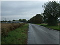
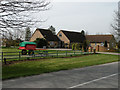
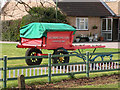
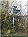
Nearby Images from Geograph Britain and Ireland:

©2020(licence)
©2015(licence)
©2009(licence)
©2009(licence)
©2016(licence)
The above images may not be of the site on this page, they are loaded from Geograph.
Please Submit an Image of this site or go out and take one for us!
Click here to see more info for this site
Nearby sites
Key: Red: member's photo, Blue: 3rd party photo, Yellow: other image, Green: no photo - please go there and take one, Grey: site destroyed
Download sites to:
KML (Google Earth)
GPX (GPS waypoints)
CSV (Garmin/Navman)
CSV (Excel)
To unlock full downloads you need to sign up as a Contributory Member. Otherwise downloads are limited to 50 sites.
Turn off the page maps and other distractions
Nearby sites listing. In the following links * = Image available
1.4km S 182° Devil's Dyke, Cambridgeshire* Misc. Earthwork (TL580646)
4.8km NNW 341° Wicken Fen* Natural Stone / Erratic / Other Natural Feature (TL563705)
5.3km SW 221° Bottisham Cursus Cursus (TL547619)
11.7km E 81° Howe Hill Bowl Barrow* Round Barrow(s) (TL69536822)
12.1km SSW 198° Mutlow Hill* Round Barrow(s) (TL5466354380)
13.6km SW 226° The Kingship Stone, Cherry Hinton Natural Stone / Erratic / Other Natural Feature (TL486562)
14.1km SW 224° East Pit Nature Reserve* Ancient Village or Settlement (TL485555)
14.8km SSW 210° Copley Hill* Round Barrow(s) (TL509530)
15.1km SSW 209° Babraham* Long Barrow (TL510526)
15.2km WSW 240° Cambridge Museum of Archaeology & Anthropology* Museum (TL450581)
15.3km SW 216° Wandlebury* Hillfort (TL493534)
15.3km WSW 240° Cambridge Fitzwilliam Museum* Museum (TL44955790)
15.3km SW 217° Gog and Magog Giants Hill Figures* Hill Figure or Geoglyph (TL492534)
15.6km SW 214° Wormwood Hill* Round Barrow(s) (TL497528)
16.1km WNW 287° Belsar's Hill* Hillfort (TL424703)
16.6km SW 227° Nine wells* Holy Well or Sacred Spring (TL46305420)
17.6km W 271° St Michael's Well (Cambridge)* Holy Well or Sacred Spring (TL40326584)
18.4km WNW 296° Haddenham Enclosure Causewayed Enclosure (TL412736)
18.9km NW 315° Sutton in the Isle Round Barrow Round Barrow(s) (TL443790)
19.1km NNW 329° Wardy Hill Hillfort (TL475820)
19.2km SW 223° Little Shelford Crosses* Ancient Cross (TL453516)
19.2km NW 306° Haddenham Long Barrow (TL420767)
20.6km ENE 62° How Hill Round Barrow(s) (TL75987626)
21.1km S 180° Bartlow Hills* Barrow Cemetery (TL586449)
21.3km SSE 159° Haverhill marker stone* Marker Stone (TL6633546395)
View more nearby sites and additional images


 We would like to know more about this location. Please feel free to add a brief description and any relevant information in your own language.
 Wir möchten mehr über diese Stätte erfahren. Bitte zögern Sie nicht, eine kurze Beschreibung und relevante Informationen in Deutsch hinzuzufügen.
 Nous aimerions en savoir encore un peu sur les lieux. S'il vous plaît n'hesitez pas à ajouter une courte description et tous les renseignements pertinents dans votre propre langue.
 Quisieramos informarnos un poco más de las lugares. No dude en añadir una breve descripción y otros datos relevantes en su propio idioma.