 with our Megalithic Portal iPhone app")

<< Image Pages >> Le Chaffaud - Cave or Rock Shelter in France in Poitou:Vienne (86)
Submitted by durhamnature on Tuesday, 20 November 2012 Page Views: 3440
Natural PlacesSite Name: Le Chaffaud Alternative Name: Les Grottes du ChaffaudCountry: France
NOTE: This site is 5.631 km away from the location you searched for.
Département: Poitou:Vienne (86) Type: Cave or Rock Shelter
Nearest Town: Civray Nearest Village: Savigné
Latitude: 46.158310N Longitude: 0.343020E
Condition:
| 5 | Perfect |
| 4 | Almost Perfect |
| 3 | Reasonable but with some damage |
| 2 | Ruined but still recognisable as an ancient site |
| 1 | Pretty much destroyed, possibly visible as crop marks |
| 0 | No data. |
| -1 | Completely destroyed |
| 5 | Superb |
| 4 | Good |
| 3 | Ordinary |
| 2 | Not Good |
| 1 | Awful |
| 0 | No data. |
| 5 | Can be driven to, probably with disabled access |
| 4 | Short walk on a footpath |
| 3 | Requiring a bit more of a walk |
| 2 | A long walk |
| 1 | In the middle of nowhere, a nightmare to find |
| 0 | No data. |
| 5 | co-ordinates taken by GPS or official recorded co-ordinates |
| 4 | co-ordinates scaled from a detailed map |
| 3 | co-ordinates scaled from a bad map |
| 2 | co-ordinates of the nearest village |
| 1 | co-ordinates of the nearest town |
| 0 | no data |
Internal Links:
External Links:
")
Cave with rock art, open to the public self-guided or with a tour guide.
You may be viewing yesterday's version of this page. To see the most up to date information please register for a free account.
")
Do not use the above information on other web sites or publications without permission of the contributor.
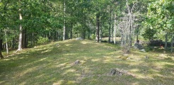
Nearby Images from Flickr
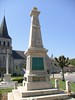
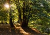
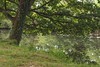
The above images may not be of the site on this page, but were taken nearby. They are loaded from Flickr so please click on them for image credits.
Click here to see more info for this site
Nearby sites
Click here to view sites on an interactive map of the areaKey: Red: member's photo, Blue: 3rd party photo, Yellow: other image, Green: no photo - please go there and take one, Grey: site destroyed
Download sites to:
KML (Google Earth)
GPX (GPS waypoints)
CSV (Garmin/Navman)
CSV (Excel)
To unlock full downloads you need to sign up as a Contributory Member. Otherwise downloads are limited to 50 sites.
Turn off the page maps and other distractions
Nearby sites listing. In the following links * = Image available
5.6km W 262° Dolmen de Beaumont Burial Chamber or Dolmen
10.0km W 260° Dolmen de la Pierre-Pèze* Burial Chamber or Dolmen
13.7km WSW 257° Russel 2 Burial Chamber or Dolmen
13.8km WSW 257° Tumulus de Nouverteils Chambered Tomb
14.1km N 5° Dolmen de Puynard Burial Chamber or Dolmen
17.4km ENE 61° Villaigue Dolmen 1* Burial Chamber or Dolmen
17.4km ENE 61° Villaigue Dolmen 2* Burial Chamber or Dolmen
20.5km SSE 159° Champagne-Mouton Oppidum Ancient Village or Settlement
20.6km WNW 301° Dolmen de Messé* Burial Chamber or Dolmen
21.4km SSW 195° La Pierrefitte (St-Georges) Burial Chamber or Dolmen
21.6km NNW 337° Dolmen de Brioux Burial Chamber or Dolmen
23.7km WNW 295° Tumulus du Montiou* Chambered Tomb
23.8km SSW 205° Les Roches (Chenon) Burial Chamber or Dolmen
23.8km ENE 71° Dolmen au Grand-Fâ Burial Chamber or Dolmen
23.8km SSW 205° La Pierre Levee (Grelaudiere) Burial Chamber or Dolmen
23.9km E 96° Pierre-Fade Standing Stone (Menhir)
24.1km SSW 204° Dolmen de la Pièce Grande 4 Burial Chamber or Dolmen
24.2km SSW 205° Dolmen de la Pièce Grande 1* Burial Chamber or Dolmen
24.4km SSW 204° Dolmen de la Pièce Grande 2 Burial Chamber or Dolmen
24.4km SSW 204° Dolmen de la Pièce Grande 3 Burial Chamber or Dolmen
24.7km SSW 204° Dolmens de l'Echalette Burial Chamber or Dolmen
24.8km SW 217° Menhir des Bouquemonts* Standing Stone (Menhir)
25.0km SSW 203° La Pierre Levee (Chenon) Burial Chamber or Dolmen
25.1km SW 230° Menhir de Villefagnan* Standing Stone (Menhir)
26.1km SSW 194° Tumulus de La Pierre Folle* Burial Chamber or Dolmen
View more nearby sites and additional images


 We would like to know more about this location. Please feel free to add a brief description and any relevant information in your own language.
 Wir möchten mehr über diese Stätte erfahren. Bitte zögern Sie nicht, eine kurze Beschreibung und relevante Informationen in Deutsch hinzuzufügen.
 Nous aimerions en savoir encore un peu sur les lieux. S'il vous plaît n'hesitez pas à ajouter une courte description et tous les renseignements pertinents dans votre propre langue.
 Quisieramos informarnos un poco más de las lugares. No dude en añadir una breve descripción y otros datos relevantes en su propio idioma.