


<< Our Photo Pages >> Wallbury Camp - Hillfort in England in Essex
Submitted by Thorgrim on Wednesday, 25 February 2004 Page Views: 14770
Iron Age and Later PrehistorySite Name: Wallbury CampCountry: England
NOTE: This site is 1.59 km away from the location you searched for.
County: Essex Type: Hillfort
Nearest Town: Bishop's Stortford Nearest Village: Thorley
Map Ref: TL493178 Landranger Map Number: 167
Latitude: 51.838853N Longitude: 0.165663E
Condition:
| 5 | Perfect |
| 4 | Almost Perfect |
| 3 | Reasonable but with some damage |
| 2 | Ruined but still recognisable as an ancient site |
| 1 | Pretty much destroyed, possibly visible as crop marks |
| 0 | No data. |
| -1 | Completely destroyed |
| 5 | Superb |
| 4 | Good |
| 3 | Ordinary |
| 2 | Not Good |
| 1 | Awful |
| 0 | No data. |
| 5 | Can be driven to, probably with disabled access |
| 4 | Short walk on a footpath |
| 3 | Requiring a bit more of a walk |
| 2 | A long walk |
| 1 | In the middle of nowhere, a nightmare to find |
| 0 | No data. |
| 5 | co-ordinates taken by GPS or official recorded co-ordinates |
| 4 | co-ordinates scaled from a detailed map |
| 3 | co-ordinates scaled from a bad map |
| 2 | co-ordinates of the nearest village |
| 1 | co-ordinates of the nearest town |
| 0 | no data |
Internal Links:
External Links:
")
A wonderful site overlooking the River Stort below and the high land stretching away to Stansted Airport to the east. The fort is Iron Age and must have dominated the Stort Valley.
Two banks and ditches surround the pear shaped hillfort. The rampart is 2m high in places with very steep descents to the marshy ground by the river. The walls are impressive but atmosphere is spoilt by the posh houses inside the fort on an estate called "The Dells"!
You may be viewing yesterday's version of this page. To see the most up to date information please register for a free account.
Do not use the above information on other web sites or publications without permission of the contributor.
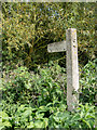
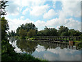
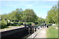
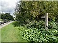
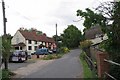
Nearby Images from Geograph Britain and Ireland:
©2015(licence)
©2006(licence)
©2013(licence)
©2015(licence)
©2020(licence)
The above images may not be of the site on this page, they are loaded from Geograph.
Please Submit an Image of this site or go out and take one for us!
Click here to see more info for this site
Nearby sites
Key: Red: member's photo, Blue: 3rd party photo, Yellow: other image, Green: no photo - please go there and take one, Grey: site destroyed
Download sites to:
KML (Google Earth)
GPX (GPS waypoints)
CSV (Garmin/Navman)
CSV (Excel)
To unlock full downloads you need to sign up as a Contributory Member. Otherwise downloads are limited to 50 sites.
Turn off the page maps and other distractions
Nearby sites listing. In the following links * = Image available
3.4km N 356° Glasscock Stone* Natural Stone / Erratic / Other Natural Feature (TL4894821169)
4.7km ENE 58° Hatfield Forest* Ancient Village or Settlement (TL532204)
5.2km ENE 69° Hatfield Forest Puddingstones* Natural Stone / Erratic / Other Natural Feature (TL541198)
5.2km NNE 17° Birchanger* Early Christian Sculptured Stone (TL507228)
6.8km SSW 194° Harlow Barrow* Round Barrow(s) (TL478112)
6.8km SSW 195° Harlow Cursus Cursus (TL477112)
6.8km SSW 194° Matching Cursus Cursus (TL47791113)
7.6km ENE 65° Stansted Airport Stone* Natural Stone / Erratic / Other Natural Feature (TL561212)
8.0km WNW 299° Caley Wood Misc. Earthwork (TL422215)
9.7km S 170° Magdalen Laver Puddingstone* Marker Stone (TL513083)
9.7km SSE 161° High Laver Puddingstone* Natural Stone / Erratic / Other Natural Feature (TL527087)
9.8km NNE 20° Ugley Green Puddingstone* Natural Stone / Erratic / Other Natural Feature (TL5242327126)
10.9km SW 218° Harlow Puddingstone* Natural Stone / Erratic / Other Natural Feature (TL428090)
11.3km WNW 296° Standon Puddingstone* Standing Stone (Menhir) (TL390224)
11.4km S 187° Canes Puddingstone Marker Stone (TL483064)
11.7km SE 135° Beauchamp Roding Puddingstone* Marker Stone (TL578098)
12.3km SSW 193° Thornwood Puddingstone Marker Stone (TL468058)
13.0km W 281° Lunardi Stone* Natural Stone / Erratic / Other Natural Feature (TL364198)
13.2km WSW 248° Emma's Well* Holy Well or Sacred Spring (TL372125)
13.6km NE 53° Tilty Puddingstone* Natural Stone / Erratic / Other Natural Feature (TL599264)
14.2km NNW 337° Brent Pelham* Natural Stone / Erratic / Other Natural Feature (TL433307)
14.3km N 353° Clavering Castle* Misc. Earthwork (TL471319)
14.9km NNE 17° Widdington Puddingstone* Natural Stone / Erratic / Other Natural Feature (TL532322)
15.0km WSW 255° Chadwell Spring* Holy Well or Sacred Spring (TL349136)
15.3km SSW 199° Epping Bury puddingstone* Marker Stone (TL44790322)
View more nearby sites and additional images


 We would like to know more about this location. Please feel free to add a brief description and any relevant information in your own language.
 Wir möchten mehr über diese Stätte erfahren. Bitte zögern Sie nicht, eine kurze Beschreibung und relevante Informationen in Deutsch hinzuzufügen.
 Nous aimerions en savoir encore un peu sur les lieux. S'il vous plaît n'hesitez pas à ajouter une courte description et tous les renseignements pertinents dans votre propre langue.
 Quisieramos informarnos un poco más de las lugares. No dude en añadir una breve descripción y otros datos relevantes en su propio idioma.