

<< Our Photo Pages >> Emma's Well - Holy Well or Sacred Spring in England in Hertfordshire
Submitted by thorgrim on Saturday, 06 May 2006 Page Views: 18689
Springs and Holy WellsSite Name: Emma's WellCountry: England County: Hertfordshire Type: Holy Well or Sacred Spring
Nearest Town: Ware Nearest Village: Amwell
Map Ref: TL372125
Latitude: 51.794331N Longitude: 0.011945W
Condition:
| 5 | Perfect |
| 4 | Almost Perfect |
| 3 | Reasonable but with some damage |
| 2 | Ruined but still recognisable as an ancient site |
| 1 | Pretty much destroyed, possibly visible as crop marks |
| 0 | No data. |
| -1 | Completely destroyed |
| 5 | Superb |
| 4 | Good |
| 3 | Ordinary |
| 2 | Not Good |
| 1 | Awful |
| 0 | No data. |
| 5 | Can be driven to, probably with disabled access |
| 4 | Short walk on a footpath |
| 3 | Requiring a bit more of a walk |
| 2 | A long walk |
| 1 | In the middle of nowhere, a nightmare to find |
| 0 | No data. |
| 5 | co-ordinates taken by GPS or official recorded co-ordinates |
| 4 | co-ordinates scaled from a detailed map |
| 3 | co-ordinates scaled from a bad map |
| 2 | co-ordinates of the nearest village |
| 1 | co-ordinates of the nearest town |
| 0 | no data |
Internal Links:
External Links:
I have visited· I would like to visit
Maisie would like to visit
")
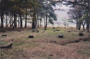
Emma's Well gave its name to the village of Amwell which was known as Emmeuuelle in the Domesday Book of 1086. It is close by the New River.
You may be viewing yesterday's version of this page. To see the most up to date information please register for a free account.
")
")
Do not use the above information on other web sites or publications without permission of the contributor.
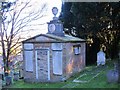
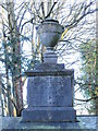
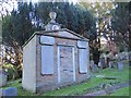
Nearby Images from Geograph Britain and Ireland:
©2015(licence)
©2015(licence)
©2015(licence)
©2015(licence)
©2015(licence)
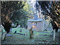
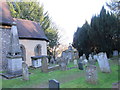
The above images may not be of the site on this page, they are loaded from Geograph.
Please Submit an Image of this site or go out and take one for us!
Click here to see more info for this site
Nearby sites
Key: Red: member's photo, Blue: 3rd party photo, Yellow: other image, Green: no photo - please go there and take one, Grey: site destroyed
Download sites to:
KML (Google Earth)
GPX (GPS waypoints)
CSV (Garmin/Navman)
CSV (Excel)
To unlock full downloads you need to sign up as a Contributory Member. Otherwise downloads are limited to 50 sites.
Turn off the page maps and other distractions
Nearby sites listing. In the following links * = Image available
2.5km WNW 297° Chadwell Spring* Holy Well or Sacred Spring (TL349136)
6.6km ESE 124° Harlow Puddingstone* Natural Stone / Erratic / Other Natural Feature (TL428090)
7.3km N 355° Lunardi Stone* Natural Stone / Erratic / Other Natural Feature (TL364198)
9.1km SSE 164° Galley Hill Puddingstone Marker Stone (TL400038)
9.4km SSW 198° Flamstead Puddingstone Marker Stone (TL346035)
9.6km S 173° Holyfield Puddingstone* Marker Stone (TL38670303)
9.7km S 174° Monkham Puddingstone Marker Stone (TL384029)
10.0km SSE 150° Parvills Puddingstone* Marker Stone (TL424039)
10.1km NNE 12° Standon Puddingstone* Standing Stone (Menhir) (TL390224)
10.3km NNE 31° Caley Wood Misc. Earthwork (TL422215)
10.5km E 99° Harlow Cursus Cursus (TL477112)
10.6km E 99° Matching Cursus Cursus (TL47791113)
10.6km E 99° Harlow Barrow* Round Barrow(s) (TL478112)
11.7km SE 127° Thornwood Puddingstone Marker Stone (TL468058)
12.0km SE 142° Epping Bury puddingstone* Marker Stone (TL44790322)
12.1km SSE 156° Upshire Stone* Natural Stone / Erratic / Other Natural Feature (TL424016)
12.2km WNW 293° Perry's Grove Boundary Ditch* Misc. Earthwork (TL25851700)
12.3km WSW 243° Wildhill Puddingstone Natural Stone / Erratic / Other Natural Feature (TL263067)
12.6km ESE 120° Canes Puddingstone Marker Stone (TL483064)
13.2km ENE 68° Wallbury Camp* Hillfort (TL493178)
13.5km W 260° Mill Green Museum Museum (TL240097)
13.6km SW 229° Griffin's Hole* Holy Well or Sacred Spring (TL2720403249)
13.8km SSE 153° Ambresbury Banks* Hillfort (TL438004)
14.2km WNW 286° Welwyn Roman Baths* Ancient Village or Settlement (TL23451602)
14.5km SSE 166° High Beach* Artificial Mound (TQ410985)
View more nearby sites and additional images


 We would like to know more about this location. Please feel free to add a brief description and any relevant information in your own language.
 Wir möchten mehr über diese Stätte erfahren. Bitte zögern Sie nicht, eine kurze Beschreibung und relevante Informationen in Deutsch hinzuzufügen.
 Nous aimerions en savoir encore un peu sur les lieux. S'il vous plaît n'hesitez pas à ajouter une courte description et tous les renseignements pertinents dans votre propre langue.
 Quisieramos informarnos un poco más de las lugares. No dude en añadir una breve descripción y otros datos relevantes en su propio idioma.