

<< Our Photo Pages >> Teotenango - Ancient Temple in Mexico in Estado de Mexico
Submitted by AlexHunger on Tuesday, 17 April 2007 Page Views: 7540
Multi-periodSite Name: TeotenangoCountry: Mexico
NOTE: This site is 27.603 km away from the location you searched for.
Region: Estado de Mexico Type: Ancient Temple
Nearest Town: Mexico City Nearest Village: Toluca
Latitude: 19.108105N Longitude: 99.596173W
Condition:
| 5 | Perfect |
| 4 | Almost Perfect |
| 3 | Reasonable but with some damage |
| 2 | Ruined but still recognisable as an ancient site |
| 1 | Pretty much destroyed, possibly visible as crop marks |
| 0 | No data. |
| -1 | Completely destroyed |
| 5 | Superb |
| 4 | Good |
| 3 | Ordinary |
| 2 | Not Good |
| 1 | Awful |
| 0 | No data. |
| 5 | Can be driven to, probably with disabled access |
| 4 | Short walk on a footpath |
| 3 | Requiring a bit more of a walk |
| 2 | A long walk |
| 1 | In the middle of nowhere, a nightmare to find |
| 0 | No data. |
| 5 | co-ordinates taken by GPS or official recorded co-ordinates |
| 4 | co-ordinates scaled from a detailed map |
| 3 | co-ordinates scaled from a bad map |
| 2 | co-ordinates of the nearest village |
| 1 | co-ordinates of the nearest town |
| 0 | no data |
Internal Links:
External Links:
I have visited· I would like to visit
DrewParsons would like to visit
")
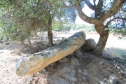
The site was started by the Matlazinca tribe and was then conquered by the Aztecs. It has a Pyramid of Quetzalcoatl, a Pyramid of Tloltec as well as a temple of the sun. It was a ceremonial center for Malinalco and Calixtlahuaca, covering some 21 square Kilometres. There is supposed to be a museum at the site.
You may be viewing yesterday's version of this page. To see the most up to date information please register for a free account.
")
")
")
")
")
")
Do not use the above information on other web sites or publications without permission of the contributor.
Click here to see more info for this site
Nearby sites
Click here to view sites on an interactive map of the areaKey: Red: member's photo, Blue: 3rd party photo, Yellow: other image, Green: no photo - please go there and take one, Grey: site destroyed
Download sites to:
KML (Google Earth)
GPX (GPS waypoints)
CSV (Garmin/Navman)
CSV (Excel)
To unlock full downloads you need to sign up as a Contributory Member. Otherwise downloads are limited to 50 sites.
Turn off the page maps and other distractions
Nearby sites listing. In the following links * = Image available
17.0km W 269° Nevado de Toluca Natural Stone / Erratic / Other Natural Feature
44.0km ESE 117° Cuernavaca - Piramide de Teopanzolco* Pyramid / Mastaba
46.3km SE 137° Xochicalco* Ancient Village or Settlement
48.6km ENE 64° Cuicuilco* Pyramid / Mastaba
49.3km ENE 66° Tlalpan Ancient Village or Settlement
53.4km ESE 103° Tepoztlan* Ancient Village or Settlement
55.7km NE 50° Museo Nacional de Antropología* Museum
60.8km NE 53° Tenochtitlan - Templo Mayor* Ancient Temple
61.4km NE 52° Tlatelolco* Ancient Village or Settlement
65.1km NE 44° Tenayuca* Pyramid / Mastaba
66.4km NE 42° Acatitlan* Ancient Temple
84.6km SSE 166° Xihuatoxtla Cave or Rock Shelter
92.4km ENE 62° Texcotzingo* Ancient Palace
99.2km ESE 119° Chalcatzingo* Rock Art
100.9km NNW 344° Huamango Ancient Village or Settlement
101.1km NE 50° Teotihuacan - Tetitla Ancient Village or Settlement
101.2km NE 51° Teotihuacan - Temple of Quetzalcoatl* Pyramid / Mastaba
101.4km NE 50° Teotihuacan - Atelelco* Ancient Palace
102.0km NE 50° Teotihuacan* Ancient Village or Settlement
102.2km NE 50° Teotihuacan - Pyramid of the Sun* Pyramid / Mastaba
102.7km NE 50° Teotihuacan - Pyramid of the Moon* Pyramid / Mastaba
110.0km NNE 14° Tula.* Ancient Village or Settlement
131.8km E 83° Xochitecatl* Pyramid / Mastaba
132.3km E 83° Cacaxtla* Ancient Village or Settlement
134.3km NE 54° Tepeapulco Pyramid* Pyramid / Mastaba
View more nearby sites and additional images


 We would like to know more about this location. Please feel free to add a brief description and any relevant information in your own language.
 Wir möchten mehr über diese Stätte erfahren. Bitte zögern Sie nicht, eine kurze Beschreibung und relevante Informationen in Deutsch hinzuzufügen.
 Nous aimerions en savoir encore un peu sur les lieux. S'il vous plaît n'hesitez pas à ajouter une courte description et tous les renseignements pertinents dans votre propre langue.
 Quisieramos informarnos un poco más de las lugares. No dude en añadir una breve descripción y otros datos relevantes en su propio idioma.