

<< Our Photo Pages >> Texcotzingo - Ancient Palace in Mexico
Submitted by AlexHunger on Friday, 04 December 2020 Page Views: 15348
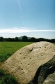
Multi-periodSite Name: Texcotzingo Alternative Name: Tetzcozingo, Molino de Flores ParcCountry: Mexico Type: Ancient Palace
Nearest Town: Mexico City Nearest Village: Texcoco de Mora
Latitude: 19.497450N Longitude: 98.8182W
Condition:
| 5 | Perfect |
| 4 | Almost Perfect |
| 3 | Reasonable but with some damage |
| 2 | Ruined but still recognisable as an ancient site |
| 1 | Pretty much destroyed, possibly visible as crop marks |
| 0 | No data. |
| -1 | Completely destroyed |
| 5 | Superb |
| 4 | Good |
| 3 | Ordinary |
| 2 | Not Good |
| 1 | Awful |
| 0 | No data. |
| 5 | Can be driven to, probably with disabled access |
| 4 | Short walk on a footpath |
| 3 | Requiring a bit more of a walk |
| 2 | A long walk |
| 1 | In the middle of nowhere, a nightmare to find |
| 0 | No data. |
| 5 | co-ordinates taken by GPS or official recorded co-ordinates |
| 4 | co-ordinates scaled from a detailed map |
| 3 | co-ordinates scaled from a bad map |
| 2 | co-ordinates of the nearest village |
| 1 | co-ordinates of the nearest town |
| 0 | no data |
Internal Links:
External Links:
")
Designed in the 15th century, the palace and grounds are interpreted as both a symbol of imperial power and a pleasure centre for the aristocracy. The nearby city of Texcoco was the second only to the capital, Tenochtitlan, in both population and importance at the time of the Spanish conquest.
Note: Aztec Maps Put Cortés to Shame. See comment.
You may be viewing yesterday's version of this page. To see the most up to date information please register for a free account.
")
")
")
")
")
")
")
")
")
")
Do not use the above information on other web sites or publications without permission of the contributor.
Click here to see more info for this site
Nearby sites
Click here to view sites on an interactive map of the areaKey: Red: member's photo, Blue: 3rd party photo, Yellow: other image, Green: no photo - please go there and take one, Grey: site destroyed
Download sites to:
KML (Google Earth)
GPX (GPS waypoints)
CSV (Garmin/Navman)
CSV (Excel)
To unlock full downloads you need to sign up as a Contributory Member. Otherwise downloads are limited to 50 sites.
Turn off the page maps and other distractions
Nearby sites listing. In the following links * = Image available
20.7km N 352° Teotihuacan - Temple of Quetzalcoatl* Pyramid / Mastaba
21.6km N 350° Teotihuacan - Tetitla Ancient Village or Settlement
21.8km N 353° Teotihuacan - Pyramid of the Sun* Pyramid / Mastaba
21.9km N 350° Teotihuacan - Atelelco* Ancient Palace
21.9km N 352° Teotihuacan* Ancient Village or Settlement
22.6km N 353° Teotihuacan - Pyramid of the Moon* Pyramid / Mastaba
33.6km WSW 258° Tenochtitlan - Templo Mayor* Ancient Temple
33.9km W 261° Tlatelolco* Ancient Village or Settlement
36.9km W 276° Tenayuca* Pyramid / Mastaba
37.7km W 279° Acatitlan* Ancient Temple
39.4km WSW 259° Museo Nacional de Antropología* Museum
43.4km WSW 238° Tlalpan Ancient Village or Settlement
43.8km WSW 240° Cuicuilco* Pyramid / Mastaba
44.6km NE 38° Tepeapulco Pyramid* Pyramid / Mastaba
56.6km ESE 120° Xochitecatl* Pyramid / Mastaba
57.1km ESE 119° Cacaxtla* Ancient Village or Settlement
62.7km SSW 208° Tepoztlan* Ancient Village or Settlement
72.9km SE 132° Cholula* Pyramid / Mastaba
76.0km SW 214° Cuernavaca - Piramide de Teopanzolco* Pyramid / Mastaba
83.4km NW 319° Tula.* Ancient Village or Settlement
83.8km NE 35° Huapalcalco Pyramid Pyramid / Mastaba
91.3km S 177° Chalcatzingo* Rock Art
92.1km SSW 213° Xochicalco* Ancient Village or Settlement
92.4km WSW 242° Teotenango* Ancient Temple
107.8km WSW 246° Nevado de Toluca Natural Stone / Erratic / Other Natural Feature
View more nearby sites and additional images


 We would like to know more about this location. Please feel free to add a brief description and any relevant information in your own language.
 Wir möchten mehr über diese Stätte erfahren. Bitte zögern Sie nicht, eine kurze Beschreibung und relevante Informationen in Deutsch hinzuzufügen.
 Nous aimerions en savoir encore un peu sur les lieux. S'il vous plaît n'hesitez pas à ajouter une courte description et tous les renseignements pertinents dans votre propre langue.
 Quisieramos informarnos un poco más de las lugares. No dude en añadir una breve descripción y otros datos relevantes en su propio idioma.