Featured: How and why the ancients enchanted Great Britain and Brittany

How and why the ancients enchanted Great Britain and Brittany

Megaliths by David Corio

Megaliths by David Corio

Who's Online

There are currently, 206 guests and 3 members online.

You are a guest. To join in, please register for free by clicking here

Sponsors

<< Our Photo Pages >> Poverty Point - Mound A - Artificial Mound in United States in The South

Submitted by bat400 on Tuesday, 29 January 2013  Page Views: 10030

Pre-ColumbianSite Name: Poverty Point - Mound A
Country: United States Region: The South Type: Artificial Mound
Nearest Town: Vicksburg, MS  Nearest Village: Epps, Louisiana
Latitude: 32.635300N  Longitude: 91.4108W
Condition:
5Perfect
4Almost Perfect
3Reasonable but with some damage
2Ruined but still recognisable as an ancient site
1Pretty much destroyed, possibly visible as crop marks
0No data.
-1Completely destroyed
2 Ambience:
5Superb
4Good
3Ordinary
2Not Good
1Awful
0No data.
3 Access:
5Can be driven to, probably with disabled access
4Short walk on a footpath
3Requiring a bit more of a walk
2A long walk
1In the middle of nowhere, a nightmare to find
0No data.
4 Accuracy:
5co-ordinates taken by GPS or official recorded co-ordinates
4co-ordinates scaled from a detailed map
3co-ordinates scaled from a bad map
2co-ordinates of the nearest village
1co-ordinates of the nearest town
0no data
4

Internal Links:
External Links:

Poverty Point - Mound A
Poverty Point - Mound A submitted by bat400 : Mound A seen from the south east. The 'tail' of the bird is to the right. The highest point is across the wing span, on the 'bird's' back. There is a boardwalk that allows you to walk up onto the mound. Photo by bat400, October 2011. (Vote or comment on this photo)
Effigy Mound in West Carroll County, Louisiana.
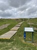
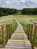
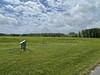
Mound A is the largest mound at Poverty Point and it's been suggested that the mound was intentionally shaped like a flying bird. The Poverty Point earthworks are among the very oldest in North America, but Mound A construction occured at the end of construction of other earthworks at the site. It is the largest of the mounds and was built in one season and dated to ~1250 BC. At that time, it would have been the largest earthwork in the western hemisphere.

It is 70 feet high, 640 feet along the "wing" and 710 feet from head to tail. The "head" of the bird was badly damaged by "treasure" hunters in the early 1900's before the site was under protection. For many years trees had been allowed to grow on the mound, but these have recently been removed as the fully grown trees were starting to fall naturally and damage the structure as they were uprooted. (In 2011 this gave the mound a "skinned" appearance which will improve as grasses grow more thickly on the surface.)

Information Sources:
* Poverty Point - A terminal Archaic Culture of the Lower Mississippi Valley, Jon L. Gibson, 1996.
* Northeast Louisiana Mound Trail guide.

Note: Publication of findings from last major excavations. Dates and estimates of construction man-hours. See comments.
You may be viewing yesterday's version of this page. To see the most up to date information please register for a free account.


Poverty Point - Mound A
Poverty Point - Mound A submitted by AKFisher : The massive "Bird Effigy Mound" at Poverty Point, Louisiana, constructed 1800 BC -- 1200 BC. This mound is 72-ft tall and is 710-ft long. The width or wingspan of the effigy is 640 feet. The school children on it give an idea how large it is. Photo courtesy Dr Greg Little, author of the Illustrated Encyclopedia of Native American Indian Mounds & Earthworks (2016).  (Vote or comment on this photo)

Poverty Point - Mound A
Poverty Point - Mound A submitted by durhamnature : Diagram from archive.org (Vote or comment on this photo)

Do not use the above information on other web sites or publications without permission of the contributor.

Nearby Images from Flickr
Poverty Point
Poverty Point
Poverty Point
Poverty Point
Poverty Point
Poverty Point

The above images may not be of the site on this page, but were taken nearby. They are loaded from Flickr so please click on them for image credits.


Click here to see more info for this site

Nearby sites

Click here to view sites on an interactive map of the area

Key: Red: member's photo, Blue: 3rd party photo, Yellow: other image, Green: no photo - please go there and take one, Grey: site destroyed

Download sites to:
KML (Google Earth)
GPX (GPS waypoints)
CSV (Garmin/Navman)
CSV (Excel)

To unlock full downloads you need to sign up as a Contributory Member. Otherwise downloads are limited to 50 sites.


Turn off the page maps and other distractions

Nearby sites listing. In the following links * = Image available
 550m E 79° Poverty Point - Earthworks* Ancient Village or Settlement
 550m E 81° Poverty Point* Ancient Village or Settlement
 2.8km S 180° Lower Jackson* Artificial Mound
 8.1km N 9° Mott Archaeological Preserve Artificial Mound
 18.3km SSW 204° Marsden Mounds* Artificial Mound
 19.1km ENE 72° Julice Mound Artificial Mound
 20.4km ENE 74° Transylvania Mound* Artificial Mound
 22.9km S 170° Tendal Mound* Artificial Mound
 28.3km SSW 193° Insley Mounds* Artificial Mound
 33.2km SE 142° Schicker Mound Artificial Mound
 33.9km W 268° Jordan Mounds Site Artificial Mound
 41.5km NNE 17° Galloway Place Mound Artificial Mound
 45.1km NW 311° Venable Mound Artificial Mound
 46.1km NW 313° Caney Bayou Mound Artificial Mound
 46.7km SE 138° Fitzhugh Mounds* Artificial Mound
 48.6km ENE 67° Cary Mounds* Artificial Mound
 53.8km E 90° Aden Mounds* Artificial Mound
 54.8km S 169° Shackleford Church Mounds Artificial Mound
 57.0km NE 46° Grace Mounds Artificial Mound
 57.6km ENE 60° Rolling Fork Mounds* Artificial Mound
 58.2km SSE 164° Balmoral Mounds* Artificial Mound
 58.2km ESE 116° Kings Crossing Mounds* Artificial Mound
 60.4km ESE 102° Haynes Bluff Mounds* Artificial Mound
 60.4km S 184° Ghost Site Mounds Artificial Mound
 61.1km NE 56° Mont Helena* Artificial Mound
View more nearby sites and additional images

<< Kilkenneth Cairn

Tafi del Valle >>

Please add your thoughts on this site

Understanding the Neolithic

Understanding the Neolithic

Sponsors

Auto-Translation (Google)

Translate from English into:

"Poverty Point - Mound A" | Login/Create an Account | 3 News and Comments
  
Go back to top of page    Comments are owned by the poster. We aren't responsible for their content.
Mound A, Poverty Point: Mounuments - Implications for HunterGatherer Complexity by bat400 on Tuesday, 29 January 2013
(User Info | Send a Message)
Tristam Kidder, the speaker descibed in the previous comment's report, and Anthony Ortmann have had their paper on the construction of Poverty Point's massive "Mound A" published at Geoarchaeology, Vol 28, Iss 1., published online: 7 DEC 2012.

"Building Mound A at Poverty Point, Louisiana: Mounumental Public Architecture, Ritual Practice, and Implications for Hunter Gatherer Complexity"

Abstract:Hunter-gatherer societies are often characterized by limited complexity and social equality. Therefore, the construction of monumental architecture by hunter-gatherers is seen as the manifestation of social and political inequality. The massive size and rapid construction of Mound A at Poverty Point (ca. 3261 cal. yr B.P.) in northeast Louisiana challenges these notions. Geoarchaeological investigations of stratigraphy at the macro- and micro-levels shows there are no erosion events, natural episodes of soil formation, or cultural stages. We infer from these results that Mound A was constructed by a large labor force over a short period of time. There is no evidence, however, that the mound was constructed under the aegis of a ranked socio-political system. We argue instead that the mound was constructed as a ritual feature and that leadership required to mobilize labor and resources was situational and emerged through ritual practice that developed because of the need to integrate a large population.

Comment by bat400: This timescale for the building of Mound A, and its timing at or toward the end of other building projects at Poverty Point, would imply that Hunter Gathers could be mobilized for short lived, large scale building projects, but without an authoritarian leadership. In turn, this would support mound building for this culture was a ritual (possibly an act of worship) in and of itself, without a specific purpose for the completed structure.
[ Reply to This ]
    Similarities of Poverty Point, Hopewell Earthworks by bat400 on Tuesday, 29 January 2013
    (User Info | Send a Message)
    The Poverty Point earthworks could be confused for an Ohio Hopewell site, except for two facts: It is located in Louisiana, and it’s more than 1,000 years older than any Hopewell mound.

    One of the biggest puzzles in North American archaeology is how relatively small bands of hunter-gatherers living at that time built monumental architecture on this scale without food surpluses provided by farming or centralized leadership.

    One theory is that many small groups of hunter-gatherers came together on a seasonal basis year after year for generations to slowly construct this complex of parallel embankments and mounds.
    However, the results of new excavations into the largest of Poverty Point’s mounds refute this theory.

    Mound A is a massive mound about 72 feet tall with a broad, roughly rectangular platform extending off its eastern side. Anthony Ortmann (Murray State University, Kentucky) and Tristram Kidder (Washington University, St. Louis) excavated a 32-foot-deep trench into Mound A.
    Ortmann and Kidder carefully examined the mound and found no evidence of any interruptions in its construction. They estimate that the entire mound was built in three months.

    This, of course, implies that a large number of hunter-gatherers were mobilized to undertake this massive public works project. Ortmann and Kidder conclude that “whatever the structure of Poverty Point society, it is unlike anything documented in the historic or contemporary hunter-gatherer ethnographic record.”

    The conundrum of Poverty Point also is at the heart of our attempts to understand the achievements of the Ohio Hopewell culture. The Hopewell were mainly hunter-gatherers who lived in small groups that had no authoritarian political leaders.
    And although some monumental Hopewell earthworks [Fort Ancient] were constructed in stages over centuries, I believe that the sprawling Newark Earthworks was built, as Poverty Point [Mound A] was, in a remarkably brief period.

    Newark encompasses several discrete earthworks that include [gigantic geometric figures.] The site is akin to a ceremonial machine with separate, specialized components that worked together to fulfill a larger purpose.

    Ortmann and Kidder argue that the “absence of any indication of material and social inequality at Poverty Point suggest that ritual practices may have provided the social sanctions that enabled a limited number of people to direct and lead the construction of monumental architecture.” I agree and believe that the same argument could be applied to Newark.

    Poverty Point was unprecedented for its time. The Hopewellian achievement was equally unprecedented for its time.

    For more, see Brad Lepper's column at the Columbus Dispatch.

    [ Reply to This ]

Poverty Point - Louisiana Mound preceded Mississippian Moundbuilders by 2000 years by bat400 on Sunday, 17 May 2009
(User Info | Send a Message)
Originally submitted by Andy B (andy@megalithic.co.uk) on Thursday, 14 May 2009 [The talk given by Poverty Point's leading archaeologist took place in Tuscaloosa, Alabama, the location of the Moundville site.]

About 3,300 years ago, a group of archaic period Native Americans living in what is now northeast Louisiana decided to build a great mound.

Ninety days after the project was begun by the Stone Age hunters and gatherers, the T-shaped, earthen mound — 70 feet high, 1,000 feet long in one direction and 700 feet long in the other — was complete.

The site, near modern-day Monroe, La., is known today as “Poverty Point”. On Friday, T. R. Kidder, chair of the anthropology department at Washington University in St. Louis, told the University of Alabama Anthropology Club it is one of the most mysterious sites in the country.

“It is the second-largest earthen mound in all of North America, second only to one in Illinois,” he said. “The paradox is, what was going on here at this time that led to this sudden creation of this great mound?”

Like Moundville, where a large population of Native Americans constructed several mounds about 900 years ago, Poverty Point was one of the larger organized communities of its day, Kidder said in a Friday morning interview.

“It was probably the largest hunter-gatherer community in all of North America, say north of Mexico,” Kidder said. “But that was a very simple time of very little complexity — it was a literally a ‘stone age’ society — but all of a sudden and in literally a month and a half, they have organized themselves and built this great mound.”

Kidder said evidence shows that at the time there were between 1,000 and 2,000 people living in the community where the mound was constructed, “which means that to accomplish what they did in such a short period of time, they had to recruit workers from all over the Southeast.”

“The mound took the equivalent of 31,000 modern dump trucks of dirt to build,” he said. “That’s a lot of work by a lot of people.

“That is another paradox — how did they get all this organized and completed in only 90 days?”

Kidder said the time it took to build the mound was established by archaeological methods that showed no erosion between the layers in the dirt. He said one theory about the location of the mound is that it covers what was a low-lying swamp.
“We know swamps were associated with the underworld and were to be avoided,” he said. “And at the base of the mound is fine silt we believe was put there to seal off that underworld. But there are a lot of swamps and there were a lot of archaic Native Americans who didn’t bother to build mounds.

“Why here, why these people?” he said.

The Native Americans who lived in the area flourished for more than 1,000 years, Kidder said.
“Then, shortly after the mound was built, there was dramatic climate change in the Southeast, with much flooding, which drove the hunters and gatherers who had been there so long away for good,” Kidder said. “All that was left was the mound.”

For more, see: TuscaloosaNews.com.
[ Reply to This ]

Your Name: Anonymous [ Register Now ]
Subject:


Add your comment or contribution to this page. Spam or offensive posts are deleted immediately, don't even bother

<<< What is five plus one as a number? (Please type the answer to this question in the little box on the left)
You can also embed videos and other things. For Youtube please copy and paste the 'embed code'.
For Google Street View please include Street View in the text.
Create a web link like this: <a href="https://www.megalithic.co.uk">This is a link</a>  

Allowed HTML is:
<p> <b> <i> <a> <img> <em> <br> <strong> <blockquote> <tt> <li> <ol> <ul> <object> <param> <embed> <iframe>

We would like to know more about this location. Please feel free to add a brief description and any relevant information in your own language.
Wir möchten mehr über diese Stätte erfahren. Bitte zögern Sie nicht, eine kurze Beschreibung und relevante Informationen in Deutsch hinzuzufügen.
Nous aimerions en savoir encore un peu sur les lieux. S'il vous plaît n'hesitez pas à ajouter une courte description et tous les renseignements pertinents dans votre propre langue.
Quisieramos informarnos un poco más de las lugares. No dude en añadir una breve descripción y otros datos relevantes en su propio idioma.