


<< Our Photo Pages >> Dringeen Oughter - Standing Stone (Menhir) in Ireland (Republic of) in Co. Mayo
Submitted by bernard-yves on Friday, 12 May 2006 Page Views: 4225
Neolithic and Bronze AgeSite Name: Dringeen OughterCountry: Ireland (Republic of)
NOTE: This site is 4.598 km away from the location you searched for.
County: Co. Mayo Type: Standing Stone (Menhir)
Nearest Town: Cong
Latitude: 53.557958N Longitude: 9.310846W
Condition:
| 5 | Perfect |
| 4 | Almost Perfect |
| 3 | Reasonable but with some damage |
| 2 | Ruined but still recognisable as an ancient site |
| 1 | Pretty much destroyed, possibly visible as crop marks |
| 0 | No data. |
| -1 | Completely destroyed |
| 5 | Superb |
| 4 | Good |
| 3 | Ordinary |
| 2 | Not Good |
| 1 | Awful |
| 0 | No data. |
| 5 | Can be driven to, probably with disabled access |
| 4 | Short walk on a footpath |
| 3 | Requiring a bit more of a walk |
| 2 | A long walk |
| 1 | In the middle of nowhere, a nightmare to find |
| 0 | No data. |
| 5 | co-ordinates taken by GPS or official recorded co-ordinates |
| 4 | co-ordinates scaled from a detailed map |
| 3 | co-ordinates scaled from a bad map |
| 2 | co-ordinates of the nearest village |
| 1 | co-ordinates of the nearest town |
| 0 | no data |
Internal Links:
External Links:
")
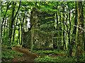
A 1.7 metre tall standing stone.
You may be viewing yesterday's version of this page. To see the most up to date information please register for a free account.
Do not use the above information on other web sites or publications without permission of the contributor.
davidmorgan has found this location on Google Street View:
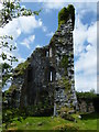
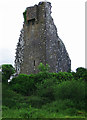
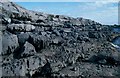
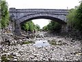
Nearby Images from Geograph Britain and Ireland:
©2011(licence)
©2020(licence)
©2006(licence)
©2006(licence)
©2020(licence)
The above images may not be of the site on this page, they are loaded from Geograph.
Please Submit an Image of this site or go out and take one for us!
Click here to see more info for this site
Nearby sites
Click here to view sites on an interactive map of the areaKey: Red: member's photo, Blue: 3rd party photo, Yellow: other image, Green: no photo - please go there and take one, Grey: site destroyed
Download sites to:
KML (Google Earth)
GPX (GPS waypoints)
CSV (Garmin/Navman)
CSV (Excel)
To unlock full downloads you need to sign up as a Contributory Member. Otherwise downloads are limited to 50 sites.
Turn off the page maps and other distractions
Nearby sites listing. In the following links * = Image available
2.9km ESE 111° Cong Stones* Standing Stones
3.3km ESE 110° Cong West* Stone Circle
3.3km ESE 110° Cong Stone Circles Stone Circle
3.3km ESE 108° Cong North* Stone Circle
3.3km ESE 111° Cong South* Stone Circle
3.4km SSE 149° Cong.* Rock Art (M149543)
3.4km ESE 109° Cong East* Stone Circle
4.3km N 354° Inishowen Stone Circle (M128615)
5.3km ENE 77° Neale Stone* Standing Stone (Menhir)
7.8km S 183° The Inchagoill Stone Early Christian Sculptured Stone (M126494)
12.8km E 84° Cregduff* Henge
15.0km ENE 58° Carrowreagh* Stone Circle (M2665)
16.7km SSE 166° Ardcorkey Stone Circle (M1741)
21.6km W 261° Maumgawnagh* Standing Stone (Menhir)
22.9km W 264° Knockanbaun* Standing Stones
23.3km W 263° Maumgawnagh Barrow Round Barrow(s) (L899549)
24.5km W 264° Poundcarton Stone Row / Alignment (L887553)
26.4km W 276° Leenaun Tomb Burial Chamber or Dolmen
26.5km NW 323° Boheh* Rock Art (L97517866)
27.7km NNE 13° Belcarra Standing Stone* Standing Stone (Menhir)
28.7km W 274° Glencraff Tomb Burial Chamber or Dolmen
29.1km WSW 259° Lough Inagh Crannog
29.7km W 273° Glencraff Stone Standing Stone (Menhir)
29.7km W 273° Glencraff Dun Stone Fort or Dun
29.9km NNW 332° Sandy Hill Mound* Misc. Earthwork
View more nearby sites and additional images


 We would like to know more about this location. Please feel free to add a brief description and any relevant information in your own language.
 Wir möchten mehr über diese Stätte erfahren. Bitte zögern Sie nicht, eine kurze Beschreibung und relevante Informationen in Deutsch hinzuzufügen.
 Nous aimerions en savoir encore un peu sur les lieux. S'il vous plaît n'hesitez pas à ajouter une courte description et tous les renseignements pertinents dans votre propre langue.
 Quisieramos informarnos un poco más de las lugares. No dude en añadir una breve descripción y otros datos relevantes en su propio idioma.