

<< Our Photo Pages >> Cathair Crobh Dearg - Stone Fort or Dun in Ireland (Republic of) in Co. Kerry
Submitted by Klingon on Sunday, 10 April 2005 Page Views: 10533
Multi-periodSite Name: Cathair Crobh Dearg Alternative Name: The CityCountry: Ireland (Republic of)
NOTE: This site is 2.817 km away from the location you searched for.
County: Co. Kerry Type: Stone Fort or Dun
Nearest Town: Rathmore Nearest Village: Gortnagane
Map Ref: W1386388309
Latitude: 52.040588N Longitude: 9.256058W
Condition:
| 5 | Perfect |
| 4 | Almost Perfect |
| 3 | Reasonable but with some damage |
| 2 | Ruined but still recognisable as an ancient site |
| 1 | Pretty much destroyed, possibly visible as crop marks |
| 0 | No data. |
| -1 | Completely destroyed |
| 5 | Superb |
| 4 | Good |
| 3 | Ordinary |
| 2 | Not Good |
| 1 | Awful |
| 0 | No data. |
| 5 | Can be driven to, probably with disabled access |
| 4 | Short walk on a footpath |
| 3 | Requiring a bit more of a walk |
| 2 | A long walk |
| 1 | In the middle of nowhere, a nightmare to find |
| 0 | No data. |
| 5 | co-ordinates taken by GPS or official recorded co-ordinates |
| 4 | co-ordinates scaled from a detailed map |
| 3 | co-ordinates scaled from a bad map |
| 2 | co-ordinates of the nearest village |
| 1 | co-ordinates of the nearest town |
| 0 | no data |
Internal Links:
External Links:
I have visited· I would like to visit
Runemage would like to visit
Klingon visited on 30th Mar 2005 - their rating: Cond: 3 Amb: 4 Access: 4
")
You may be viewing yesterday's version of this page. To see the most up to date information please register for a free account.
")
")
")
Do not use the above information on other web sites or publications without permission of the contributor.
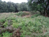
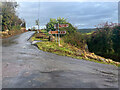
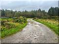
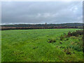
Nearby Images from Geograph Britain and Ireland:
©2023(licence)
©2023(licence)
©2023(licence)
©2023(licence)
©2023(licence)
The above images may not be of the site on this page, they are loaded from Geograph.
Please Submit an Image of this site or go out and take one for us!
Click here to see more info for this site
Nearby sites
Click here to view sites on an interactive map of the areaKey: Red: member's photo, Blue: 3rd party photo, Yellow: other image, Green: no photo - please go there and take one, Grey: site destroyed
Download sites to:
KML (Google Earth)
GPX (GPS waypoints)
CSV (Garmin/Navman)
CSV (Excel)
To unlock full downloads you need to sign up as a Contributory Member. Otherwise downloads are limited to 50 sites.
Turn off the page maps and other distractions
Nearby sites listing. In the following links * = Image available
3.0km E 83° Awnaskirtawn Standing Stone* Standing Stone (Menhir) (W1686788620)
6.4km N 1° Scrahanagullaun Stone Row / Alignment
7.3km E 84° Gortavehy West Standing Stone* Standing Stone (Menhir) (W2119488946)
8.9km E 90° Kippagh Row* Stone Row / Alignment
8.9km SSE 151° Slievereagh standing stone* Standing Stone (Menhir)
9.1km SSE 151° Slievereagh Pair* Standing Stones (W18138028)
10.0km E 90° Kilmeedy W* Stone Circle (W23888814)
10.3km E 89° Unidentified (W242882)* Standing Stone (Menhir) (W2423088228)
10.6km ESE 103° Comeenatrush Lake Log Boat* Ancient Village or Settlement
10.7km E 88° Kilmeedy - eastern stone circle* Stone Circle
11.1km SSE 156° Derrynasaggart Stone Row / Alignment
11.4km SSE 155° Carizban Stone* Standing Stone (Menhir)
11.6km SSE 155° Radharc Na Greme Stones* Stone Row / Alignment
11.8km W 277° Ardaneanig Row* Stone Row / Alignment (W02139003)
12.0km ESE 105° Ballyvouskill circle* Stone Circle (W25418496)
12.2km ESE 104° Ballyvouskill cairn* Cairn
12.7km ESE 111° Caherdowney Wedge Tomb* Wedge Tomb
12.8km SW 229° Derrybanane* Wedge Tomb (W0411580006)
13.1km S 178° Lumnagh More* Stone Circle (W14187523)
13.1km ESE 105° Caherdowney west ringfort (cashel)* Stone Fort or Dun
13.4km ESE 104° Caherdowney Ringfort (cashel)* Stone Fort or Dun
13.6km SSE 155° Gortnatubbrid* Stone Circle (W19337586)
13.6km SE 145° Killeen Inscribed Stone* Ancient Cross (W2145177008)
13.7km SSE 149° Shanacloon* Standing Stones (W2074876475)
13.7km E 95° Cloghboola More circle Stone Circle (W27588691)
View more nearby sites and additional images


 We would like to know more about this location. Please feel free to add a brief description and any relevant information in your own language.
 Wir möchten mehr über diese Stätte erfahren. Bitte zögern Sie nicht, eine kurze Beschreibung und relevante Informationen in Deutsch hinzuzufügen.
 Nous aimerions en savoir encore un peu sur les lieux. S'il vous plaît n'hesitez pas à ajouter une courte description et tous les renseignements pertinents dans votre propre langue.
 Quisieramos informarnos un poco más de las lugares. No dude en añadir una breve descripción y otros datos relevantes en su propio idioma.