


<< Image Pages >> Footprints of Acahualinca Museum - Museum in Nicaragua
Submitted by durhamnature on Friday, 15 February 2013 Page Views: 4556
MuseumsSite Name: Footprints of Acahualinca Museum Alternative Name: Huellas de AcahualincaCountry: Nicaragua
NOTE: This site is 6.656 km away from the location you searched for.
Type: Museum
Nearest Town: Managua
Latitude: 12.136389N Longitude: 86.251389W
Condition:
| 5 | Perfect |
| 4 | Almost Perfect |
| 3 | Reasonable but with some damage |
| 2 | Ruined but still recognisable as an ancient site |
| 1 | Pretty much destroyed, possibly visible as crop marks |
| 0 | No data. |
| -1 | Completely destroyed |
| 5 | Superb |
| 4 | Good |
| 3 | Ordinary |
| 2 | Not Good |
| 1 | Awful |
| 0 | No data. |
| 5 | Can be driven to, probably with disabled access |
| 4 | Short walk on a footpath |
| 3 | Requiring a bit more of a walk |
| 2 | A long walk |
| 1 | In the middle of nowhere, a nightmare to find |
| 0 | No data. |
| 5 | co-ordinates taken by GPS or official recorded co-ordinates |
| 4 | co-ordinates scaled from a detailed map |
| 3 | co-ordinates scaled from a bad map |
| 2 | co-ordinates of the nearest village |
| 1 | co-ordinates of the nearest town |
| 0 | no data |
Internal Links:
External Links:
")
Small, recently modernised museum on the north edge of Managua. The museum has a variety of prehistoric displays, but the main feature are the displays of 6000 year old human footprints found on the shores of Lake Managua.
The museum is open from 8am to 5pm Monday to Friday, and from 9am to 4pm on Saurday and Sunday. The lat-long reference is for the city centre, not the museum.
Website, in English and Spanish, at-
http://www.nicaragua.com/museums/acahualinca-footprints/
You may be viewing yesterday's version of this page. To see the most up to date information please register for a free account.
Do not use the above information on other web sites or publications without permission of the contributor.
Nearby Images from Flickr
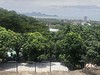
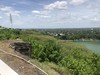
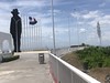

The above images may not be of the site on this page, but were taken nearby. They are loaded from Flickr so please click on them for image credits.
Click here to see more info for this site
Nearby sites
Click here to view sites on an interactive map of the areaKey: Red: member's photo, Blue: 3rd party photo, Yellow: other image, Green: no photo - please go there and take one, Grey: site destroyed
Download sites to:
KML (Google Earth)
GPX (GPS waypoints)
CSV (Garmin/Navman)
CSV (Excel)
To unlock full downloads you need to sign up as a Contributory Member. Otherwise downloads are limited to 50 sites.
Turn off the page maps and other distractions
Nearby sites listing. In the following links * = Image available
nankm 0° Managua Rock Art* Rock Art
24.9km SE 140° Masaya Rock Art* Rock Art
33.6km SSE 152° Pensacola* Sculptured Stone
33.9km NW 314° Momotombito Island* Sculptured Stone
39.7km SE 125° San Francisco Museum (Granada) Museum
53.7km SSE 162° Riachuelo Cave* Rock Art
53.7km SE 127° Jinotepe* Rock Art
57.9km SE 134° Isla El Muerto* Rock Art
63.4km SE 135° Zapatero Island* Sculptured Stone
76.7km WNW 295° Subtiaba* Ancient Village or Settlement
85.4km NNE 13° Chaguitillo* Rock Art
92.7km E 92° Aguas Buenas* Misc. Earthwork
96.6km E 92° Museo Arqueológico Gregorio Aguilar Barea* Museum
104.9km SE 133° Ometepe Indigenous Cemetery* Ancient Village or Settlement
105.9km SE 133° Ometepe* Rock Art
230.1km NNW 343° Unknown Stela Sculptured Stone
234.7km NNE 31° Cueva la Conga Rock Art
286.7km SE 137° Williamsberg Mounds* Artificial Mound
292.8km SE 133° Anita Grande* Artificial Mound
330.9km SE 137° Santa Ana, San José Carving
340.5km SE 136° Parque de la Merced Carving
341.4km SE 136° San José Legislative Assembly Carving
341.5km SE 136° Museo Nacional de Costa Rica Museum
341.8km SE 136° Plaza de la Justicia Carving
341.8km SE 136° San José Supreme Court Carving
View more nearby sites and additional images


 We would like to know more about this location. Please feel free to add a brief description and any relevant information in your own language.
 Wir möchten mehr über diese Stätte erfahren. Bitte zögern Sie nicht, eine kurze Beschreibung und relevante Informationen in Deutsch hinzuzufügen.
 Nous aimerions en savoir encore un peu sur les lieux. S'il vous plaît n'hesitez pas à ajouter une courte description et tous les renseignements pertinents dans votre propre langue.
 Quisieramos informarnos un poco más de las lugares. No dude en añadir una breve descripción y otros datos relevantes en su propio idioma.