

<< Other Photo Pages >> Mound at Fort Toulouse - Fort Jackson Park - Artificial Mound in United States in The South
Submitted by stonetracker on Wednesday, 15 February 2023 Page Views: 588
Multi-periodSite Name: Mound at Fort Toulouse - Fort Jackson Park Alternative Name: Taskigi MoundCountry: United States
NOTE: This site is 55.811 km away from the location you searched for.
Region: The South Type: Artificial Mound
Nearest Town: Wetumpka AL
Latitude: 32.503880N Longitude: 86.2591W
Condition:
| 5 | Perfect |
| 4 | Almost Perfect |
| 3 | Reasonable but with some damage |
| 2 | Ruined but still recognisable as an ancient site |
| 1 | Pretty much destroyed, possibly visible as crop marks |
| 0 | No data. |
| -1 | Completely destroyed |
| 5 | Superb |
| 4 | Good |
| 3 | Ordinary |
| 2 | Not Good |
| 1 | Awful |
| 0 | No data. |
| 5 | Can be driven to, probably with disabled access |
| 4 | Short walk on a footpath |
| 3 | Requiring a bit more of a walk |
| 2 | A long walk |
| 1 | In the middle of nowhere, a nightmare to find |
| 0 | No data. |
| 5 | co-ordinates taken by GPS or official recorded co-ordinates |
| 4 | co-ordinates scaled from a detailed map |
| 3 | co-ordinates scaled from a bad map |
| 2 | co-ordinates of the nearest village |
| 1 | co-ordinates of the nearest town |
| 0 | no data |
Be the first person to rate this site - see the 'Contribute!' box in the right hand menu.
Internal Links:
External Links:
I have visited· I would like to visit
stonetracker would like to visit
")
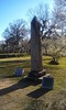
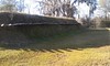
This site sits at a strategic location where the Coosa and Tallapoosa Rivers join to form the Alabama River. It is one of the longest and most heavily occupied indigenous sites in Alabama. It remained the site of significant American Indian occupation until the removal of the Creek Indians in the 1830s. The Historic period Alabama and Muscogee Creek villages, named Pakana and Taskigi respectively, were located here.
You may be viewing yesterday's version of this page. To see the most up to date information please register for a free account.
")
")
")
Do not use the above information on other web sites or publications without permission of the contributor.
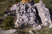
Nearby Images from Flickr
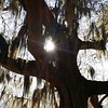
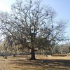
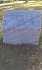

The above images may not be of the site on this page, but were taken nearby. They are loaded from Flickr so please click on them for image credits.
Click here to see more info for this site
Nearby sites
Click here to view sites on an interactive map of the areaKey: Red: member's photo, Blue: 3rd party photo, Yellow: other image, Green: no photo - please go there and take one, Grey: site destroyed
Download sites to:
KML (Google Earth)
GPX (GPS waypoints)
CSV (Garmin/Navman)
CSV (Excel)
To unlock full downloads you need to sign up as a Contributory Member. Otherwise downloads are limited to 50 sites.
Turn off the page maps and other distractions
Nearby sites listing. In the following links * = Image available
76.1km N 5° Talladega Natl Forest Stone 1Ta719* Standing Stone (Menhir)
81.3km WSW 255° Old Cahawba Archaeological Park* Misc. Earthwork
83.6km N 11° Horn Mountain Stone Standing Stone (Menhir)
114.8km NE 38° Rother L. Harris Reservoir Stone Standing Stone (Menhir)
118.8km NNW 327° Bessemer Mounds* Artificial Mound
123.6km NNE 21° Talladega National Forest Stone 1Ta756 Standing Stone (Menhir)
129.8km NNE 20° Oxford Stone Mound* Artificial Mound
129.8km NNE 19° Choccolocco Creek Mounds* Artificial Mound
139.8km NNE 19° Choccolocco Stone Standing Stone (Menhir)
140.4km WNW 294° Moundville Archeological Park* Ancient Village or Settlement
153.1km NNE 19° Shelton Stone Mound Complex* Cairn
170.4km SE 132° Kolomoki Mounds Historic Park* Artificial Mound
179.1km SW 229° Mauvilla Ancient Village or Settlement
199.3km N 11° Collinsville Indian Mound* Artificial Mound
203.6km NNE 18° Coker Ford Site* Ancient Village or Settlement
225.0km NE 36° Etowah Mounds - Mound B* Artificial Mound
225.1km NE 36° Etowah Mounds - Mound A* Artificial Mound
225.2km NE 36° Etowah Mounds - Mound C* Artificial Mound
225.4km NE 36° Etowah Mounds - Ditch and Palisade* Misc. Earthwork
225.4km NE 36° Etowah Mounds Museum* Museum
226.2km NE 36° Arborrigg* Modern Stone Circle etc
229.9km SW 224° Bottle Creek* Ancient Village or Settlement
231.8km NNW 339° Oakville Mounds* Artificial Mound
234.1km SSE 148° Chattahoochee Landing Mound Group* Artificial Mound
235.7km S 188° Fort Walton Mound* Artificial Mound
View more nearby sites and additional images


 We would like to know more about this location. Please feel free to add a brief description and any relevant information in your own language.
 Wir möchten mehr über diese Stätte erfahren. Bitte zögern Sie nicht, eine kurze Beschreibung und relevante Informationen in Deutsch hinzuzufügen.
 Nous aimerions en savoir encore un peu sur les lieux. S'il vous plaît n'hesitez pas à ajouter une courte description et tous les renseignements pertinents dans votre propre langue.
 Quisieramos informarnos un poco más de las lugares. No dude en añadir una breve descripción y otros datos relevantes en su propio idioma.