


<< Text Pages >> Pillsbury Temple Mound - Artificial Mound in United States in The South
Submitted by bat400 on Friday, 05 October 2007 Page Views: 13665
Site WatchSite Name: Pillsbury Temple MoundCountry: United States
NOTE: This site is 8.19 km away from the location you searched for.
Region: The South Type: Artificial Mound
Nearest Town: Bradenton
Latitude: 27.520700N Longitude: 82.6521W
Condition:
| 5 | Perfect |
| 4 | Almost Perfect |
| 3 | Reasonable but with some damage |
| 2 | Ruined but still recognisable as an ancient site |
| 1 | Pretty much destroyed, possibly visible as crop marks |
| 0 | No data. |
| -1 | Completely destroyed |
| 5 | Superb |
| 4 | Good |
| 3 | Ordinary |
| 2 | Not Good |
| 1 | Awful |
| 0 | No data. |
| 5 | Can be driven to, probably with disabled access |
| 4 | Short walk on a footpath |
| 3 | Requiring a bit more of a walk |
| 2 | A long walk |
| 1 | In the middle of nowhere, a nightmare to find |
| 0 | No data. |
| 5 | co-ordinates taken by GPS or official recorded co-ordinates |
| 4 | co-ordinates scaled from a detailed map |
| 3 | co-ordinates scaled from a bad map |
| 2 | co-ordinates of the nearest village |
| 1 | co-ordinates of the nearest town |
| 0 | no data |
Internal Links:
External Links:
Artificial Mound in Bradenton County, Florida.
Shell Mound. Possibly used for a building site.
Location is approximate, but within .25 miles of the site.
Note: Budget cuts delay sale. See comments on the planned sale of this burial mound.
You may be viewing yesterday's version of this page. To see the most up to date information please register for a free account.
Do not use the above information on other web sites or publications without permission of the contributor.
Nearby Images from Flickr

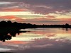

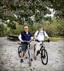

The above images may not be of the site on this page, but were taken nearby. They are loaded from Flickr so please click on them for image credits.
Click here to see more info for this site
Nearby sites
Click here to view sites on an interactive map of the areaKey: Red: member's photo, Blue: 3rd party photo, Yellow: other image, Green: no photo - please go there and take one, Grey: site destroyed
Download sites to:
KML (Google Earth)
GPX (GPS waypoints)
CSV (Garmin/Navman)
CSV (Excel)
To unlock full downloads you need to sign up as a Contributory Member. Otherwise downloads are limited to 50 sites.
Turn off the page maps and other distractions
Nearby sites listing. In the following links * = Image available
933m ENE 70° De Soto National Memorial* Artificial Mound
7.7km NE 49° Madira Bickel Mound State Archaeological Site* Artificial Mound
24.2km SSE 153° Humming Stone Sarasota (Summstein)* Modern Stone Circle etc
36.6km N 7° Weedon Island Preserve* Barrow Cemetery
38.3km SSE 157° Spanish Point Shell Midden* Artificial Mound
38.8km E 88° Portavant Mound Site Artificial Mound
54.4km N 357° Safety Harbor Mound* Artificial Mound
64.6km SE 140° Little Salt Spring Natural Stone / Erratic / Other Natural Feature
83.9km N 355° Oelsner Indian Mound* Artificial Mound
107.8km SSE 152° Pineland* Ancient Village or Settlement
144.8km SSE 147° Mound Key Archaeological State Park Artificial Mound
154.4km ESE 120° Ortona Prehistoric Village Artificial Mound
155.3km N 2° Crystal River Archaeological State Park* Barrow Cemetery
160.4km ESE 113° Fort Center Archaeological Site* Artificial Mound
175.4km SSE 151° Naples Canal Not Known (by us)
193.5km ENE 74° Three Forks Marsh Artificial Mound
195.1km ESE 109° Lake Okeechobee* Ancient Village or Settlement
200.4km NE 44° Indian Mound Village Site* Artificial Mound
201.0km ESE 122° Big (Tony's) Circle Mounds Artificial Mound
205.7km NE 38° Hontoon Island State Park* Artificial Mound
209.5km ENE 62° Brevard Museum of History and Natural Sciences* Museum
210.7km ENE 57° Windover (Florida)* Barrow Cemetery
222.9km E 86° Vero Beach* Ancient Village or Settlement
226.6km ESE 108° Big Mound City Misc. Earthwork
232.7km NE 49° Snyder's Mound* Ancient Mine, Quarry or other Industry
View more nearby sites and additional images


 We would like to know more about this location. Please feel free to add a brief description and any relevant information in your own language.
 Wir möchten mehr über diese Stätte erfahren. Bitte zögern Sie nicht, eine kurze Beschreibung und relevante Informationen in Deutsch hinzuzufügen.
 Nous aimerions en savoir encore un peu sur les lieux. S'il vous plaît n'hesitez pas à ajouter une courte description et tous les renseignements pertinents dans votre propre langue.
 Quisieramos informarnos un poco más de las lugares. No dude en añadir una breve descripción y otros datos relevantes en su propio idioma.