

<< Our Photo Pages >> Dixon Mound - Artificial Mound in United States in Great Lakes Midwest
Submitted by stonetracker on Monday, 06 February 2023 Page Views: 519
Multi-periodSite Name: Dixon MoundCountry: United States
NOTE: This site is 5.524 km away from the location you searched for.
Region: Great Lakes Midwest Type: Artificial Mound
Nearest Town: Homer OH
Latitude: 40.251535N Longitude: 82.524447W
Condition:
| 5 | Perfect |
| 4 | Almost Perfect |
| 3 | Reasonable but with some damage |
| 2 | Ruined but still recognisable as an ancient site |
| 1 | Pretty much destroyed, possibly visible as crop marks |
| 0 | No data. |
| -1 | Completely destroyed |
| 5 | Superb |
| 4 | Good |
| 3 | Ordinary |
| 2 | Not Good |
| 1 | Awful |
| 0 | No data. |
| 5 | Can be driven to, probably with disabled access |
| 4 | Short walk on a footpath |
| 3 | Requiring a bit more of a walk |
| 2 | A long walk |
| 1 | In the middle of nowhere, a nightmare to find |
| 0 | No data. |
| 5 | co-ordinates taken by GPS or official recorded co-ordinates |
| 4 | co-ordinates scaled from a detailed map |
| 3 | co-ordinates scaled from a bad map |
| 2 | co-ordinates of the nearest village |
| 1 | co-ordinates of the nearest town |
| 0 | no data |
Internal Links:
External Links:
I have visited· I would like to visit
stonetracker visited on 1st Apr 2022 - their rating: Cond: 4 Amb: 4 Access: 4 Other accounts have described access to this mound as "private" and "no trespassing." But I encountered no such issues on a recent visit. Parked in a nearby lot for town offices, walked in back and the mound was maybe 100 ft to the left in a field not far from a baseball diamond. The mound property was not posted, but the possible enclosure referred to in the description is posted as private.
")
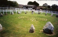
Mound site is about 100 ft east of a public baseball field adjacent to a parking lot for Homer OH town offices. Other accounts have described it as a single conical mound about 15 ft in height, although it looked more like 20-30 ft to my eyes. Mound is somewhat overgrown with shrubs and small trees but clearly visible. It was never excavated, but the shape of the mound and site configuration suggests that it was built by the Adena culture.
There is what looks like the ruined remains of a rectangular enclosure 400 ft to the south of it, but access is posted with No Trespassing signs and it is very overgrown. Whether it is prehistoric or simply the remains of some historic boundary or other structure is unknown.
You may be viewing yesterday's version of this page. To see the most up to date information please register for a free account.
")
")
Do not use the above information on other web sites or publications without permission of the contributor.
Nearby Images from Flickr


The above images may not be of the site on this page, but were taken nearby. They are loaded from Flickr so please click on them for image credits.
Click here to see more info for this site
Nearby sites
Click here to view sites on an interactive map of the areaKey: Red: member's photo, Blue: 3rd party photo, Yellow: other image, Green: no photo - please go there and take one, Grey: site destroyed
Download sites to:
KML (Google Earth)
GPX (GPS waypoints)
CSV (Garmin/Navman)
CSV (Excel)
To unlock full downloads you need to sign up as a Contributory Member. Otherwise downloads are limited to 50 sites.
Turn off the page maps and other distractions
Nearby sites listing. In the following links * = Image available
17.2km N 11° McLaughlin Mound* Artificial Mound
20.3km S 174° Alligator Mound* Artificial Mound
20.6km SSE 161° Ferris Owen* Artificial Mound
22.7km SSE 157° Upham* Artificial Mound
23.0km SSE 163° Newark Earthworks - Octagon* Misc. Earthwork
24.1km SSE 159° Newark Earthworks - Wright* Misc. Earthwork
24.7km N 357° Raleigh Mound Artificial Mound
24.7km SSE 161° Newark Earthworks - Great Circle* Misc. Earthwork
25.4km S 178° Infirmary Mound Artificial Mound
25.5km N 359° Braddock Mound Artificial Mound
32.7km SSE 154° Tippett Mound Artificial Mound
34.4km SSE 160° Fairmount* Artificial Mound
36.8km SE 143° Flint Ridge* Ancient Mine, Quarry or other Industry
43.6km WSW 256° Highbanks Mound I* Artificial Mound
44.0km WSW 255° Highbanks Mound II* Artificial Mound
44.6km WSW 254° Highbanks Park Works* Hillfort
45.5km SSE 157° Glenford Fort* Hillfort
47.2km WSW 248° Jeffers Mound* Artificial Mound
48.0km SW 235° Ohio Historical Center* Museum
51.8km WSW 253° Wright-Holder Works* Misc. Earthwork
55.5km WSW 239° Shrum Mound* Artificial Mound
55.8km E 92° Porteus Mound* Artificial Mound
57.0km SW 224° Indian Mound Park* Artificial Mound
79.9km SSW 196° Tarlton Cross* Artificial Mound
80.7km SSW 207° Circleville* Misc. Earthwork
View more nearby sites and additional images


 We would like to know more about this location. Please feel free to add a brief description and any relevant information in your own language.
 Wir möchten mehr über diese Stätte erfahren. Bitte zögern Sie nicht, eine kurze Beschreibung und relevante Informationen in Deutsch hinzuzufügen.
 Nous aimerions en savoir encore un peu sur les lieux. S'il vous plaît n'hesitez pas à ajouter une courte description et tous les renseignements pertinents dans votre propre langue.
 Quisieramos informarnos un poco más de las lugares. No dude en añadir una breve descripción y otros datos relevantes en su propio idioma.