

<< Our Photo Pages >> Upham - Artificial Mound in United States in Great Lakes Midwest
Submitted by bat400 on Friday, 07 December 2007 Page Views: 3779
Pre-ColumbianSite Name: UphamCountry: United States
NOTE: This site is 0.195 km away from the location you searched for.
Region: Great Lakes Midwest Type: Artificial Mound
Nearest Town: Newark, Ohio
Latitude: 40.063700N Longitude: 82.4188W
Condition:
| 5 | Perfect |
| 4 | Almost Perfect |
| 3 | Reasonable but with some damage |
| 2 | Ruined but still recognisable as an ancient site |
| 1 | Pretty much destroyed, possibly visible as crop marks |
| 0 | No data. |
| -1 | Completely destroyed |
| 5 | Superb |
| 4 | Good |
| 3 | Ordinary |
| 2 | Not Good |
| 1 | Awful |
| 0 | No data. |
| 5 | Can be driven to, probably with disabled access |
| 4 | Short walk on a footpath |
| 3 | Requiring a bit more of a walk |
| 2 | A long walk |
| 1 | In the middle of nowhere, a nightmare to find |
| 0 | No data. |
| 5 | co-ordinates taken by GPS or official recorded co-ordinates |
| 4 | co-ordinates scaled from a detailed map |
| 3 | co-ordinates scaled from a bad map |
| 2 | co-ordinates of the nearest village |
| 1 | co-ordinates of the nearest town |
| 0 | no data |
Internal Links:
External Links:
I have visited· I would like to visit
bat400 has visited here
")
Located on a slight rise west of the drive entrance to the Newark High School, Upham Mound is approximately 4 feet high and 20 feet in diameter. There is no record of its excavation.
The mound is on private property, but you can see it at any time from the very near Granville Road or the school entrance.
[Some information from Indian Mounds of the Middle Ohio Valley, Susan L Woodward and Jerry N McDonald. 2002, the McDonald and Woodward Publishing Company, Blacksburg VA.]
You may be viewing yesterday's version of this page. To see the most up to date information please register for a free account.
")
Do not use the above information on other web sites or publications without permission of the contributor.
Nearby Images from Flickr
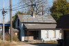

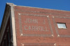


The above images may not be of the site on this page, but were taken nearby. They are loaded from Flickr so please click on them for image credits.
Click here to see more info for this site
Nearby sites
Click here to view sites on an interactive map of the areaKey: Red: member's photo, Blue: 3rd party photo, Yellow: other image, Green: no photo - please go there and take one, Grey: site destroyed
Download sites to:
KML (Google Earth)
GPX (GPS waypoints)
CSV (Garmin/Navman)
CSV (Excel)
To unlock full downloads you need to sign up as a Contributory Member. Otherwise downloads are limited to 50 sites.
Turn off the page maps and other distractions
Nearby sites listing. In the following links * = Image available
1.7km SSW 194° Newark Earthworks - Wright* Misc. Earthwork
2.6km WSW 244° Newark Earthworks - Octagon* Misc. Earthwork
2.6km WNW 302° Ferris Owen* Artificial Mound
2.7km SSW 202° Newark Earthworks - Great Circle* Misc. Earthwork
7.0km W 276° Alligator Mound* Artificial Mound
9.3km WSW 241° Infirmary Mound Artificial Mound
10.1km SSE 147° Tippett Mound Artificial Mound
11.8km SSE 166° Fairmount* Artificial Mound
15.8km ESE 122° Flint Ridge* Ancient Mine, Quarry or other Industry
22.7km NNW 337° Dixon Mound* Artificial Mound
22.8km SSE 158° Glenford Fort* Hillfort
38.2km N 352° McLaughlin Mound* Artificial Mound
46.7km NNW 347° Raleigh Mound Artificial Mound
47.4km NNW 348° Braddock Mound Artificial Mound
48.9km W 262° Ohio Historical Center* Museum
50.5km ENE 68° Porteus Mound* Artificial Mound
52.4km W 281° Highbanks Mound II* Artificial Mound
52.4km WNW 282° Highbanks Mound I* Artificial Mound
52.6km W 280° Highbanks Park Works* Hillfort
52.6km WSW 248° Indian Mound Park* Artificial Mound
52.9km W 274° Jeffers Mound* Artificial Mound
56.9km W 262° Shrum Mound* Artificial Mound
58.8km W 276° Wright-Holder Works* Misc. Earthwork
64.0km SSW 209° Tarlton Cross* Artificial Mound
68.2km SW 221° Circleville* Misc. Earthwork
View more nearby sites and additional images


 We would like to know more about this location. Please feel free to add a brief description and any relevant information in your own language.
 Wir möchten mehr über diese Stätte erfahren. Bitte zögern Sie nicht, eine kurze Beschreibung und relevante Informationen in Deutsch hinzuzufügen.
 Nous aimerions en savoir encore un peu sur les lieux. S'il vous plaît n'hesitez pas à ajouter une courte description et tous les renseignements pertinents dans votre propre langue.
 Quisieramos informarnos un poco más de las lugares. No dude en añadir una breve descripción y otros datos relevantes en su propio idioma.