


<< Our Photo Pages >> Marietta Earthworks - Quadranaou - Pyramid / Mastaba in United States in Great Lakes Midwest
Submitted by bat400 on Sunday, 12 September 2010 Page Views: 3874
Multi-periodSite Name: Marietta Earthworks - Quadranaou Alternative Name: Camp TupperCountry: United States
NOTE: This site is 19.09 km away from the location you searched for.
Region: Great Lakes Midwest Type: Pyramid / Mastaba
Nearest Town: Marietta, OH
Latitude: 39.425450N Longitude: 81.46151W
Condition:
| 5 | Perfect |
| 4 | Almost Perfect |
| 3 | Reasonable but with some damage |
| 2 | Ruined but still recognisable as an ancient site |
| 1 | Pretty much destroyed, possibly visible as crop marks |
| 0 | No data. |
| -1 | Completely destroyed |
| 5 | Superb |
| 4 | Good |
| 3 | Ordinary |
| 2 | Not Good |
| 1 | Awful |
| 0 | No data. |
| 5 | Can be driven to, probably with disabled access |
| 4 | Short walk on a footpath |
| 3 | Requiring a bit more of a walk |
| 2 | A long walk |
| 1 | In the middle of nowhere, a nightmare to find |
| 0 | No data. |
| 5 | co-ordinates taken by GPS or official recorded co-ordinates |
| 4 | co-ordinates scaled from a detailed map |
| 3 | co-ordinates scaled from a bad map |
| 2 | co-ordinates of the nearest village |
| 1 | co-ordinates of the nearest town |
| 0 | no data |
Internal Links:
External Links:
I have visited· I would like to visit
bat400 has visited here
")
Originally a linear embankment with openings surrounded the Quadranaou, and three other flat-topped pyramids. Unfortunately, nothing visible remains of the associated enclosure today.
Sources include: Indian Mounds of the Middle Ohio Valley, Woodward and McDonald, 2002.
You may be viewing yesterday's version of this page. To see the most up to date information please register for a free account.
")
")
")
Do not use the above information on other web sites or publications without permission of the contributor.
Nearby Images from Flickr
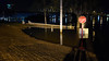

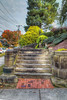

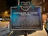
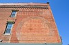
The above images may not be of the site on this page, but were taken nearby. They are loaded from Flickr so please click on them for image credits.
Click here to see more info for this site
Nearby sites
Click here to view sites on an interactive map of the areaKey: Red: member's photo, Blue: 3rd party photo, Yellow: other image, Green: no photo - please go there and take one, Grey: site destroyed
Download sites to:
KML (Google Earth)
GPX (GPS waypoints)
CSV (Garmin/Navman)
CSV (Excel)
To unlock full downloads you need to sign up as a Contributory Member. Otherwise downloads are limited to 50 sites.
Turn off the page maps and other distractions
Nearby sites listing. In the following links * = Image available
336m ESE 114° Marietta Earthworks - Capitolium* Artificial Mound
456m S 178° Campus Martius* Museum
487m SW 218° Marietta Earthworks* Misc. Earthwork
1.0km ESE 123° Marietta Earthworks - Conus* Artificial Mound
23.8km E 92° Reynolds Mound* Artificial Mound
58.7km W 265° Wolf Plains Group* Artificial Mound
67.2km NNE 21° Barnesville Rock Art* Rock Art
82.2km NE 48° Grave Creek Mound* Artificial Mound
88.7km NW 304° Glenford Fort* Hillfort
92.7km NW 313° Flint Ridge* Ancient Mine, Quarry or other Industry
96.2km NNW 339° Porteus Mound* Artificial Mound
98.2km SW 220° May Moore Mound* Misc. Earthwork
98.7km NW 310° Tippett Mound Artificial Mound
99.0km NW 307° Fairmount* Artificial Mound
106.0km NE 38° Hodgen's Cemetery Mound* Artificial Mound
107.5km NW 310° Newark Earthworks - Great Circle* Misc. Earthwork
107.6km NW 310° Newark Earthworks - Wright* Misc. Earthwork
108.1km W 272° Karshner Mound Artificial Mound
108.3km NW 311° Upham* Artificial Mound
109.4km NW 310° Newark Earthworks - Octagon* Misc. Earthwork
110.9km NW 311° Ferris Owen* Artificial Mound
111.9km NW 307° Infirmary Mound Artificial Mound
114.2km NW 309° Alligator Mound* Artificial Mound
114.7km W 278° Tarlton Cross* Artificial Mound
119.2km S 190° Criel Mound* Barrow Cemetery
View more nearby sites and additional images


 We would like to know more about this location. Please feel free to add a brief description and any relevant information in your own language.
 Wir möchten mehr über diese Stätte erfahren. Bitte zögern Sie nicht, eine kurze Beschreibung und relevante Informationen in Deutsch hinzuzufügen.
 Nous aimerions en savoir encore un peu sur les lieux. S'il vous plaît n'hesitez pas à ajouter une courte description et tous les renseignements pertinents dans votre propre langue.
 Quisieramos informarnos un poco más de las lugares. No dude en añadir una breve descripción y otros datos relevantes en su propio idioma.