<< Our Photo Pages >> Castro de Vila Nova de São Pedro - Castro or Chafurdão in Portugal in Lisboa
Submitted by Bak_teria on Monday, 10 August 2015 Page Views: 2610
Iron Age and Later PrehistorySite Name: Castro de Vila Nova de São Pedro Alternative Name: Castelo de Vila Nova de São Pedro, Alto do CasteloCountry: Portugal Distrito: Lisboa Type: Castro or Chafurdão
Nearest Town: Azambuja Nearest Village: Vila Nova de São Pedro
Latitude: 39.219760N Longitude: 8.840293W
Condition:
| 5 | Perfect |
| 4 | Almost Perfect |
| 3 | Reasonable but with some damage |
| 2 | Ruined but still recognisable as an ancient site |
| 1 | Pretty much destroyed, possibly visible as crop marks |
| 0 | No data. |
| -1 | Completely destroyed |
| 5 | Superb |
| 4 | Good |
| 3 | Ordinary |
| 2 | Not Good |
| 1 | Awful |
| 0 | No data. |
| 5 | Can be driven to, probably with disabled access |
| 4 | Short walk on a footpath |
| 3 | Requiring a bit more of a walk |
| 2 | A long walk |
| 1 | In the middle of nowhere, a nightmare to find |
| 0 | No data. |
| 5 | co-ordinates taken by GPS or official recorded co-ordinates |
| 4 | co-ordinates scaled from a detailed map |
| 3 | co-ordinates scaled from a bad map |
| 2 | co-ordinates of the nearest village |
| 1 | co-ordinates of the nearest town |
| 0 | no data |
Internal Links:
External Links:
I have visited· I would like to visit
Bak_teria visited on 23rd Jul 2015 - their rating: Cond: 3 Amb: 4 Access: 4

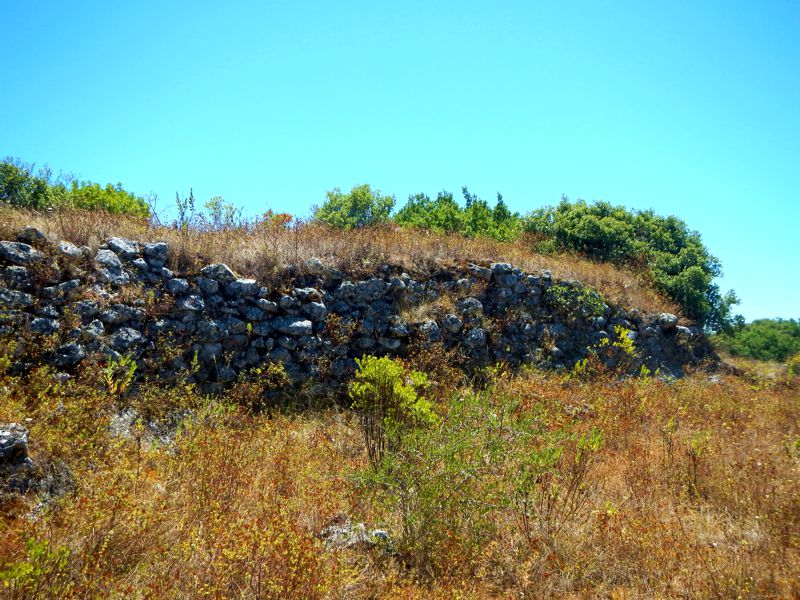
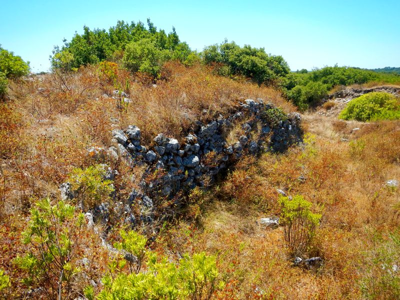
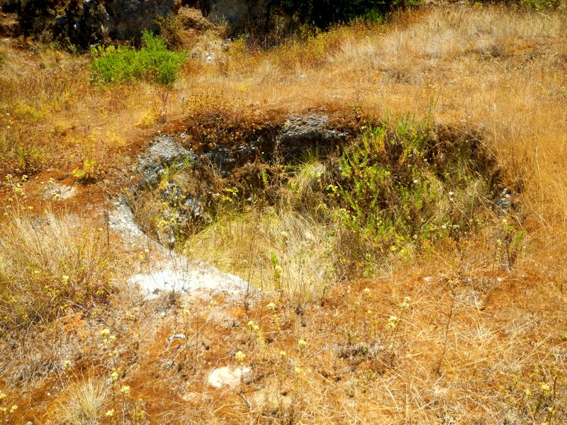
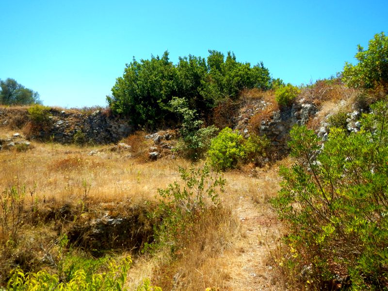
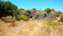
This castro is a fortified settlement built in the Chalcolithic era (3500 BC) and used until the end of the Bronze age (from 1000 to 700 BC). It is located in Vila Nova de São Pedro, from the Municipality of Azambuja, part of the Lisbon district and was originally discovered by Hipólito Raposo in 1936. This monument was classified as Portuguese MN – Monumento Nacional (National Monument) in 22nd of November, 1971. The access to it is free and there are signposts by the road that will lead you the site.
About the architecture
It has a triple network of defensive walls. The inner or central fortification wall have a diameter of about 40 meters and a thickness which can vary between 3.5 and 7 meters. The height, which is also variable, reaches from 1.60 meters to 3.6 meters, depending on the location. It should be noted that the second line of defense walls have turrets. This fortified settlement had various stages of occupation: The first phase was an open settlement and only in the second was built the first wall of the fortification. The third phase is charachterized by the re-building of a second defensive system and the fourth stage was the building of a new and more effective defensive system.
About the location and the economy
This castro is endowed with an excellent strategic location, which guaranteed it great protection conditions. The fortification dominates the valley of Almoster in a place which communicated with the Tagus river (Tejo), the main and most important means of communication for the inhabitants of this settlement. The estate exhumed during the various excavation campaigns confirms the roots of a growing economic activity in the area. From it, we mention the presence of hand mills, axes, adzes, gouges and flint blades, in addition to representative samples of wheat, barley and vegetables, it is certain that linen was also grown. A fact that by itself certify the development of another activity directly related to the agricultural practice, textiles, confirmed also by the discovery of several ceramic loom weights inside the settlement.
Along with agriculture, the cattle breeding occupied a central place in the daily life of these fortified settlements, although it still persisted some of the old Neolithic practices such as hunting, fishing and recollection. It is also very important to mention the discovery of thousands of arrowheads associated with the Chalcolithic period, also associated with Castro of Zambujal, near by the municipality of Torres Vedras. In excavations made back in 1952 it was also found a furnace for the manufacture of ceramics.
Links and other important information sources (texts written in Portuguese):
- DGPC
- Portal do Arqueólogo
- Wikipedia reference page
You may be viewing yesterday's version of this page. To see the most up to date information please register for a free account.

Do not use the above information on other web sites or publications without permission of the contributor.
Click here to see more info for this site
Nearby sites
Click here to view sites on an interactive map of the areaKey: Red: member's photo, Blue: 3rd party photo, Yellow: other image, Green: no photo - please go there and take one, Grey: site destroyed
Download sites to:
KML (Google Earth)
GPX (GPS waypoints)
CSV (Garmin/Navman)
CSV (Excel)
To unlock full downloads you need to sign up as a Contributory Member. Otherwise downloads are limited to 50 sites.
Turn off the page maps and other distractions
Nearby sites listing. In the following links * = Image available
19.0km W 263° Castro de Pragança* Castro or Chafurdão
22.8km NNW 346° Anta-Capela de Alcobertas* Burial Chamber or Dolmen
30.4km WNW 302° Cidade Romana de Eburobritium Ancient Village or Settlement
37.0km ENE 73° Menir de Ulme* Standing Stone (Menhir)
40.2km WSW 245° Tholos do Barro* Chambered Tomb
40.8km W 274° Museu da Lourinhã* Museum
41.7km WSW 247° Castro do Zambujal* Castro or Chafurdão
41.9km SSW 210° Dólmen de Monte Serves* Burial Chamber or Dolmen
42.6km NNW 338° Estação Arqueológica de Parreitas Ancient Village or Settlement
44.3km SW 226° Tholos da Tituaria* Chambered Tomb
44.3km N 9° Miradouro Jurássico de Alqueidão da Serra* Modern Stone Circle etc
47.2km SW 217° Anta de Casaínhos* Burial Chamber or Dolmen
49.3km SW 221° Anta de Carcavelos* Burial Chamber or Dolmen
49.4km SW 219° Gruta de Salemas* Cave or Rock Shelter
49.6km SW 219° Anta do Alto da Toupeira* Burial Chamber or Dolmen
50.6km WNW 288° Gruta da Furninha* Cave or Rock Shelter
54.6km SSW 204° Humming Stone Lisbon (Summstein) Modern Stone Circle etc
56.4km SW 216° Anta das Pedras Grandes* Burial Chamber or Dolmen
56.8km ESE 109° Menires do Alminho Standing Stones
57.1km ESE 109° Alminho Cromeleque Stone Circle
58.7km SW 231° Conjunto Megalítico de Barreira* Standing Stones
59.5km NE 51° Anta de Vale da Lage* Burial Chamber or Dolmen
60.7km SW 215° Necrópole de Carenque* Rock Cut Tomb
60.8km ENE 64° Antas da Jogada Burial Chamber or Dolmen
61.1km SE 135° Anta Das Antas 1 Burial Chamber or Dolmen
View more nearby sites and additional images




 We would like to know more about this location. Please feel free to add a brief description and any relevant information in your own language.
 Wir möchten mehr über diese Stätte erfahren. Bitte zögern Sie nicht, eine kurze Beschreibung und relevante Informationen in Deutsch hinzuzufügen.
 Nous aimerions en savoir encore un peu sur les lieux. S'il vous plaît n'hesitez pas à ajouter une courte description et tous les renseignements pertinents dans votre propre langue.
 Quisieramos informarnos un poco más de las lugares. No dude en añadir una breve descripción y otros datos relevantes en su propio idioma.